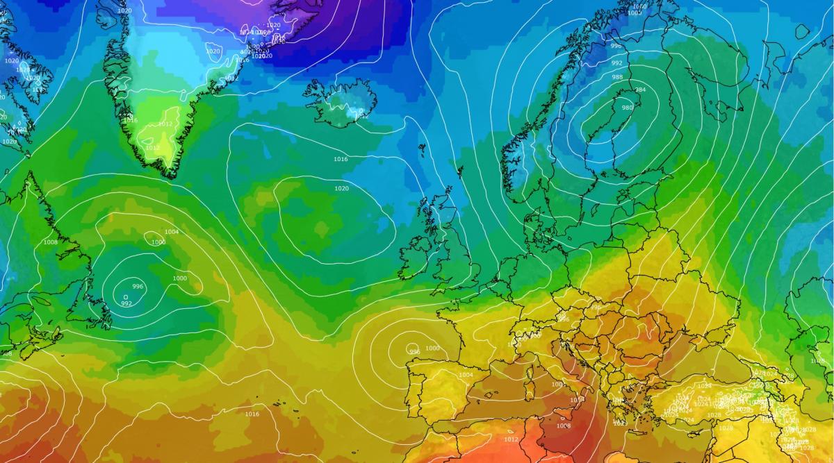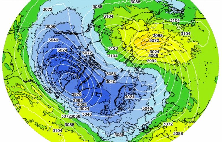



November has begun quiet and anticyclonic, with temperatures near to slightly below average in many regions. The anticyclonic start to November is looking set to end early next week, with low pressure coming into southern Britain. It will not be a straightforward change to mild wet weather, however, as high pressure will move to the north-west of Britain, and this is set to push the low back southwards late next week and bring in the season's first northerly blast.
Rain is set to push in from the south-west during Monday to Wednesday of next week, probably affecting most of England and Wales and the southern part of Northern Ireland, but Scotland and the north of Northern Ireland, and possibly part of northern England, look likely to miss the rain completely. It will be a predominantly dry week in most parts of Scotland, turning cold and sunny as the week progresses.
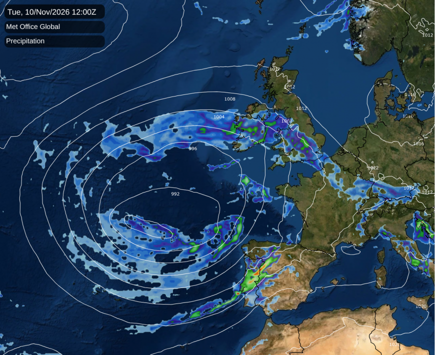
Towards the end of the week, northern Scotland looks set to see the first snow showers of the season, probably with lying snow on higher ground, and sleet and wet snow to low levels. It will probably not be cold enough for snow at low levels further south, with rain showers affecting some eastern coastal parts of England. But when the northerly subsides, much of the country can expect a couple of ground frosts, and also air frosts in some inland areas.
The shift to wet and unsettled weather looks set to arrive more convincingly the week after next, going into mid-November, but there is a fair amount of uncertainty regarding how rapidly the lows coming in off the North Atlantic will push away our high pressure area. The ECMWF 42-day forecast is predicting that the typical El Nino November pattern with a low height anomaly just to the west of Britain will set in during the second half of November, which would turn the weather mild and wet, especially towards the south-west.
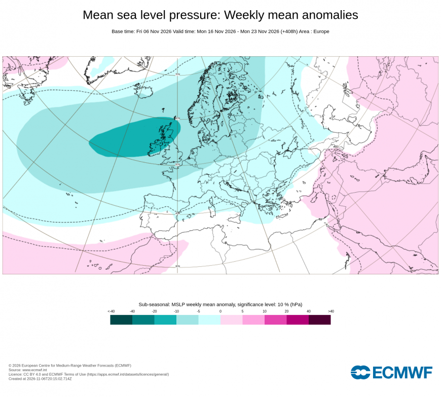
However, it is suggesting increasing blocking over Greenland and Iceland into December, which would increase the chances of some colder blasts as well, most likely from the north rather than the east.
Overall, the second half of November does look likely to be mild and wet overall, but some short-lived northerlies cannot be ruled out, particularly in the north. Confidence in mild and wet weather is highest towards the south and especially south-west, with Scotland, especially the north of Scotland, having more chance of holding onto colder, drier weather at times. It is currently not clear whether the record early sudden stratospheric warming event will contribute to increased blocking over Greenland or not.
Global temperatures have been roughly tied with those of during September 2023, with the Copernicus/ERA5 based analysis having September 2026 as nominally second warmest after 2023, and October 2026 nominally warmest, just ahead of 2023. But according to Copernicus's Pulse site, which has near real time updates of daily global temperature, temperatures have risen to be comfortably record warmest globally on most days since around 20 October, and especially since the beginning of November.
This is to be expected during a record breaking El Nino event in the Pacific, with global temperatures continuing to rise overall. Again, the exceptional warmth is coming especially from the sea surface temperatures, which are running over 0.2 °C ahead of 2023 - which may not sound much, but it is a substantial difference when averaged globally. The land masses are starting to catch up after having lagged behind for a few months.
Even when global temperatures are record warm, there is still regional variation around the globe and individual regions can be cooler than average. Temperatures are currently a little below average over much of western and central Europe, and there is a pool of substantially below-average temperatures over eastern Asia. Conversely, temperatures are exceptionally high over much of the Arctic, as has been common in recent years, and are also above average over the majority of Africa and eastern North America and Canada.
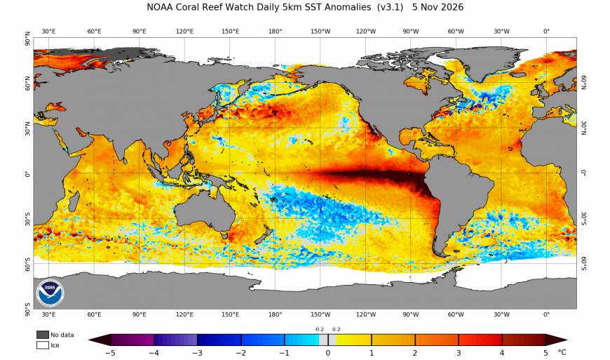
There is also a region of below-average sea surface temperatures in the North Atlantic, to the west of Britain. This has been a regular feature since around 2014/15, likely linked with increasing Greenland ice melt which is interfering with the Gulf Stream and the allied North Atlantic Drift. Sea surface temperatures are also below average in a region of the southern Pacific Ocean east of Australia and New Zealand, but, unsurprisingly, they are record high in a band to the west of South America associated with the record breaking El Nino event.
Loading recent activity...