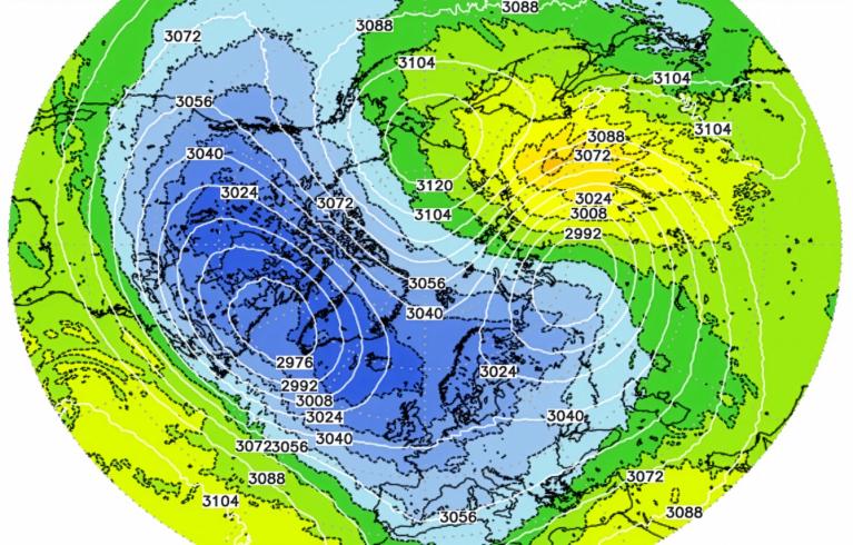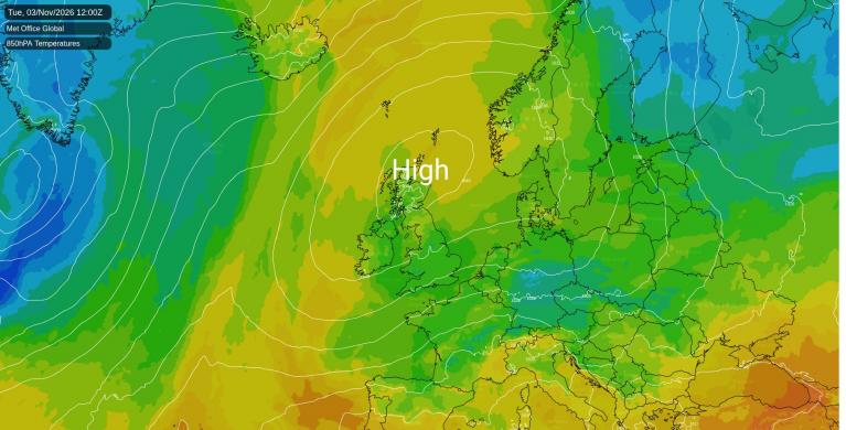



The quiet, mostly dry and rather cool weather will continue for the rest of the week and through the weekend, with high pressure centred just north of Scotland controlling the weather over the next few days, though it will gradually weaken and drift over Scandinavia over the weekend. Some weakening fronts will move in from the south on Friday and through Saturday across the southern half of the UK, bringing some scattered showers, perhaps heavy in the southwest, but they’ll be hit and miss, with many staying dry.
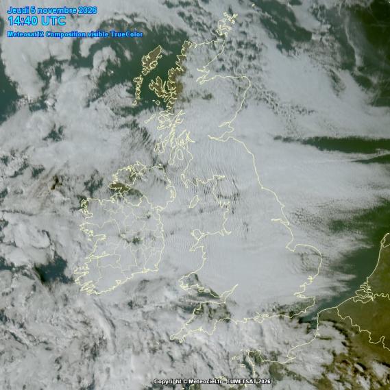
High pressure inversion will trap a lot of moisture at lower levels of the atmosphere across many areas the next few days, leading to stubborn cloud cover leading to grey skies, though the far north and northwest will see some sunshine.
UK under a lot of cloud this afternoon
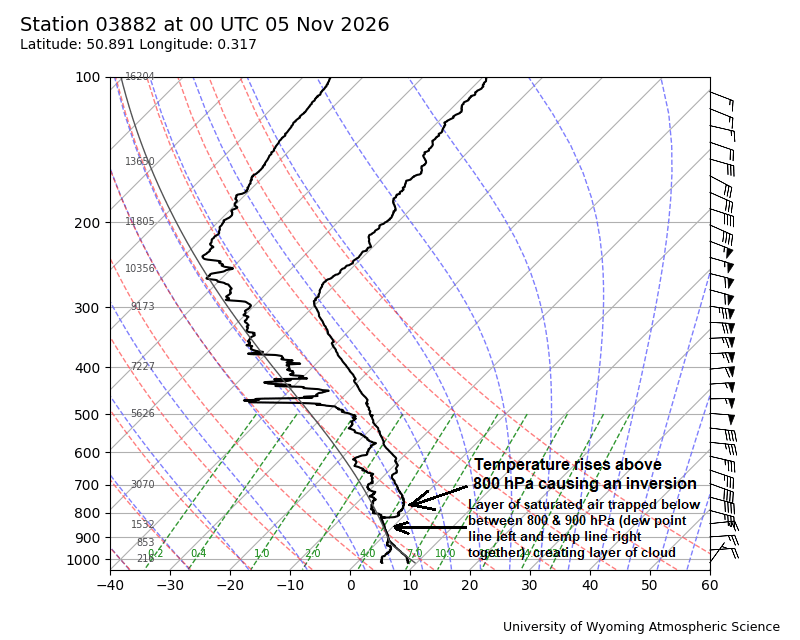
The 00z Herstmonceux radiosonde ascent this morning shows nicely the inversion where subsiding warms up acting as a lid trapping cooler but moister air near the surface and creating a layer of cloud.
Into next week and some uncertainty over how far northeast wind and rain to the southwest over the Atlantic will spread, depending on how close to the UK a low west of Biscay and its associated fronts comes.
It should stay largely dry and cool with light winds on Monday, perhaps a lot of cloud or a risk of fog and frost where skies have cleared overnight, highs in high single figures at best in the north, 10-11C in the south. Tuesday may start to see outbreaks of showery rain spread up from the south across England and Wales during the morning, though uncertainty how far north, with high pressure rebuilding across the north for a time.
Wednesday may see showery outbreaks of rain develop more widely across England, Wales and southern Scotland - as colder air trying to push south across the north meets milder air pushing up from the south ahead of low pressure moving in towards the southwest. Though some places could stay dry.
Some uncertainty how far south the colder arctic air pushes south later in the week. After outbreaks of rain clear the south on Thursday, the ECMWF pushes a cold northerly flow down across all parts on Friday, as a deep low moves across Scandinavia and high pressure builds rapidly from the west. Wintry showers for the far north and down eastern coasts. However, the GFS over the last few runs is quite at odds with this idea, with low pressure taking control to the west and southwest, bringing mild south to southwesterly flow with outbreaks of rain at times across all parts to end the week.
00z ECMWF high res run showed a cold northerly flow Friday week, but GFS doesn't
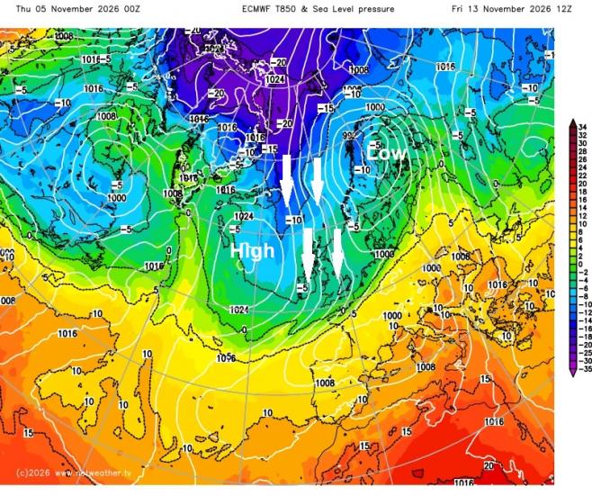
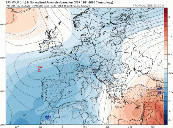
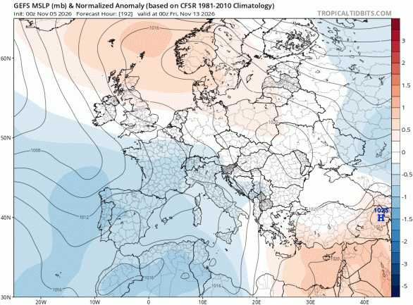
The 00z ensemble mean of both ECMWF and GFS are at odds too for the end of next week with pressure tendencies, especially to the north with positioning of high pressure, but also low pressure to the south - which makes quite a difference in outcome. A northerly wouldn’t happen with the GEFS signal.
00z EPS mean for next Friday
00z GEFS for next Friday
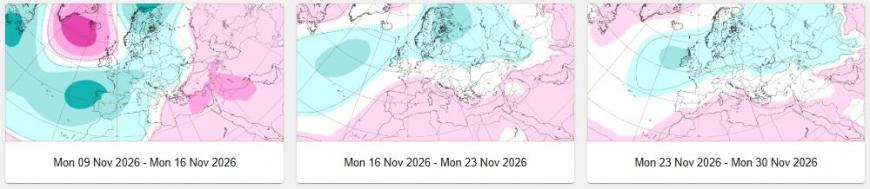
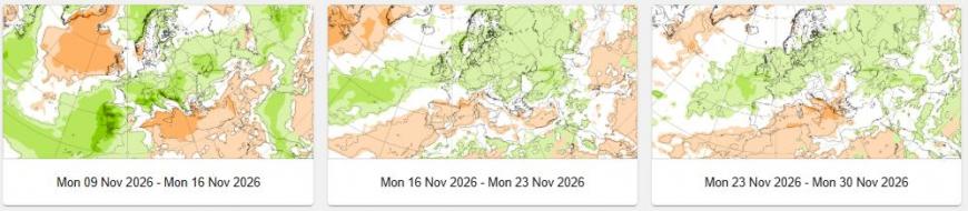
Looking further ahead, from mid-month to the end of the month, there is a signal from the latest sub-seasonal run from the ECMWF showing a much wetter second half of November like we saw in October, when that month saw a dry first half with this month looking the same. But confidence on this not high for now, low pressure may become more dominant during the second half of this month and this ties on with the forecast for increasing strength of the subtropical jet stream upstream over southern USA, driven by the super El Nino - which may eventually strengthen troughing and jet stream over the North Atlantic, driving areas of low pressure towards NW Europe.
ECWMF subseasonal mslp forecast (blues low pressure and reds high pressure)
ECMWF subseasonal precipitation forecast (greens higher precipitation)
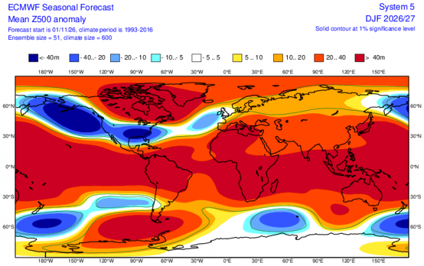
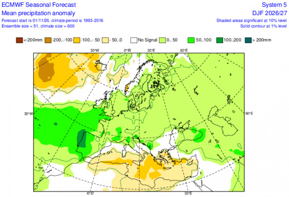
Looking even further ahead, The ECMWF seasonal forecast November update is out and for December-February suggests a low pressure anomaly to the southwest may have quite a lot of influence on UK weather through the period. But not a strong low pressure signal like over USA, where the Super El Nino is likely to drive a strong sub-tropical jet stream with storminess over the southern half of the US. But the precipitation forecast over 3 months suggests some much needed rainfall, with a positive anomaly signalled towards the south and southwest. Temperatures are forecast to be above average though. With positive heights signal over Greenland, there is potential for colder air to flood south at times, especially later in winter and across the north.
Loading recent activity...