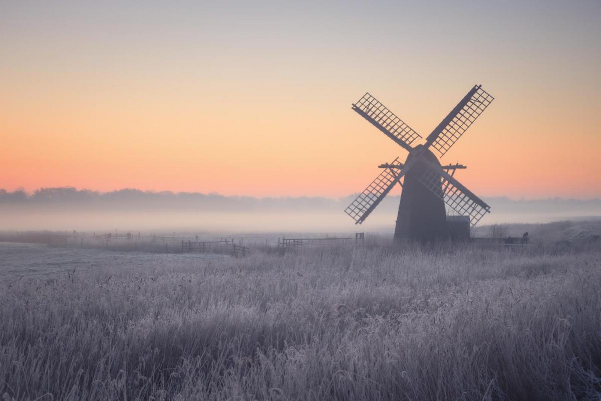
During the day, incoming sunshine warms the earth, the sea and lakes. The ground absorbs infrared radiation, and heats the air that it is in contact with it, at the surface. When the sun sets, that incoming supply of heat energy is cut off, but the ground keeps radiating heat. The surface cools. How fast that occurs and how the air responds depends on the cloud conditions that night and the dryness of the air.
If it is a clear autumn night, the infrared radiation just heads out into the night sky and off into space. There is nothing in the clear skies to stop it. If there is a layer of lower cloud, it acts very much like a blanket on your bed. Thin high cloud is less effective and minimal.
The bottom of the cloud, the cloud base will absorb or stop the exiting heat. Water vapour droplets are good at this. Think about a sunny but cool air day. When the sun goes behind a cloud, it can suddenly feel much colder as the cloud stops the incoming infrared rays. A layer of Stratocumulus under an area of high pressure can bring gloomy skies by day, but it can save a frost from occurring at night. However, gaps can appear in 'StratoCu' cloud layer which is tricky to forecast, where and when. These gaps can allow temperatures to fall in some areas. A bit like if the duvet comes off your feet or your arm.
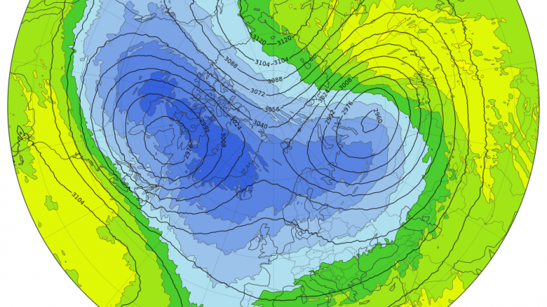
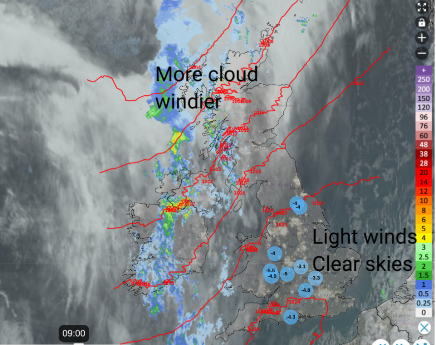 Example of a radiation night over England with low temperatures and high pressure (late Nov 2025 9am) Netweather Radar
The cloud base can help radiate the slightly warmer air back down towards earth, or at least keep a layer of less cold air steady until the sun gets to work on the next day. This is about net energy amounts: incoming radiation, radiation loss or keeping things steady until the next bout of incoming radiation arrives.
On clear nights, or when clear spells occur, surface temperatures in autumn can get low enough for fog or frost to form. The nights are getting longer and in late October the sun sets around 4:40pm and rises around 6:50am, that’s 14 hours without the sun.
High pressure brings stable and stagnating conditions to the UK, with light winds, often dry weather for days on end. It can be a cloudy high, or a clear and sunny one. The light winds enable fog and frost to form, as still air get colder in places, rather than being stirred up.
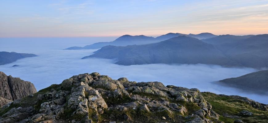
Above the inversion (Rob Davies)
You might hear mention of an inversion, when there is warmer air aloft and colder air at the surface. Mountain climbers love these conditions, once they reach the top. You climb through the cloud layer, to pop out in crisp sunshine and blue skies with a view of the cloud blanket below.
With a cold lower level and calm conditions, the coldest air stays at the surface. Frost hollows are sheltered areas that keep pools of air undisturbed and chilly. They often produce our lowest UK minimum temperatures in the shoulder seasons of autumn or spring. If there has been rain in the day and the grass or earth is damp, moisture can condense out and become dew as the temperatures fall and the air becomes saturated.
If you are driving early in the morning, you might notice a shallow layer of fog over a field, or a line of fog or low cloud which is following a river. The moisture around the river banks or from dampness in the fields is just condensing out as the night ends. As the water vapour changes state into its liquid form, dew, it releases a bit of (latent heat) energy. The radiative cooling will still be going on if the skies are clear at dawn, but this energy release can halt temperatures from falling further.
This is a rather gentle setup: dew forms or pockets of shallow fog and then the day gets going, and that is it.
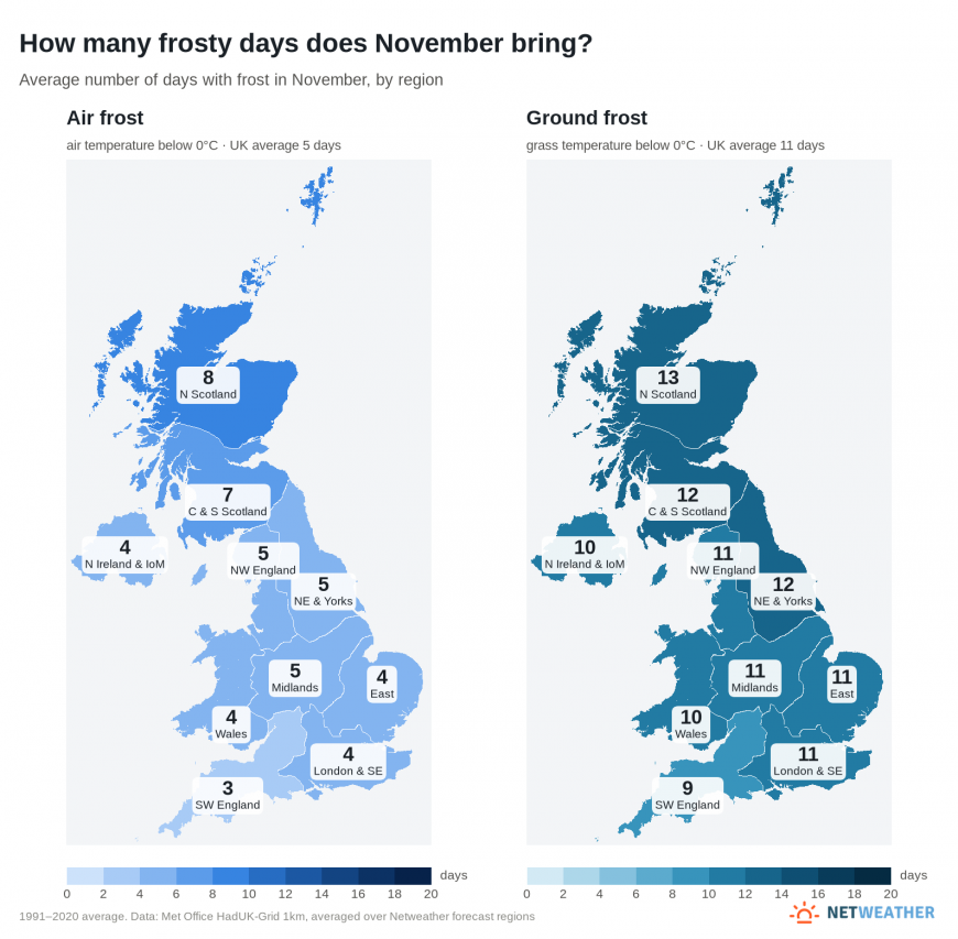
As we head towards winter and the temperatures fall further, the risk of frost and fog increases. There are different types of fog; here we will look at Radiation Fog. This can cause severe weather conditions with impacts for people and transport. There is an air frost or a ground frost. Ground frost includes the unofficial grass frost. You can relate these to air temperatures at or below zero, and above zero usually up to +5C. This might affect your garden plants and worry growers but it is the accompanying ice that causes most of the issues for people going about their everyday lives.
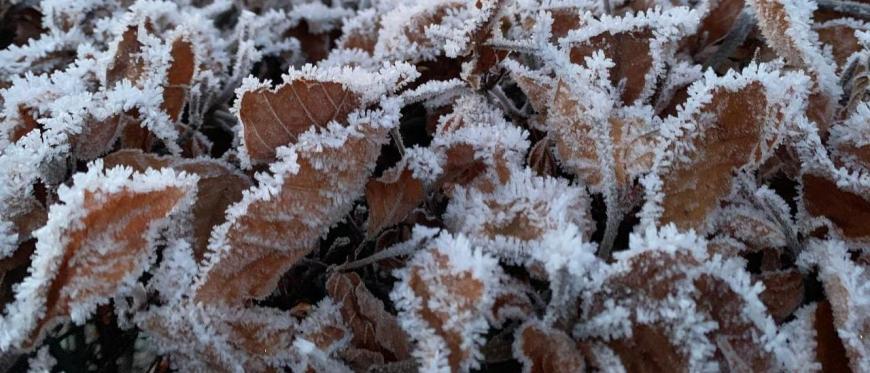
If the surface temperature is below zero, a rather feathery hoar frost forms. The water vapour in the air freezes onto the cold surface and turns to a solid ice state. Again, latent energy is released, but more energy this time as this is a change to a solid, rather than just to liquid dew. In early autumn, ground frosts begin as gardeners prepare, and the first air frosts will be reported, often in rural Highland Scotland. In towns and cities, the tarmac roads and concrete of buildings all store heat from the day for longer than out in the countryside. Sea swimmers will tell you about the lag in shore temperatures, with late October being ‘warmer’ in the water than early April. So along the coasts in autumn, those warmer waters act as a buffer, with frost less likely to form.
For frost and fog to form, the air temperatures need to fall away, and this is more likely to happen inland, in rural areas on a clear and quiet night in autumn. By mid-winter, all of the UK can experience a frost. Air temperatures are measured in a Stevenson Screen at least one metre above the ground.
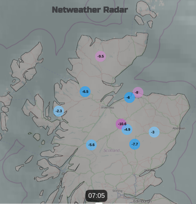
Netweather Radar with lowest temperatures showing a chilly, clear start in early January 2024
If there is a very light breeze, there will be a bit of mixing in the lowest layer, near the surface. Rather than dew or frost forming, if the air is saturated, then fog can form. You need moisture and clear skies, and then radiation fog can form. There are lots of things in the balance, such as how much breeze, incoming clouds, and when the sun will appear.
Fog is just like clouds on the ground. It is defined as fog if visibility is reduced to less than 1000 metres. Dense fog is when visibility is below 100m and that can be very dangerous (as is freezing fog when temperatures are below zero). Under clear skies, the air temperature lowers and the air can no longer hold the moisture so it condenses and fog forms. Thinking about the net balance of infrared radiation, in the early morning there can still be a cooling at 8am before the suns rays can make any difference in November.
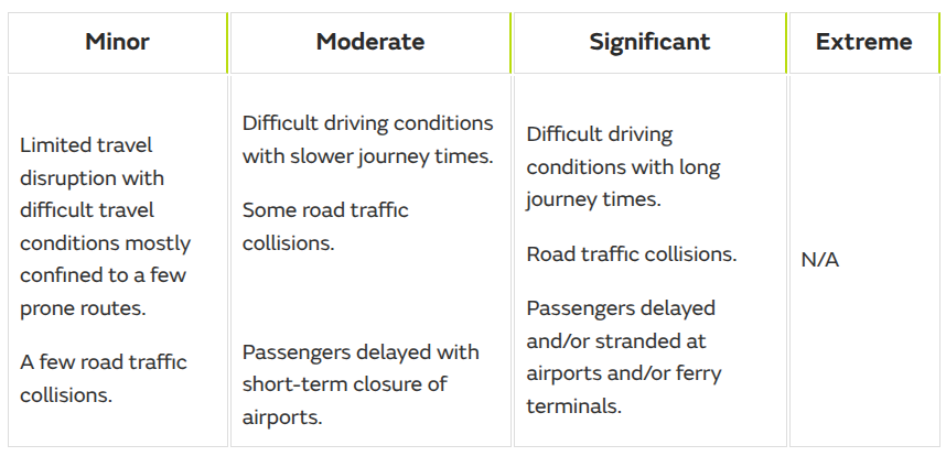
The UK Met Office does issue warnings for fog. In forecasts to the public, this focuses on visibility below 200m. The warnings are either yellow or amber, not red. This relates to the persistence of fog and how people adjust. If the fog continues for days, the impacts lessen. "High [Extreme] impacts from fog are therefore not expected and not catered for on the impacts table" MO.
Each season as the air temperatures begin to fall, a new thread starts in the Netweather community forum First ground and air frost watch 2026-27 season
Loading recent activity...