A prolonged settled spell is on the way, thanks to blocking high pressure building over the UK and model forecasts broadly support at least 10 days of high pressure in charge bringing mostly dry and sunny conditions by day, though fog will likely become increasingly widespread this weekend for those who have Halloween and Bonfire events.
Blocking high pressure builds across the UK to end October and start November
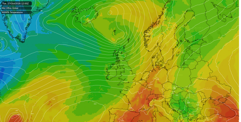
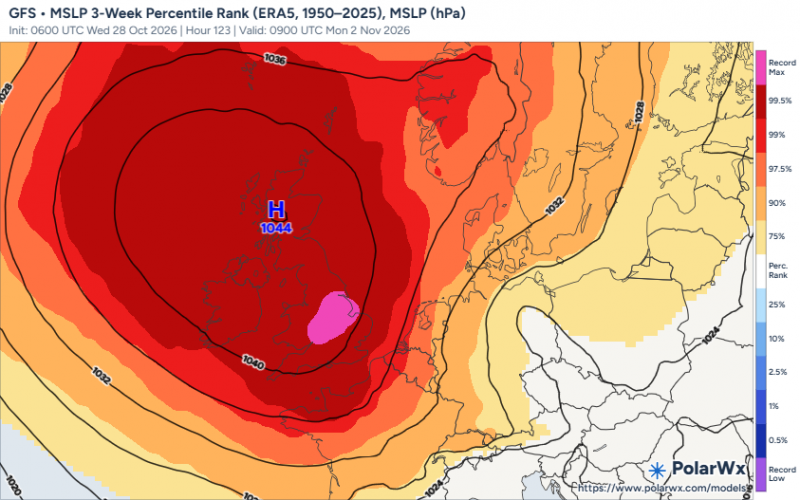
After the stormy run of Austen, Boelo and a third deep low, conditions will begin to settle down from today, as the strong 200mph jet stream that was driving the storms at the UK, buckles north allowing high pressure to increasingly build north across the UK. A blocking area of high pressure building across the UK will become slow-moving, bringing a prolonged period of dry and settled weather across many parts, likely persisting through next week up to around the 7th of November, after which, high pressure may sink south to allow more mobile, cyclonic westerlies to take over, with more unsettled conditions establishing off the Atlantic.
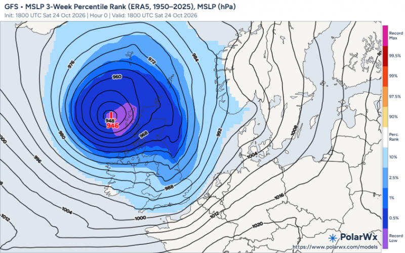
From near record low pressure last weekend near the UK to near record high pressure early next week:
Showers across the north and west today will fade as high pressure extends north over the near continent, leading to mostly dry and settled Thursday. High pressure will briefly retreat east on Friday, to allow a weather front to move in from the west. This will bring a band of rain across western Scotland and the island of Ireland later on Friday which will become slow-moving into Saturday - before weakening and sinking south across England and Wales on Sunday, bringing some patchy drizzle in places.
Otherwise, continuing mostly dry and settled on Friday and through the weekend, with some chilly nights and increasingly widespread fog developing overnight where skies clear, which could cause some issues in the mornings and may be stubborn to clear with the weaker sun now.
Widespread fog looks to form overnight at the weekends
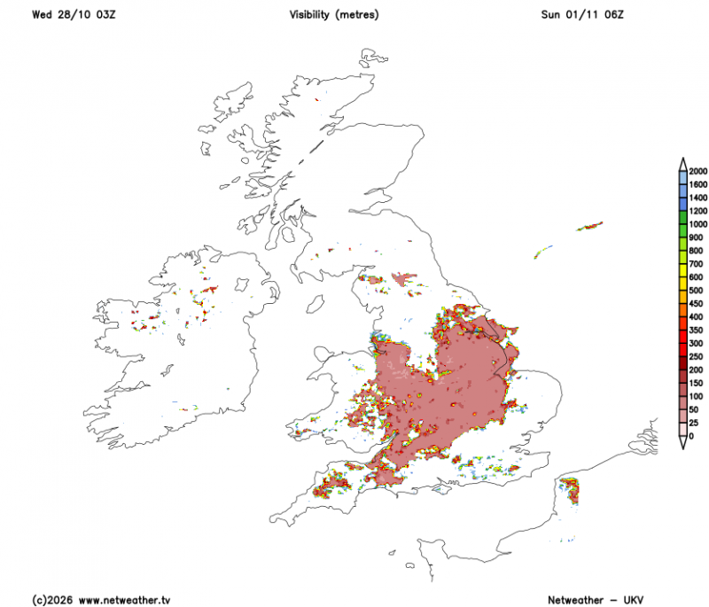
With the ground saturated from recent rain, moist ground, clearer skies and lighter winds as a new area of high pressure builds in from the Atlantic across the UK will encourage widespread mist and fog overnight and in the mornings. Extensive fog is expected to cause difficult driving conditions over the weekend and perhaps next week too, and in some places the mist, fog and low cloud may not clear at all and make it feel quite chilly.
High pressure is set to dominate the UK through the first week of November, bringing a lot of dry weather. Cloud amounts will be variable, with weak fronts circulating around the high, possibly bringing a focus of cloud and light rain or drizzle at times, but no particular region favoured for these. Fog will likely form where skies clear and is expected to be slow to clear and may linger all day in some places. It’s more likely towards the east, and where it lingers it will stay chilly. Expect slow, murky morning commutes on several days.
For most, temperatures look to be fairly close to average, though it will remain cold where fog sticks around. Some overnight frost is possible next week where skies are clear and winds light, so it’s worth having the ice scraper handy.
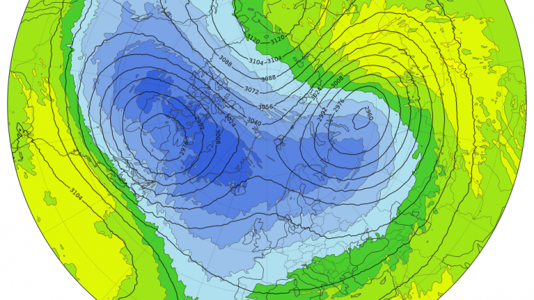
Meanwhile, models are showing a dramatic weakening of the polar vortex, with a 80% chance of a Sudden Stratospheric Warming in the next two weeks, which would be record-early. These events can sometimes increase the odds of colder spells weeks later, but the link is far from guaranteed, so it’s one to watch rather than plan around.
Loading recent activity...