After last weekend’s storms, you may be glad to know that this coming weekend looks much quieter. It is Halloween on Saturday night, so that may bring its own noise and excitement but high pressure close to the UK means much lighter winds. There will be some mist and fog with this steady setup.
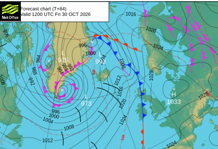
By day, Friday will feel pleasant in the sunshine. There is a cold front which will bring rain from the northwest and behind this, the air will feel colder. There is some uncertainty around the progress of this cold front, so rather than just looking too closely at the hourly timings on a weather app, view it as a wavering band. During Friday, the outbreaks of rain with more cloud seem to pester Northern Ireland and Scotland, particularly western and SW Scotland.
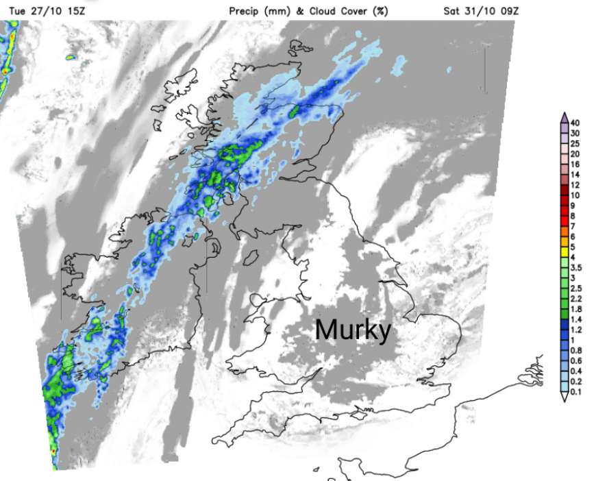
The UKV and GFS models keep a distinct band of rain over Northern Ireland and Scotland for Saturday morning, but the ECM model has it as a minor feature with only light and patchy rain. This narrow band could bring a grey, damp day to some areas, but either side of this there will be a lot of sunshine for England and Wales, and good sunny spells to the northwest, but it will feel chilly.
Halloween night
For those heading out 'Trick or Treating' or 'Guising' the weather will be ideal. Not terribly cold, but a bit of a nip in the air and even some misty murk about. It should be dry for most places and hardly any wind, so that won't mess with scary outfits and cloaks.
Sunday
Sunday will see the front fading further but leaving areas of cloud over Britain and a bit of damp weather for southern Scotland, into Northumberland, maybe Tyneside and also Cumbria. This damp patch could edge down eastern counties of England on Sunday, over the Humber into Lincolnshire. There will be more sunny but nippy weather in the north over Northern Ireland and the rest of Scotland although a weak weather front could arrive over the Scottish Islands on Sunday, bringing outbreaks of rain. Much of England and Wales will have more cloud cover on Sunday, but it will vary from gloomy to bright depending on the thickness of that cloud. For the West Midlands and Birmingham this weekend, daytime temperatures will be around 14 to 12C and down into single figures overnight. For Belfast it will be around 13C by day, so feeling cool.
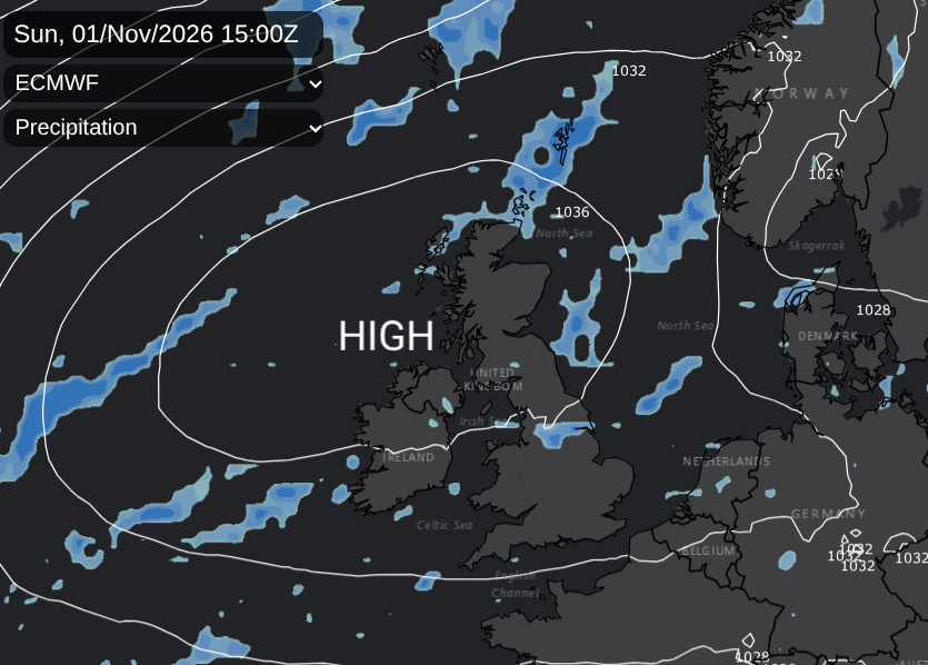
High pressure will be building and for most it will be a fair weekend with light winds. There is just this frontal band of cloud and rain which has the potential to spoil the first half of the weekend for the unlucky ones under that line.
This cloud cover will affect the nighttime temperatures. It will be mild under the areas of cloud, especially the blanket of Stratocumulus under the high pressure. Where skies are clear and with the colder air in the far north, there will be a touch of frost.
The settled weather and high pressure stay over the UK for the start of the new working week.
Loading recent activity...