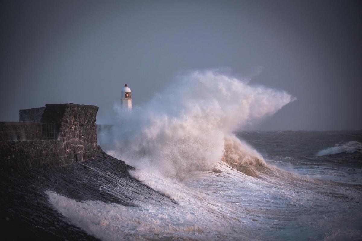
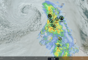
That was quite a few days of weather! First, Storm Austen moved through southern Britain with gales, rain and high gusts, resulting in power outages and travel disruption. There was also heavy rain and flooding for eastern Scotland on Friday. Next came Storm Boelo, further north and deeper, with widespread strong winds and heavy rain. As the frontal band moved by on Saturday, conditions deteriorated with driving rain and high gusts. Western areas saw heavy rain, an onshore wind and at high tide there was coastal flooding, whereas elsewhere tree debris littered streets and leaves blocked drains.
After trees fell on power lines in the storms, there are still thousands of homes and businesses without power on Monday, and electricity companies are working to reconnect supplies.
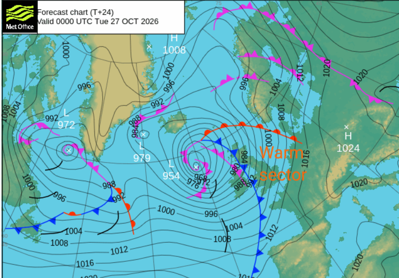
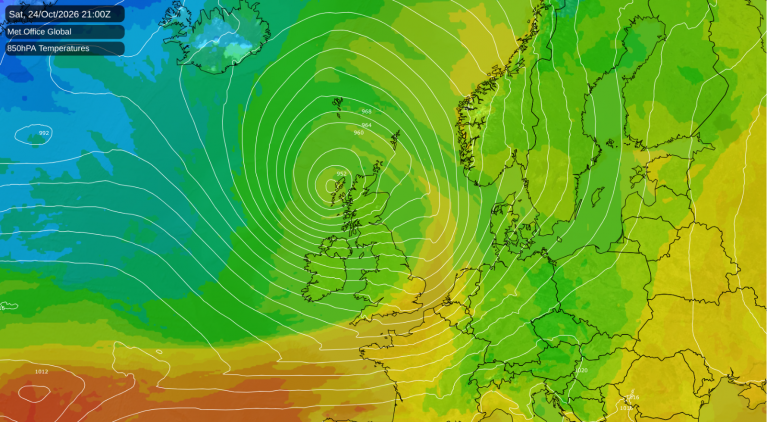
Explosively deepening low pressure (T+24 Tuesday 00z 954hPa)
This Monday morning lull did not last long and the day will become windier. Another Atlantic low pressure is deepening over the Atlantic and will be heading close to the UK on Monday night. The rain from the warm front is over the UK, as southerly winds begin to freshen around western coasts.
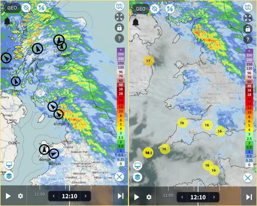
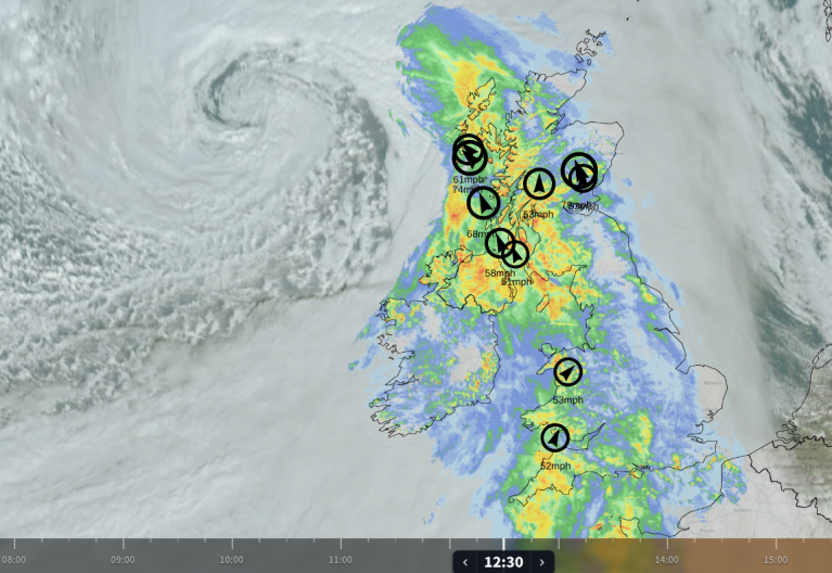
Top gusts on the Netweather radar for exposed coasts and mountains on Monday, also top temperatures in the warm sector.
The UK will be in a broad warm sector (you will notice how mild it turns), before the rain on the cold front sweeps across the UK tonight and early on Tuesday. The deep low centre will pass near northern Scotland. There will be more very windy weather for the Highlands and Islands of Scotland during Tuesday, which could hamper the power engineers' reconnection work. After disruption this weekend, there will be further changes and cancellations impacting ferry services around northern Scotland. CalMac (west coast Scotland) are cancelling some services “due to sea swell conditions” as NorthLink Ferries has issued an Early Disruption Warning to customers.
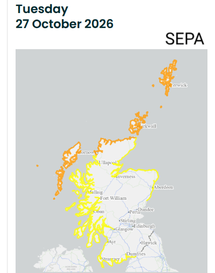
Amber coastal flooding: Likely impacts are: Flooding affecting parts of communities, Danger to life and damage to buildings, Disruption to infrastructure.
SEPA, the environment agency in Scotland, are highlighting the risk of coastal flooding this week with significant coastal impacts likely on Tuesday for the Scottish Islands and far north coast of the mainland. Natural Resources Wales and the Environment Agency for NW England are also warning of coastal flooding in the next few days.
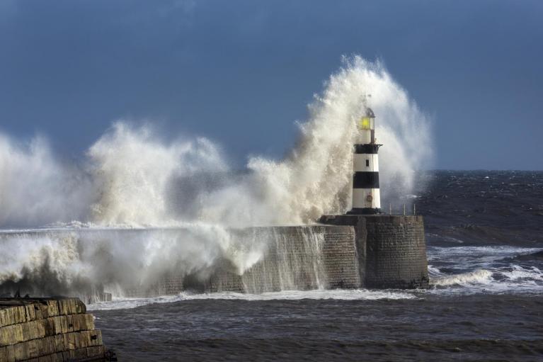
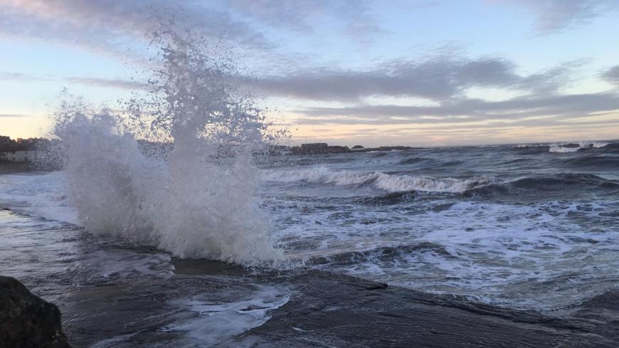
As another low pressure moves our way, there will be large waves causing spray and wave overtopping, a large storm surge in the onshore flow combined with high spring tides.
The Met Office has issued yellow wind warnings for this next low pressure.
“A spell of strong south to south-westerly winds may cause some disruption during Monday evening and the early hours of Tuesday.” MO Monday night
This covers western Britain, from Glasgow, around the Irish Sea, west coast Wales and SW Britain.
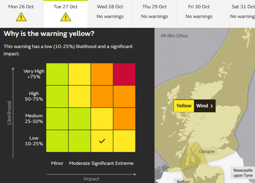
A second yellow wind warning (see above) begins in the small hours of Tuesday and runs into the evening over much of Scotland and the north coast of Northern Ireland.
“A spell of strong winds may lead to damaging gusts and transport disruption.” MO
It highlights the risk of significant impacts, but there is a wait for the forecast models to firm up on where and when could be most affected, and how wild this weather will be. It is likely that the northwest of Scotland that sees the worst of the gales and wild sea conditions, which is why southern Scotland is not in the warned area.
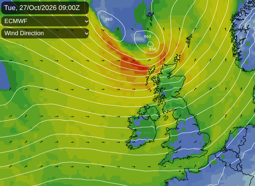
The Inshore waters forecast Outlook for Tuesday “Wind- South 6 to gale 8, veering southwest gale 8 to storm 10, decreasing 5 to 7 later. Sea state- Moderate or rough, occasionally very rough at first in the east, becoming very rough or high in the northwest" along the north coast of Scotland.
It will be windy across northern Britain, western Wales around the Irish Sea and for Northern Ireland on Tuesday morning, stormy in the far northwest then far north of Scotland.
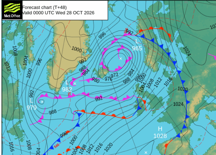
The winds ease off during Tuesday night, but a small low pressure will run in off the Atlantic. This will bring a new area of blustery winds and rain to western Scotland, perhaps brushing Northern Ireland, and it will leave showery outbreaks of rain over northern England and central Scotland early on Wednesday.
Keep an eye on flood warnings around the coasts of Britain. 105 is the free phone number to report a power cut or dangerous damage to electricty power lines or substations. It doesn't matter which energy company supplies your electricity.
For London, it will be very mild into the night on Monday. It might sound blustery overnight with rain to start Tuesday, then a fresher feel to the air, but it will stay dry. It will be mild for Cardiff this evening, then wet and blustery as the cold front moves by. There will be more rain towards the middle of the week, but it won’t be as breezy. For Glasgow, after a cold, wet day, it will feel strangely mild this evening until the cold front rain arrives and the winds strengthen. There will be more heavy rain with fresh SW winds and gusts over 40mph. Conditions around The Minch look grim by Tuesday morning with severe gales. Take care around the coasts.
Loading recent activity...