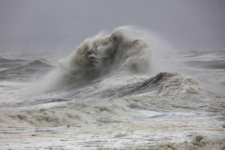
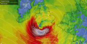
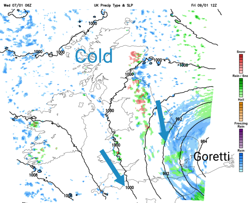
Eyes are now turning to the Atlantic and a developing windstorm for southern Britain on Thursday night, away from the incredible snow depths of northern Scotland. Goretti has been named by Meteo France as a deepening low pressure is forecast to move eastwards along the English Channel later on Thursday bringing gales and heavy rain but also the risk of snow where the precipitation encounters our current cold air.
Met Office amber warning for Snow Thursday 8pm until Friday 9am
"Heavy snow, associated with Storm Goretti, is likely to lead to disruption and dangerous travelling conditions Thursday night into Friday" MO
There are also wind and rain warnings for this "multi-hazard" event which will impact England and Wales, rather than Scotland and Northern Ireland. This will be a dramatic change from the settled, often sunny but cold weather that much of England and Wales has been seeing. There have been coastal snow showers and occasional night-time bands of sleet and snow but not a deep low for 2026.

Rain, sleet and snow
Conditions will deteriorate in southwest England on Thursday morning as rain sets in, which will turn heavy over Cornwall and then Devon at lunchtime. Rain will reach into southern Wales with snow over the hills as it comes up against the cold air. The rain will extend over more of the West Country and southern England, even into the Midlands, through Thursday afternoon.
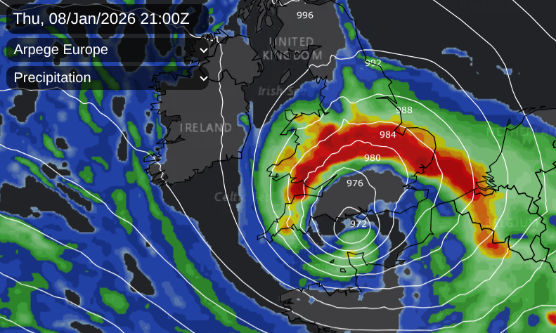
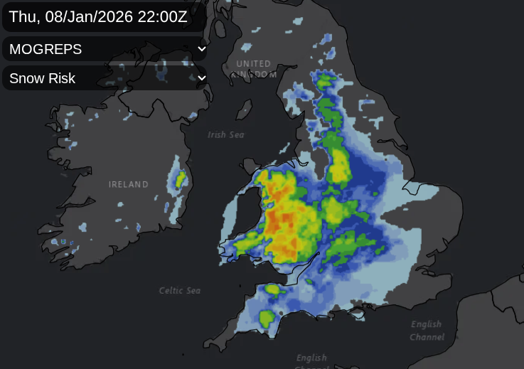
As many head home from work on Thursday evening, there is still some uncertainty about the precipitation; where the deepening low centre will be (with lighter rain near that centre), the reach of the frontal band (bringing heavy rain), along with where it will turn to snow in the cold air. Snow warnings for the higher ground of SW England including Dartmoor and Exmoor and a wider snow warning for Wales, the Midlands and along the Pennines.
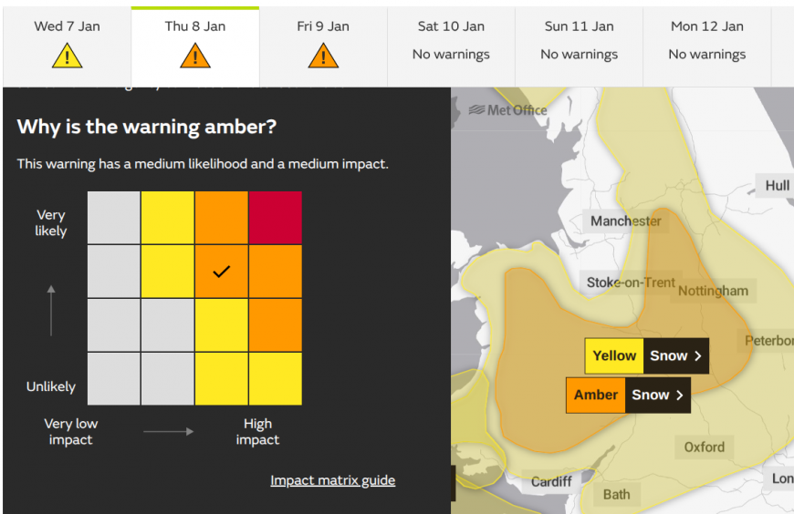
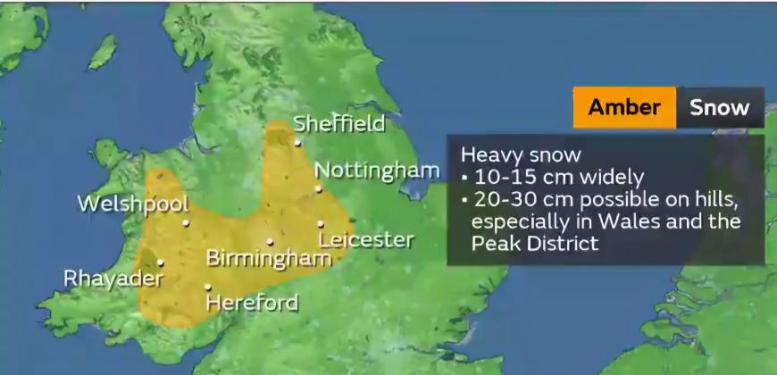
The Met Office has issued an Amber warning for snow within the wider yellow area. “...initially on hills and then to lower levels overnight, before easing through the course of Friday morning. Accumulations of 10-15 cm are likely fairly widely, with the potential for 20-30 cm in some locations, mainly on hills above 200 m elevation, more especially in Wales and/or the Peak District.” Met Office
This runs from Thursday evening overnight and through the Friday morning commute. There are also heavy rain warnings.
If you are looking at a weather app, bear in mind that the heavy rain may be further north through the Midlands. Up to the Humber, the Peak District and Merseyside could all be along the leading edge of rain, sleet and snow on Thursday evening. Embedded heavy rain is also likely to turn to snow for a time.
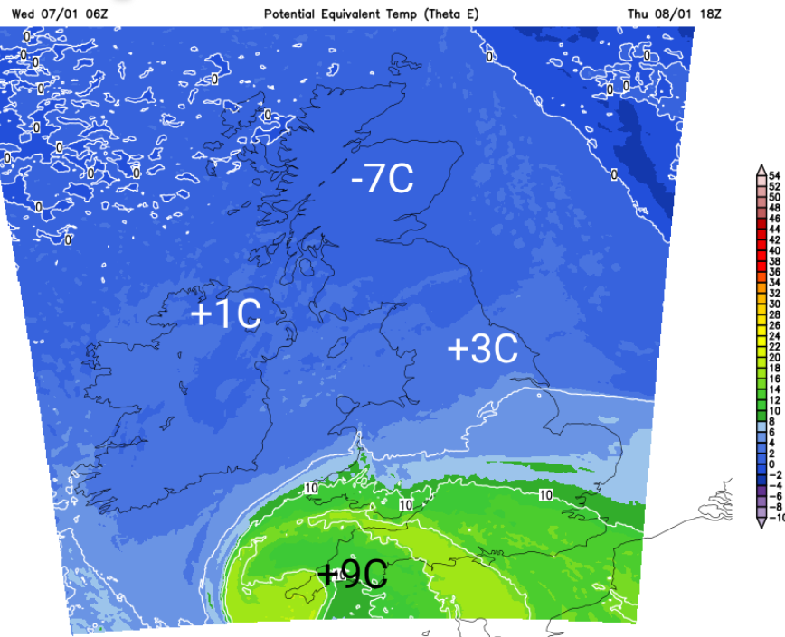
There will be milder air caught up with Goretti for the far south of England, but in the heavier rain with the existing cold air, there will be sleet and possibly significant snow, most likely over any hills.
As Goretti moves eastwards this mild air means that snow is unlikely overnight for southern England, but it will all clear away early on Friday and in that tuck of colder air from the north behind the low, things could turn wintry. In the southeast, the Downs stand out on the MOGREPS snow chart. It’s a tricky mix even into Friday morning.
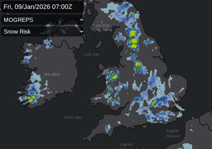
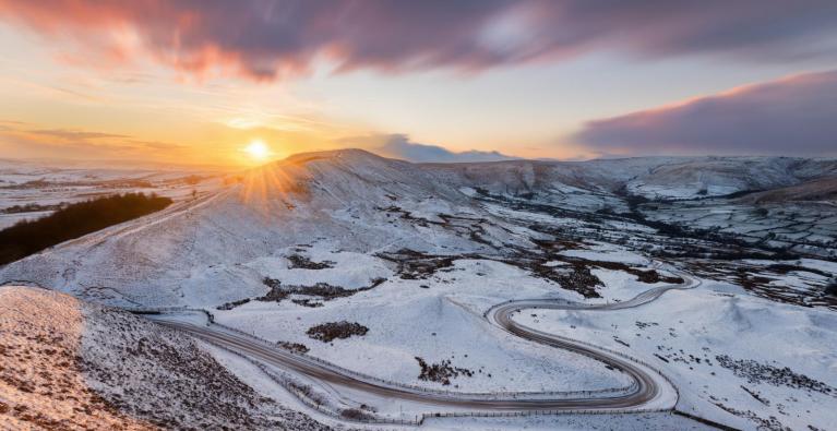
In the far north, there will be clear skies, temperatures well below freezing, widespread ice and the risk of freezing fog with light winds. It could be the coldest night of the year so far here.
Wind
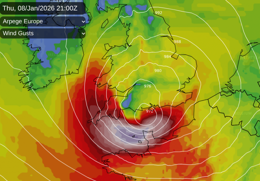
The Met Office's amber wind warning “Storm Goretti may bring a short period of exceptionally strong northwesterly winds to the Isles of Scilly and parts of Cornwall on Thursday evening, with peak gusts potentially of 80-90 mph in exposed areas. This will depend on the exact track of Storm Goretti, and should the low pressure system track further south then the risk of these very strong winds would reduce.”
This is the other area of uncertainty; if Goretti stays a bit further south, it will be northern France with more wild weather rather than centred along the Channel.
Jersey Met mentions “Very windy. S strong F6 to 7, veering W to SW severe gale F9, perhaps storm F10 for a time”. The inshore waters forecast for the English Channel mentions severe gales, even storm force winds for a time, which could impact ferry crossings.

The windy weather will start for Wales, SW England and the Channel Islands on Thursday evening. A fresh to strong E/NE wind will pick up across the southern half of Britain but again, if Goretti is a bit further south, things will change. The UKV Model has a raging northwesterly with severe gales for the Channel Islands and the eye-catching core of extreme gusts skirting close to the north coast of France through the small hours. We wouldn’t want that a further north either.
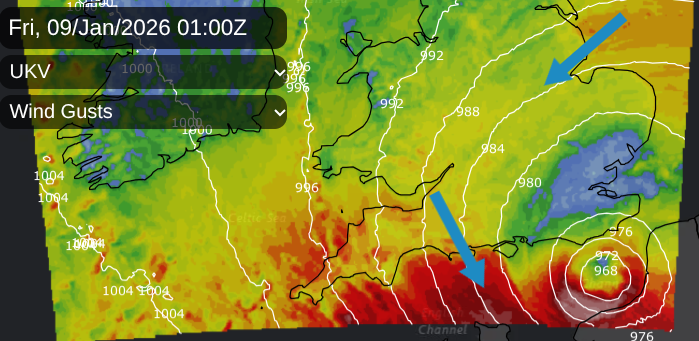
As the low pulls away, a cold north to NW flow will make Friday morning feel miserable with the wet, even wintry weather and a wind chill. Northern Ireland will be sunny and calm, the frontal icy rain will linger all day for eastern England and there will be a scattering of sleet and snow showers over Britain. It will stay windy for the southeastern part of Britain from the Humber to Cornwall. It will feel cold everywhere on Friday and the strong NW winds will last into the evening for London and the Home Counties.
Southwestern storm naming group
Our naming list (for the UK, Ireland and the Netherlands) is up to C, which would be Chandra, after Bram. Météo France is in a different group covering Iberia and NW mainland Europe. Southern Spain has been hit by heavy rain and flooding due to Storm Emilia, and then Storm Francis over the past two weekends. Which is why we have G for Goretti.
It is the potential for a vicious core of extreme wind gusts in the early hours of Friday, close to the north coast of France, which led Meteo France to name the low. The impacts of Goretti’s weather will be widespread, over England and Wales but also for the Low Countries on Friday as the low centre arrives. Precipitation and gusty winds will sweep across Iberia and more of France as Goretti’s active cold front heads for the Mediterranean and the Alps. Goretti will be quite the European event.
More discussion and chat about Storm Goretti in the Netweather community forum
Loading recent activity...