The bitter Arctic cold holds clings on this week with a few attempts at dilution. Atlantic low pressures are going to complicate the existing snow shower pattern which has clobbered northern Scotland so far this year. There is a mess of two low centres swinging over the UK later on Tuesday, and a particularly tricky, even stormy low from the southwest for Thursday night. All this precipitation will encounter the cold Arctic air, resulting in a mix of icy rain, sleet and snow.
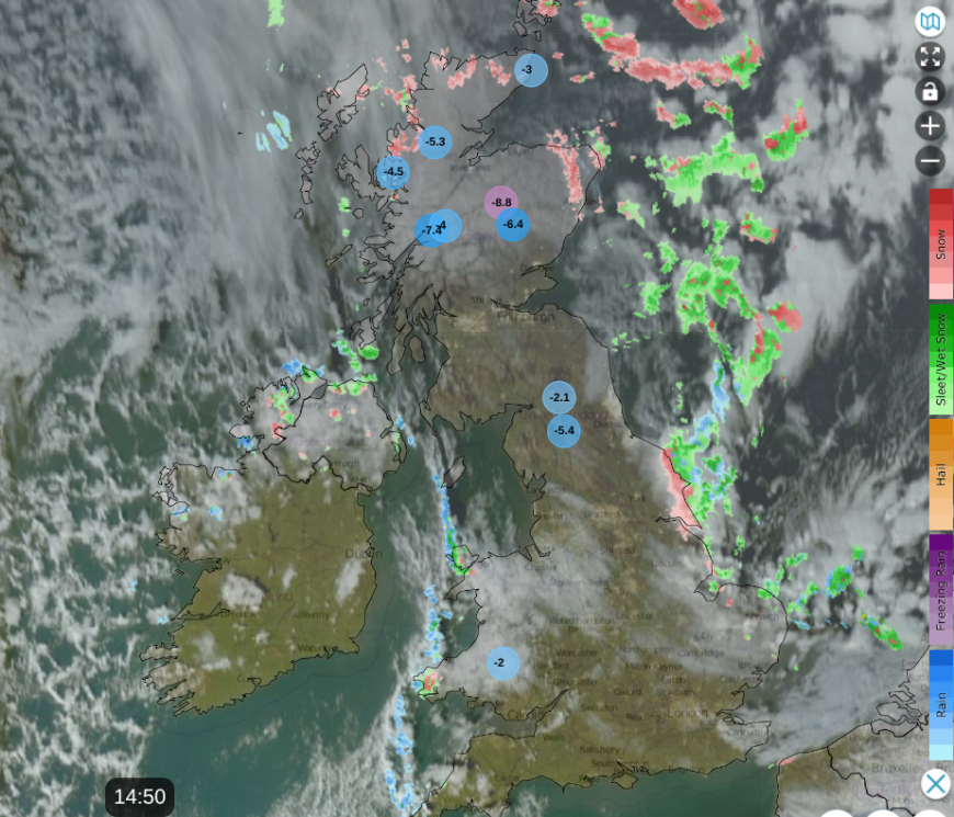
Netweather Radar showing snow shower pattern in a north wind. Lowest air temperatures and satellite cloud cover
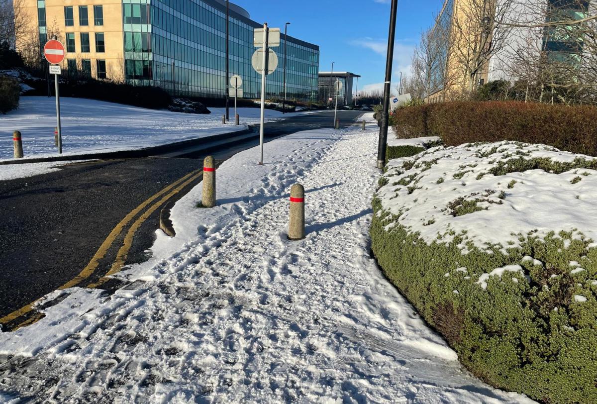
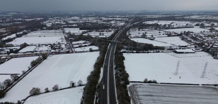
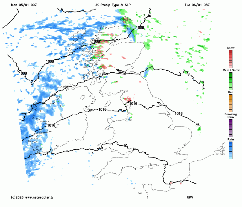
Over the past few days, variations in snow cover have centred around the flow from the north, wavering to the northwest and then back to a true northerly. As the flow backed, more showers reached Northern Ireland and Wales with heavier snow for the NW Highlands. In the northerly flow on Monday morning, wintry showers clipped western Wales, reaching Cornwall with plenty of snow for northern Scotland. Additionally, snow blanketed NE and eastern England as a feed of showers extended from Berwick-upon-Tweed down to Norfolk. Occasional bands have reached further south, bringing overnight snow to the Midlands, even SE England.
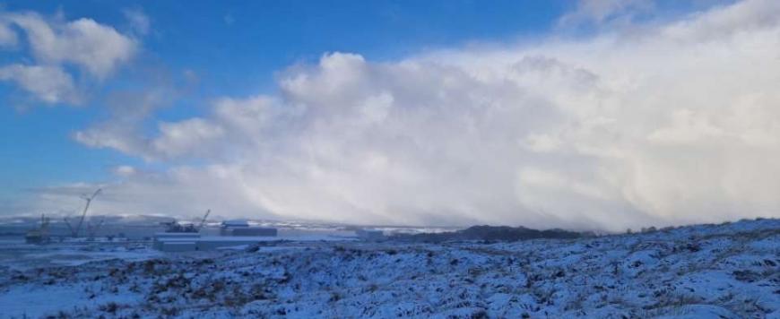
In this deep cold, the positive has been the bright, cheery sunshine. Even if you are stuck inside, the sunshine is uplifting as long as you stay warm. There will be more cloud about by midweek
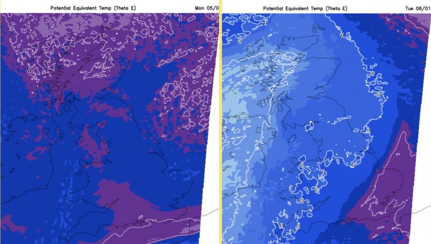
A lessening of the deep cold from the Arctic
Over the next few days, the risk of snow is from frontal bands coming up against the cold air. The computer models are not instilling high confidence in a difficult setup. With less-cold air from the west, there will be a mix of rain, sleet and possibly more snow.
Thinking about the low pressure later this week, 30 miles north or south could make a huge difference to many people over Wales and England. So far, there aren’t any weather warnings for later this week, but the likelihood of some disruptive weather is lurking and being considered.
The Met Office has to balance; the rain/snow risk, the uncertainty for the track of these incoming lows, the time of day when snow might fall, the existing conditions (we all know it is cold out there) and think about the warning matrix - the likelihood of disruptive snow and the possible impacts.
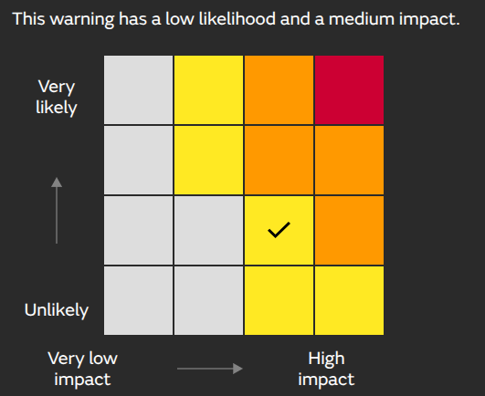
This matrix is for the snow risk over Scotland on Tuesday.
“Snow and ice are likely to bring further disruption, particularly across central and northern mainland Scotland on Tuesday.”MO
You could see snow in an area without a warning but people can cope, it's January. Also, you might be in a yellow-warned area and not see any snow. There might be a scattering of showers which miss you, or the precipitation stays as rain, rather than turning to snow. That will be a complication for Thursday night into Friday.
What changes this week?
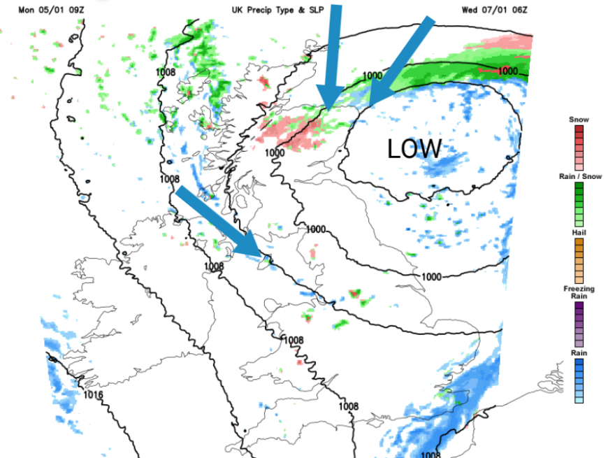
The northerly flow, which has driven snow into NE and eastern England, is easing and backing later on Monday so it will become dry and potentially icy here. A few more wintry showers will trouble north Wales and along western fringes but the main focus changes to the far northwest overnight. One low centre will move from Ireland down to Wales as the deepening low skims past northern Scotland to the North Sea.
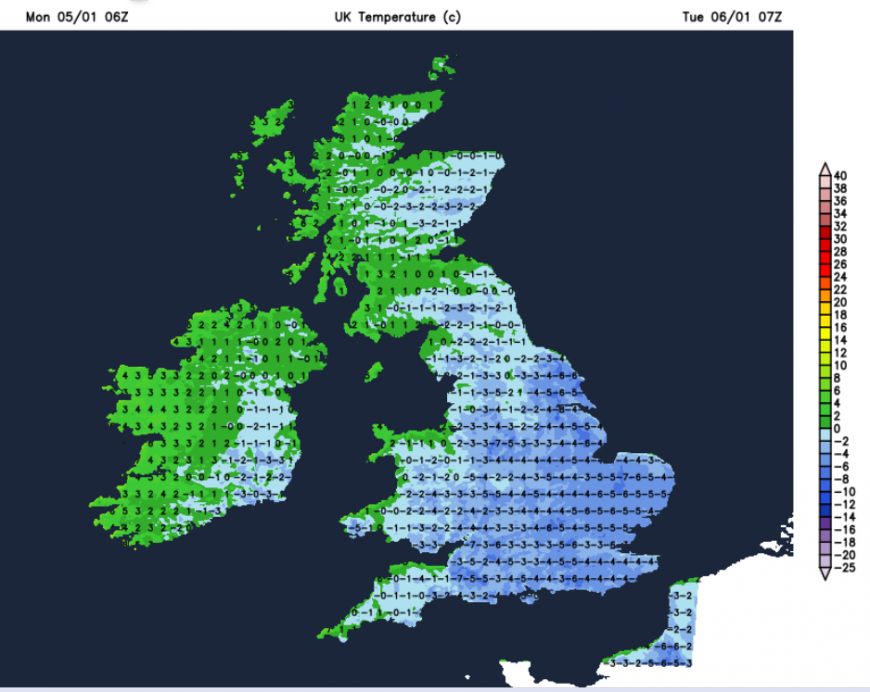
It will be very cold again overnight with a severe frost for England. Northern Ireland won’t be quite as cold and less cold air will seep in from the northwest. It will be another very cold Tuesday for London, the Home Counties and much of SE Britain as the deep cold holds on. Here, there will be light winds, clear skies and more sunshine.
These Tuesday low pressures stir up the very cold air, diluting it somewhat but bringing more cloud and precipitation from the northwest. There will be a wintry mix, with rain at the coasts over NW Scotland but gradually reaching over more of Scotland into NW England during Tuesday. There will be patchy rain with a few sleety bits for Northern Ireland as southwesterly winds begin to pickup. There will be rain and mountain snow over Wales to end the day and a band of rain and hill snow moving from central Scotland over the Cental Belt for the evening commute with blustery winds. This wet and wintry mix will move to northern England with snow over the Pennines and Peaks as the wind veers to a chilly northwesterly. As the cold front continues its way south it might deposit some snow over the Downs of SE England before dawn on Wednesday.
That deep cold will return on Wednesday to the far north. The low pressure over the North Sea will pull the Arctic air back over the Northern Isles and Grampian with a severe frost as temperatures plummet. Later this week, temperatures in Scottish glens could drop closer to -20C with lying snow and ice.
This will be another change for Wednesday, a significant wind chill. The fresh northeasterly wind will shift from the Moray coast, along the east coast of Scotland to NE England during Wednesday morning. Around the Irish Sea into Merseyside, there will also be a noticeable chilly wind, from the northwest. Many places will become dry, as the last of the rainband clears Kent. Snow showers could continue for Orkney and Grampian midweek and might nudge over eastern Scotland then NE England later on Wednesday. These will be quite hit and miss as the amount of cloud across the UK increases. You will miss that sunshine.
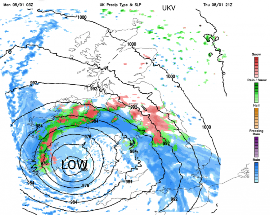
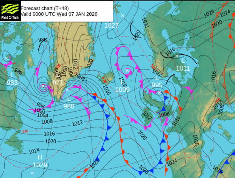
It will be cold overnight Wednesday into Thursday, especially for eastern Britain. Eyes are turning to a low pressure signal later on Thursday. The UKV model has a significant low pressure for Thursday night, bringing severe gales into the Western Approaches with heavy frontal rain from the southwest. This turns to snow as it reaches northern Britain and Northern Ireland drawing in a strong easterly wind. This leaves a wet, wintry and wild Friday as the low centre moves over Britain, although it could be quieter near the centre of the low pressure.
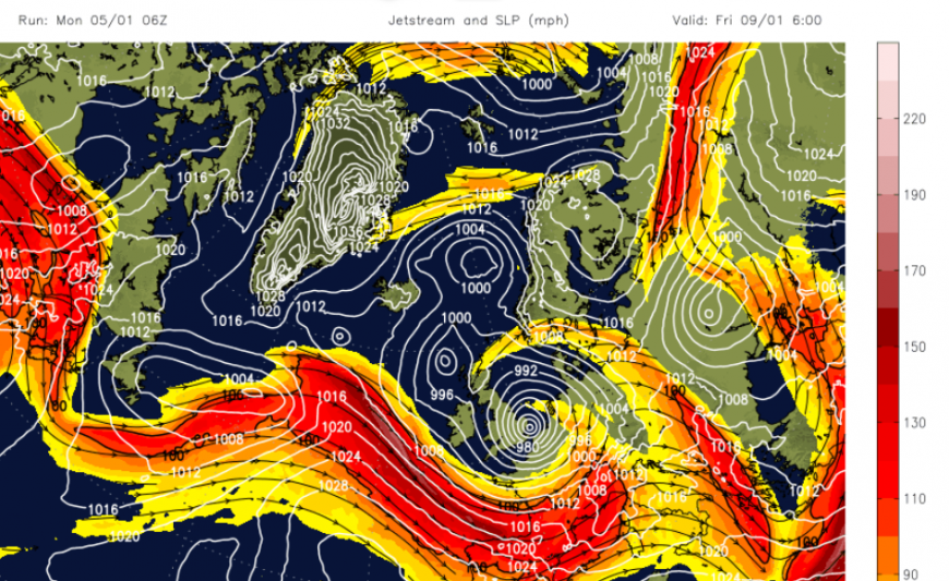
The GFS model brings the low pressure in from the southwest but edges across southern Britain so any precipitation remains over Wales and England, and the risk of snow as it hits that cold air stays over central Britain. Will the low explosively deepen in the left exit development region of the jetstream, near the UK? That would add strong winds, even gales into the mix as well.
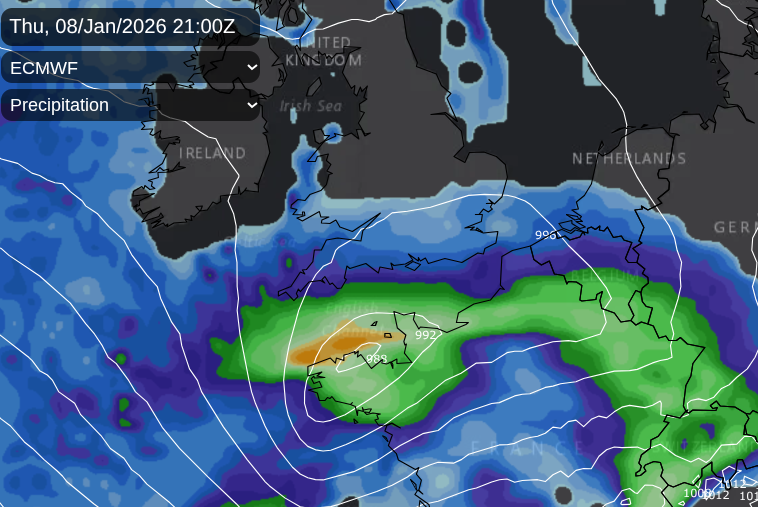
The ECM is different again, skirting along the English Channel before deepening over the Low Countries. This might bring the zone of wintry precipitation further south, to southern Britain, even London and the Home Counties by Friday morning.
So you can see why there aren't any warnings just yet, but there are signs of possible disruptive weather for Thursday night and early Friday. Plenty to consider and chat about in the Netweather community forum.
Loading recent activity...