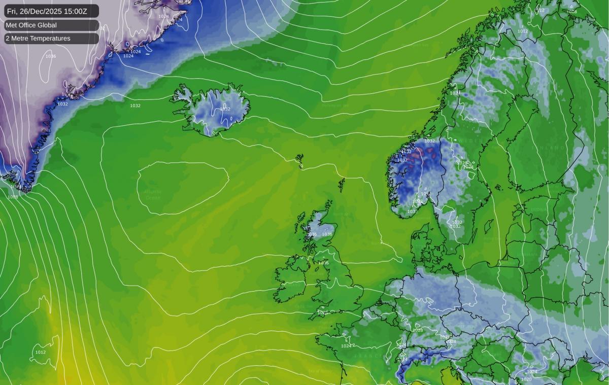
Firstly, from the team here at Netweather, we hope you had a very merry Christmas. If you're heading out for a Boxing Day walk this afternoon, wrap up warm. High pressure has settled over north-western Britain and intends to stay put for much of the coming week, bringing predominantly dry conditions but temperatures that will feel noticeably chillier than the mild December we've grown used to.
It'll be another dry day with some pleasant spells of winter sunshine, particularly, but not exclusively across western regions. The flip side of this settled pattern is the stubborn cloud that easterly winds will drag in off the North Sea, keeping things grey and rather raw from Lincolnshire up through the northeast. If you're on the east coast, that breeze will have real bite to it, so the south and east will feel the chill most keenly today despite similar thermometer readings.
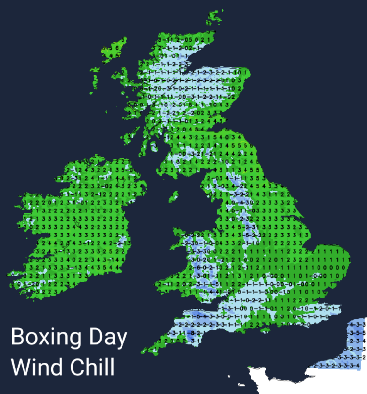
Temperatures through the week will sit below average, with daytime highs of 5 to 7C for most, occasionally nudging 8 or 9C in the south and west where the sun breaks through. After a December where double figures became almost routine, it will feel like a return to winter. That brisk easterly will sharpen the cold further, particularly along North Sea coasts where the wind chill will be noticeable.
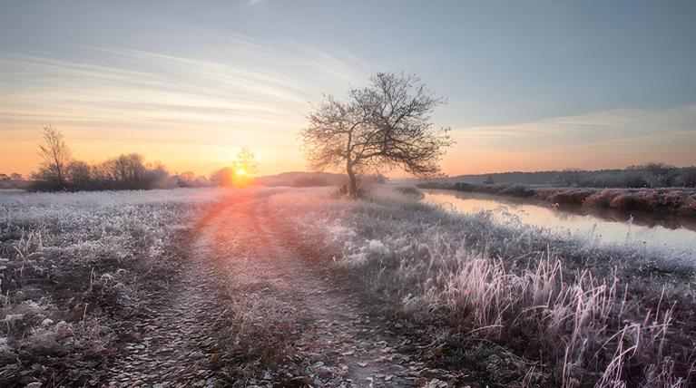
With high pressure in charge and winds falling light away from coasts, we'll see widespread frost developing in the coming nights. Rural valleys in Scotland could drop to minus 6°C, with Wales seeing minus 4°C in sheltered spots. Even suburban gardens will see a good coating of ice on car windscreens most mornings.
For anyone venturing onto higher ground this week, conditions will be rather more demanding. The fells, mountains and moors will see persistent easterly winds of 20 to 35mph, with gusts pushing higher. On the Lake District summits, temperatures around freezing will feel closer to minus 10°C in exposed spots. The Cairngorms and Snowdonia tell a similar story: plenty of sunshine for those who earn it, but bitterly cold in the wind.
The chance of any meaningful snow at low levels remains slim. This festive period shows no signal for widespread snowfall, with most areas staying dry. The odd wintry shower mixing rain and sleet might clip northern hills, but nothing disruptive is currently on the cards.
Looking toward the weekend and into early next week, the high pressure keeps its grip, though cloud amounts are likely to increase. Sunday and Monday look predominantly dry with occasional sunny spells, though eastern districts will continue to see the greyer end of proceedings. The main hazards remain overnight frost, the risk of ice on untreated surfaces, and patches of fog lingering in sheltered valleys, particularly through the Midlands and parts of Scotland.
There are tentative signs that winds may turn more northerly toward New Year's Eve as high pressure drifts westward. If this materialises, it could open the door to a few wintry showers, mainly affecting northeastern coasts and higher ground. But for now, that remains a possibility rather than a certainty, and the models will need watching.
Loading recent activity...