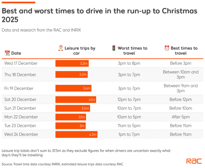
This weekend sees the start of the festive getaway. Although many people may be facing three or more days of work before Christmas, many schools will have finished for 2025 and people will be keen to get going. Christmas isn’t until Thursday next week but Saturday 20th and Christmas Eve stand out as the busiest days according to the RAC’s predictions
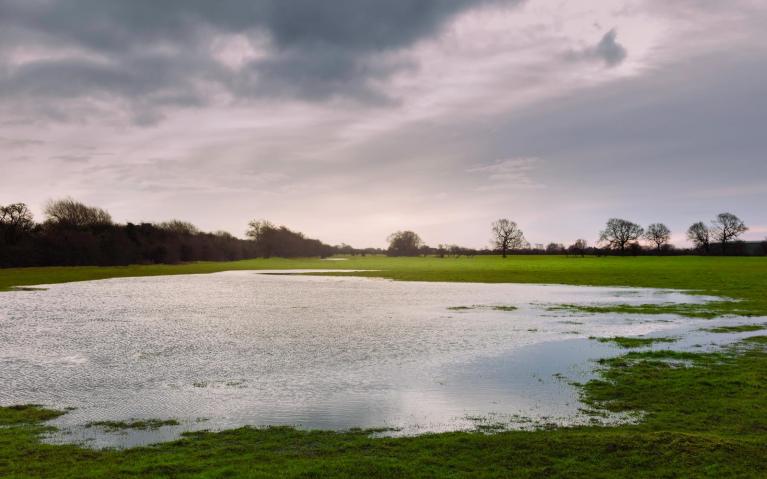
We have seen some mild, wet and windy weather recently but there does look to be a change to more settled and colder conditions for closer to Christmas. At this time of year, stormy weather can affect the rail, and ferry networks, but ice and snow brings other hazards to the roads. Along with all of that, there is the sheer amount of traffic.
This year could be a bit more spread out ahead of the Christmas Eve getaway. If you are travelling this weekend, we will have a look at the UK weather. Into next week, there are no signs of a storm in the run-up to Christmas, at the moment, just a colder easterly flow off the North Sea.
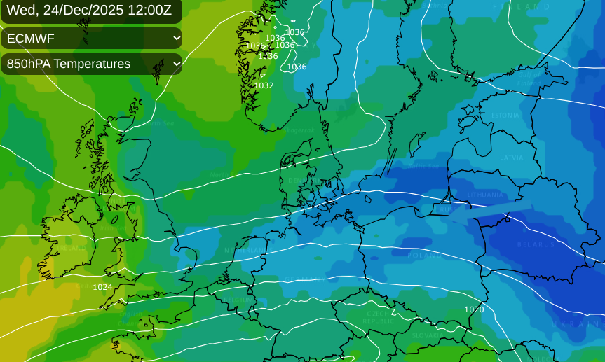
Christmas Eve colder easterly flow
Most people have little choice about when they can travel, certainly if they are using public transport and want cheaper tickets, that’s cheaper, not cheap. There will also be lots of party nights out, Christmas drinks and shops full of people searching for gifts. Saturday is being labelled Snarl-Up Saturday, although surely not as bad as in other years with Christmas still being four days away. However, the combination of outings, crazed gift shopping and food shopping along with people getting away for Christmas, will make it a busy day on the roads and trains.
Friday evening
This could be an opportunity for people to travel after work and school, so the usual Friday evening commute could be busier. Friday will be a dry and sunny but colder day for many. There will be blustery showers from the Atlantic reaching across the northern half of the UK and a few into western Wales. Overall, Friday evening looks dry, clear and chilly. There will be a few lingering showers, particularly for western Scotland which will be moving by quickly on the blustery winds. There could be a touch of frost for SE Britain but overall, no hazards towards dawn on Saturday. Ideal for an early start
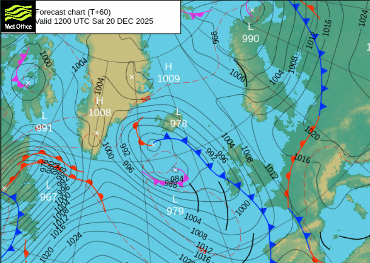
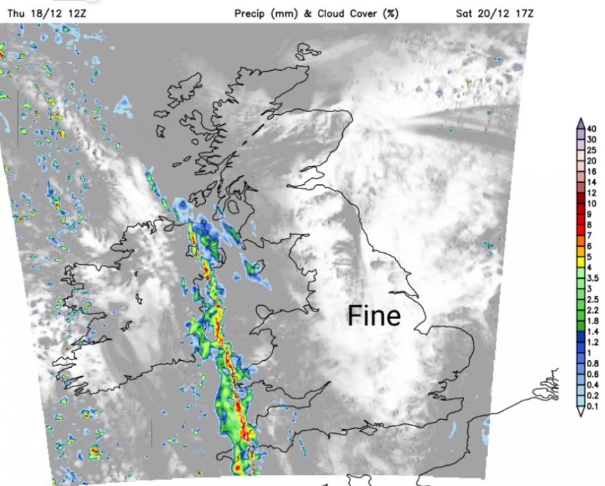
Saturday
Approaching from the Atlantic will be a cold front which stalls as it bumps up against a high pressure over Europe. The southerly winds will freshen for Northern Ireland, through the Irish Sea and the west coast of Britain on Saturday morning. For Saturday, there will be frontal rain over northeastern France and the Low Countries, which might each over SE England, some uncertainty here. There will be outbreaks of heavy rain along the incoming cold front with gusty winds. Much of Britain should stay fine and bright with dry conditions and lighter winds in the east. Not bad at all with temperatures around 9 to 11C. If you are out on Saturday evening, then it will be the cold front rain which will need watching as it could have some sharp downpours in it.
The Irish Sea and west coast of Scotland will become windy later in the day but hopefully without disruption to ferry services.
Sunday
With all the recent wet weather, what the southwest of England and south Wales doesn’t need is a frontal band staggering to a halt. This could happen on Saturday night into Sunday as a new low centre develops in the Western Channel. Hopefully the front will soon break up and leave showers over SW Britain and Northern Ireland. Elsewhere, it will be rather mixed with patchy rain and a lot more cloud as the easterly flow kicks in. Northern Irleland could see a rather wet day and there might be further pulses of rain from France into southern Britain. None of this looks severe but locally there could be problems with surface water.
Overall, not too bad.
Loading recent activity...