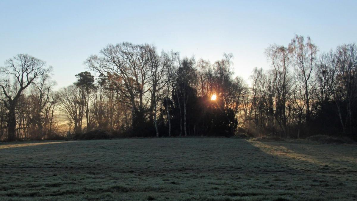
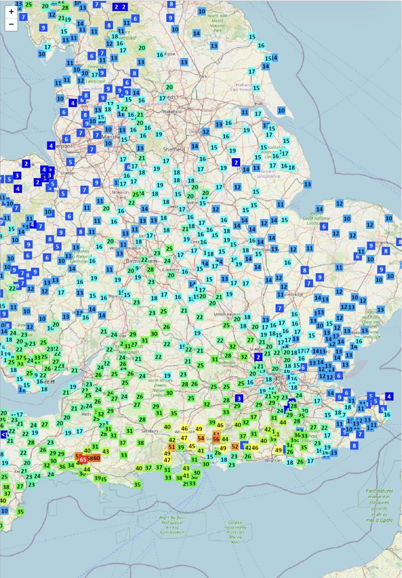
Thursday was a washout across large areas of England and Wales, 10-20mm fell quite widely, while far south of England saw 20-40mm, locally more across Dorset and Hampshire. Following on top of wet week beforehand across the west.
24hr rainfall totals up to 8pm yesterday - data from Starling Roost Weather
England and Wales will see a drier day today and tomorrow away from western coasts, as a weak ridge of high pressure builds, Scotland seeing some showers today but a drier day on Saturday.
Sunday and Monday are looking more unsettled, as low pressure moves in across the southwest, bringing showers or longer spells of rain up from the south across many areas, showers could linger across central and southern areas on Tuesday too. But it doesn’t look like there will be any disruptive weather for those making an early Christmas getaway this weekend and early next week.
More rain on the way for many Sunday & early next week, as low pressure moves in close across the southwest
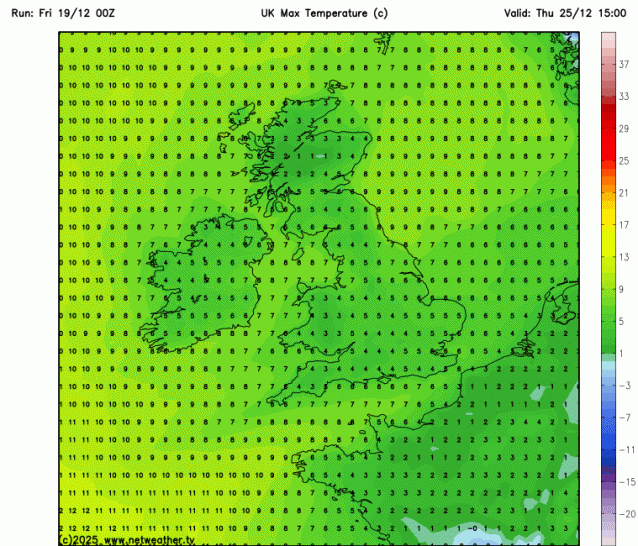
However, it looks to dry out after Tuesday, as high pressure building over Scandinavia extends further west toward Scotland, bringing drier conditions from the east for the rest of the week. With an easterly flow developing, it will turn colder too, with temperatures falling through the week, temperatures on Christmas Day and Boxing Day may reach 4-6C at best, while there will be a risk of frost overnight - where skies clear.
At the moment, high pressure looks to be too close to the north and the easterly flow is not particularly cold aloft, so snow looks unlikely on Christmas day, as it will be mostly dry. However, the easterly flow will bring a shallow layer of cold and dry continental air which could pick up enough moisture to bring low cloud thick enough to produce some drizzle or even some wintry precipitation inland and over higher ground in the east. Sunshine amounts on Christmas Day are uncertain, but probably the best chance may be in the west, with eastern areas perhaps at risk of low cloud off the North Sea.
Temperatures in falling through next week, as an chillier easterly flow develops
.png?w=646)
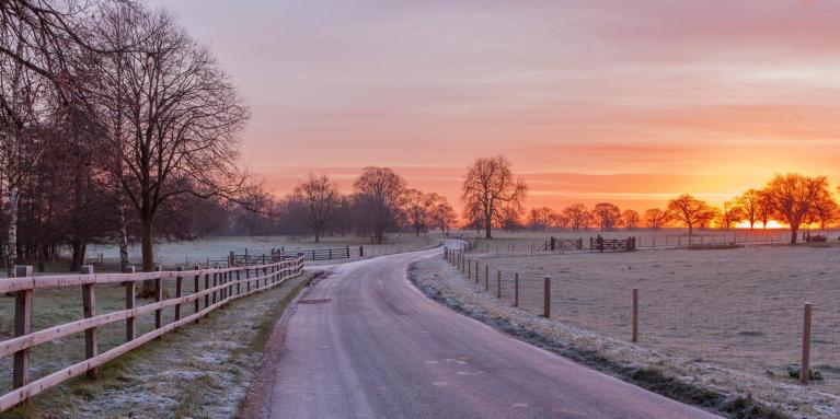
Christmas Day looking chilly but dry
So a dry and chilly Christmas is looking likely, which makes a change from the usual mild southwesterlies bringing grey skies and rain or drizzle on the big day. But what might be in store after Christmas through to the New Year, with many people not back at work?
00z EPS mslp mean suggests high pressure sticking close by from Christmas to New Year, perhaps drifitng west, so staying mostly dry, settled and chilly.
For now, current model output suggests that high pressure will remain close to northern UK, perhaps drifting further west, this may keep the UK and Ireland locked in cold easterly, northeasterly or northerly flow, so temperatures staying below average. Looking mostly dry for now, but potential that rain, sleet or even snow could push in from the northeast or north around the high pressure. Certainly it looks like Atlantic low pressure systems will most likely be blocked and kept at bay.
Loading recent activity...