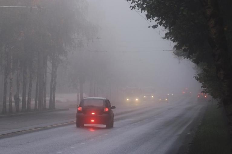
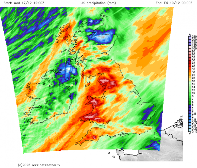
More rain on the way for most parts of the UK for the rest of the week, England and Wales look particularly wet on Thursday, with yellow rain warnings once again in force for southern and western areas. Friday and Saturday are looking drier and brighter for southern, central and eastern areas, blustery showers in the north and northwest on Friday, rain moving into the west Saturday. All parts seeing showers or longer spells of rain on Sunday.
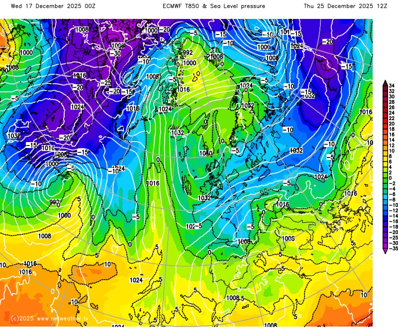
However, it looks to turn drier and colder next week, as high pressure builds close to the north, while Atlantic low pressure systems are re-routed to the southwest and south of the UK. This will allow a southeasterly flow to develop early next week, before backing easterly from mid-week, which may bring in colder air from Russia in time for Christmas. Still some showers around on Monday, but a drying trend from Tuesday, as the drier continental flow develops.
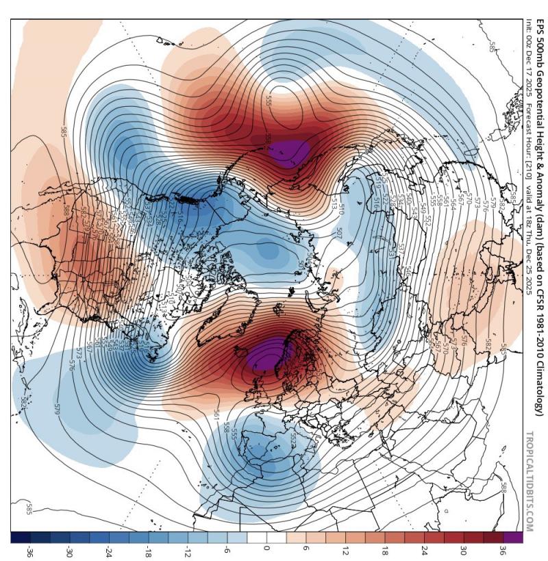
The change from Atlantic low pressure domination since the start of the month to a regime more dominated by high pressure next week is coming about from anticyclonic wave-breaking over the weekend over the far north Atlantic. This leads to North Atlantic trough disruption, with upper trough extending south from Greenland to end the week being squeezed by a wave break / poleward buckling jet stream over the NW Atlantic, which then disrupts the trough into a cut-off low that then drops southeast towards SW Europe, which then allows high pressure to build to the north of the UK next week.
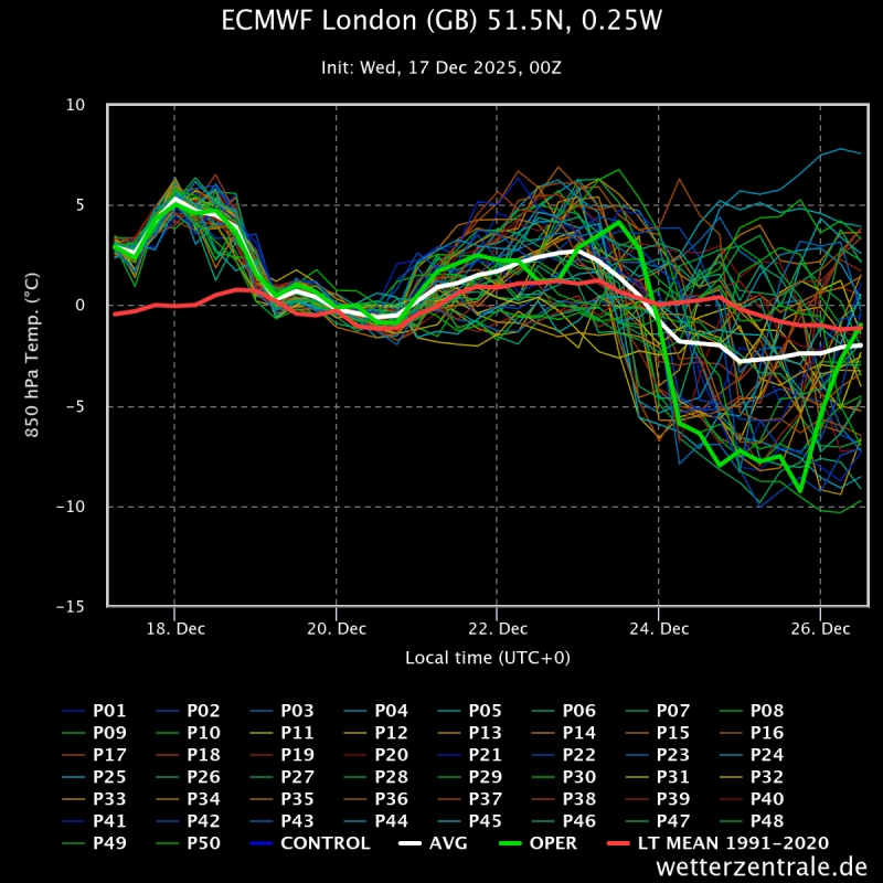
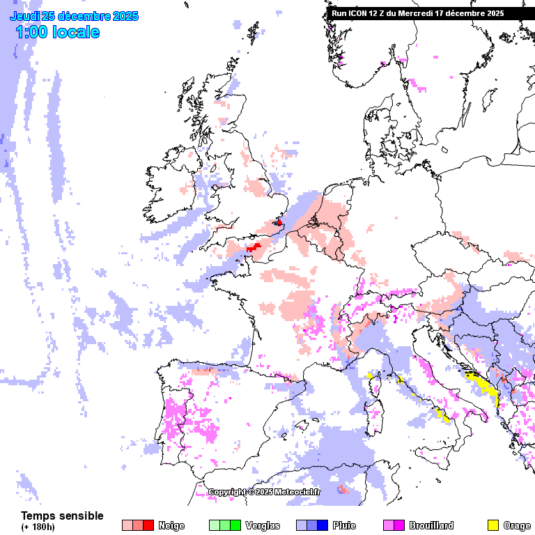
But how quickly trough disrupts to southwest of UK and how close low pressure may be - is causing uncertainty over how cold the resultant continental flow that develops over UK will become. 00z EC high res. coldest of the overnight runs, bringing -8 to -9C T850s across England & Wales on Xmas Day, which could be cold enough for sleet/snow in showery easterly flow. However, 00z GFS had a less cold SEly flow, with no wintriness, rain for most.
A look at the 00z EPS for London indicates the high res run was at the cold end of the spread for Xmas, but not without support. A large spread in the ECMWF ensembles though by Christmas, which brings the uncertainty over how cold the easterly will be.
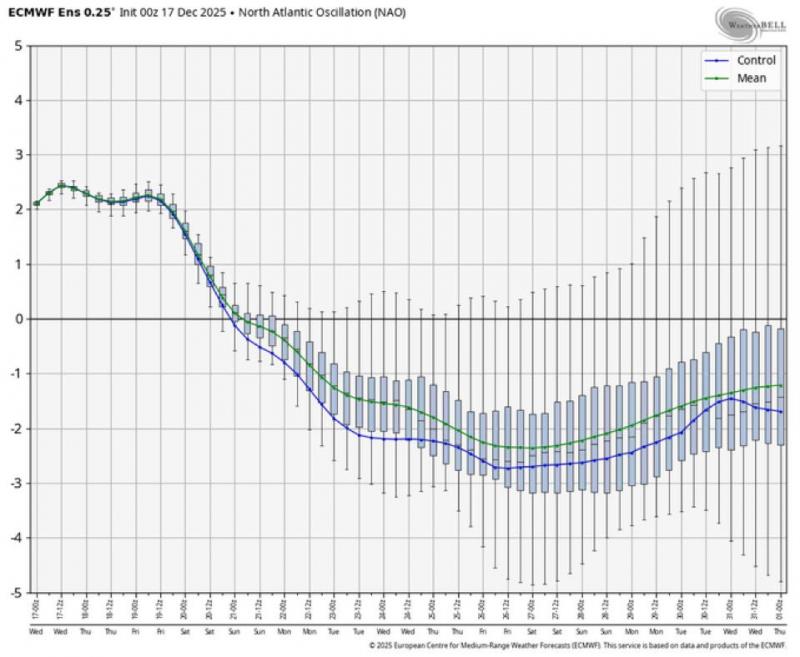
The 00z EPS ensemble mean showed a strong block to north of the UK with anomalously high mean 500 hPa heights over the Norwegian Sea for Christmas, North Atlantic Oscillation (NAO) going pretty negative as a result next week, which indicates higher pressure than normal over Iceland and low pressure over Portugal.
The midday runs out so far are a mix bag but seem to converge on the idea of deep cold air over NW Russia being tapped into and a strengthening easterly flow on the southern flank of high pressure to the north bringing it towards the UK arriving by Christmas Day. 12z GFS has air cold enough for snow to fall from showers across the north, while 12z GEM and ICON has air cold enough air for snow across all parts of the UK by the end of Christmas Day.
Much depends on the orientation and position of high pressure likely centred to the north of the UK and low pressure to the south over the near continent. Slight differences or changes can make a lot of difference in the depth of cold arriving from the east.
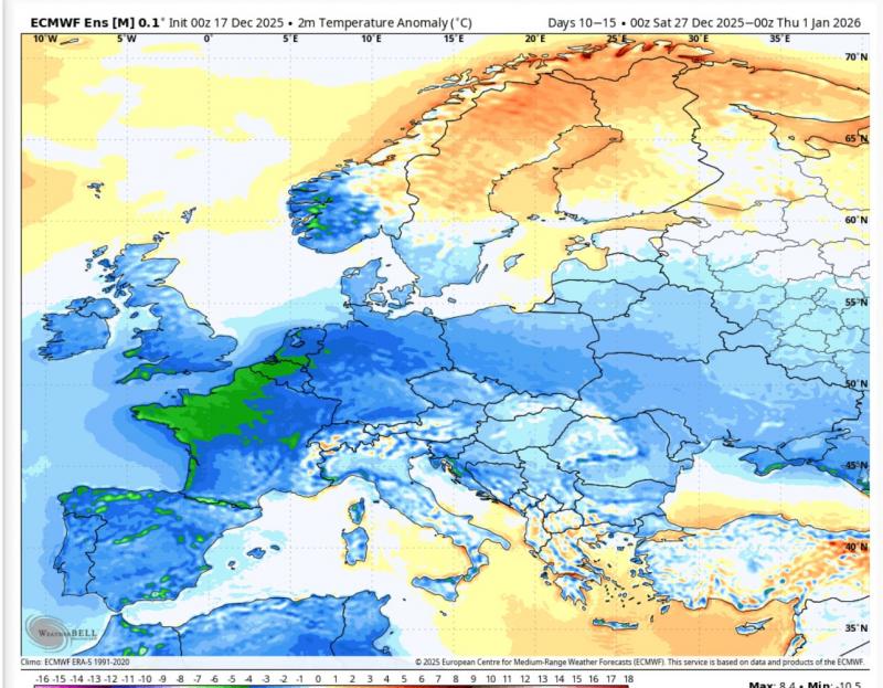
So, we should look east for our weather for the festive period, potential to tap into air cold enough for snow even on the big day, while the ensembles suggest, for now, the cold conditions will persist through to the New Year, as the EPS mean 2 metre temperature chart for days 10-15 below suggests:
Loading recent activity...