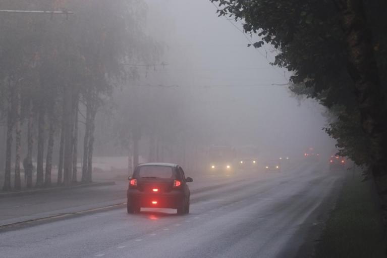
Wednesday has brought a cold, frosty and foggy start to southeastern Britain, where conditions have been clear and calm overnight. A low southwest of Iceland is throwing its weather fronts over the UK with band of wet and blustery weather. It brings a zone of milder air for the middle of the week with temperatures around 9 to 11C. Thursday looks even milder for southern Britain.
The Met Office has heavy rain warnings for SW Britain on Wednesday and more of southern Britain on Thursday. This “could lead to some travel disruption and possible flooding.”
Wednesday's band of rain is relatively straightforward. It edges southeastwards but the main feed of rain is onto southwestern-facing areas. Hence, the rain warning for SW Britain but there will also be pulses of rain for SW Scotland and NW England until the band really begins to move across England this evening. Heavy showers will follow, reaching over Northern Ireland and Scotland tonight, in colder air. There will be hail and a bit of snow on the mountain tops.
In the mild air further south, the frontal band will clear all but Kent by Thursday morning.
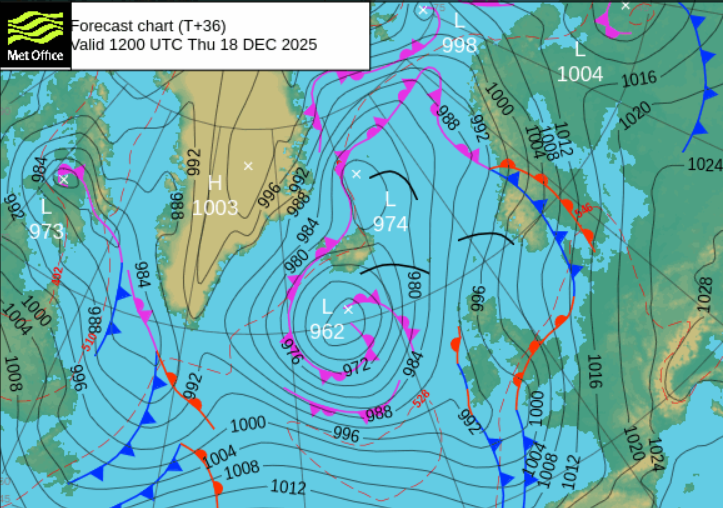
Next, it will wave back northwards, bringing more rain and mild air from the south. The rain could be heavy over south-western Britain as a new low centre develops. The rain will intensify as the winds pick up. There is another band of showery rain along the west coast of Scotland into County Fermanagh and Co. Tyrone. There will be fine, sunny weather in the far north before the frontal cloud arrives. How this waving front and new low centre develop does introduce some uncertainty about where will see the heaviest rain, and strong winds. Conditions on the ground contribute to the forecast impacts and it has been very wet in the west and southwest of Britain.
The UKV model takes the heavy rain around the low northwards and slightly eastwards through the day. So very wet weather for England (away from far SE) and over Wales. Conditions could be wet and wild over SW England and south Wales at lunchtime. The rainband in the west will drift over Northern Ireland and almost combine with the main rain from the south. However, in the strong southerly flow, there will be good rainshadow effects over southern and central Scotland for areas to the lee of high ground.
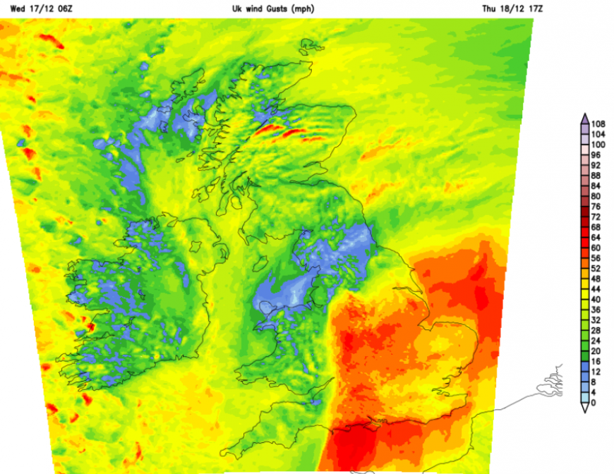
Strong winds, even gales are expected for the Channel Islands and south coast of England by lunchtime and moving inland across southeastern Britain during the day. The UKV shows southerly gales even severe gales for the south coast of Cornwall and Devon early afternoon with strong winds for the SE quadrant of Britain during the afternoon.
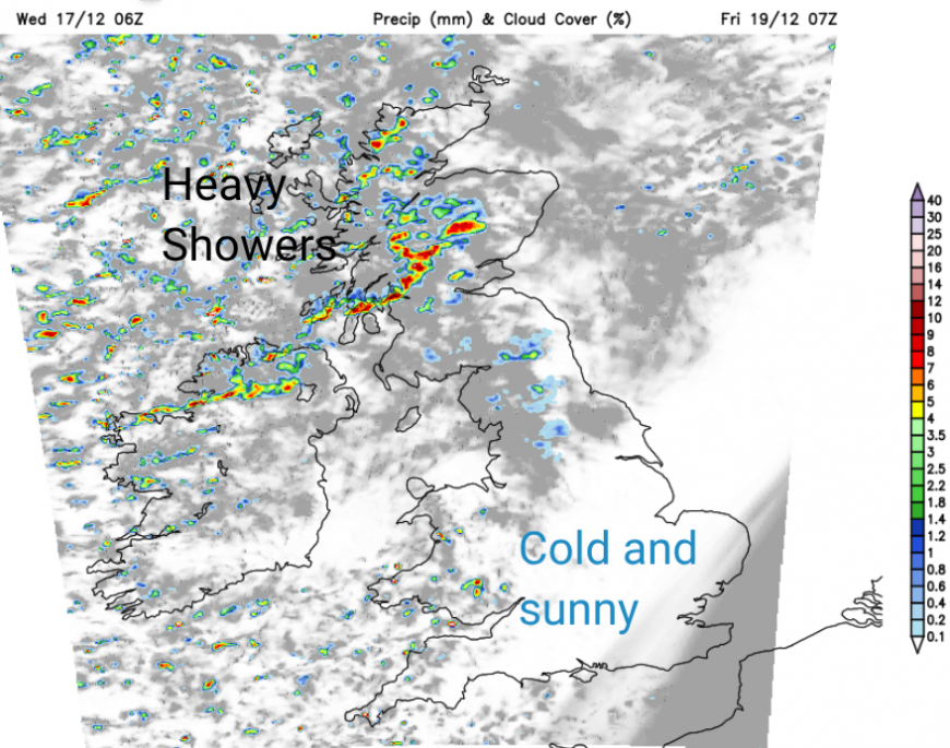
By Thursday evening, the strong winds should be clearing from the east coast of England and the western frontal band will be bringing lively line convection into western Britain. This will add to the tricky conditions on the roads with surface water and spray, leading to poor visibility.
It will be mild for England on Thursday evening but colder air will follow from the west and in the north, so it will turn chilly and clear. Most areas will become drier on Thursday night with just a scattering of showers from the northwest. Heavy and gusty showers will move over Northern Ireland and Scotland on Friday morning, with sunny spells as the rest of Britain sees a sunny but nippy start with a few showers from the west.
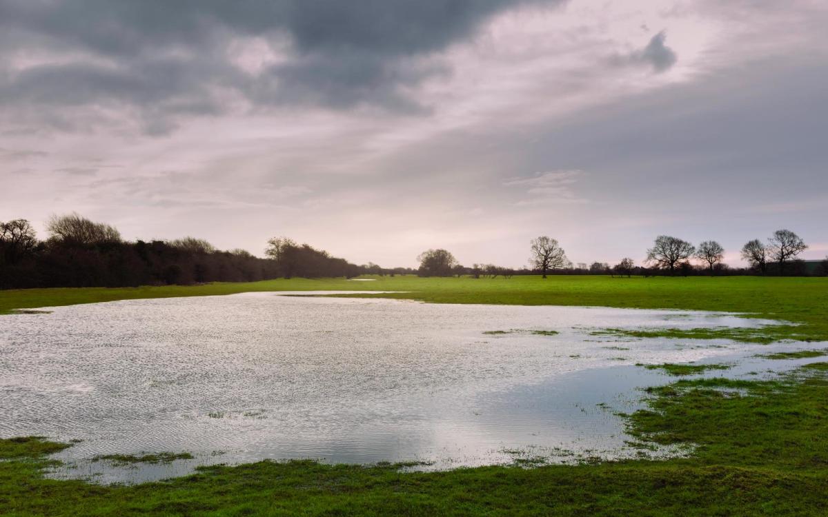
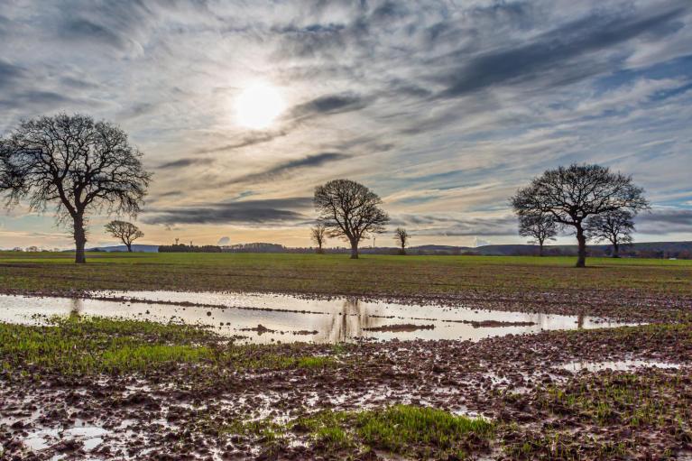
There has been a lot of rain in recent weeks. The first half of December has been very wet in place, mostly in the west. Northeastern Scotland, which suffered from extreme water scarcity for several seasons, will hardly see any rain midweek, sheltered to the lee of high ground.
“Without above average rainfall this winter, there is an increased risk of water scarcity for the east of Scotland in 2026. If conditions are drier than normal, the east of Scotland could experience an even more severe drought next year than experienced this year.” SEPA
Although it appears to be raining heavily a lot, with the ground saturated in the west and large puddles, there are still concerns about water supplies in Britain. The East and West Midlands and Yorkshire regions are still officially in drought, as are parts of Sussex and there are concerns for eastern (particularly NE) Scotland.

Judging from Facebook comments, this can be hard to fathom but it is a balance and a question of storage and usage. Not just what falls from the skies, which can soon run away into the rivers and the sea.
The Met Office has announced that 2025 is already the UKs sunniest year on record, beating 2003. Plenty of sunshine but not enough rain in the reservoirs, for the high demand.
Loading recent activity...