There are two more weekends before Christmas, and it’s only two weeks until Christmas Day if you haven’t started your shopping yet. If you are heading up town, have a party night out, or are off to the Panto, what does the weekend weather have in store?
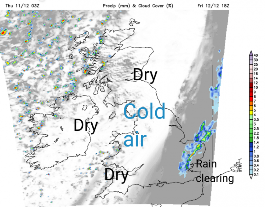
Friday will feel colder. This has been a very mild week even with the blustery winds. Colder air arrives from the west during Thursday night but it will take until Friday night to reach Kent and East Anglia. This brings a frost for southern Britain by Saturday morning but more breezy at the other end of the UK as a front approaches NW Scotland. Milder air will topple in for the weekend but things turn colder once more in the north during Sunday night.
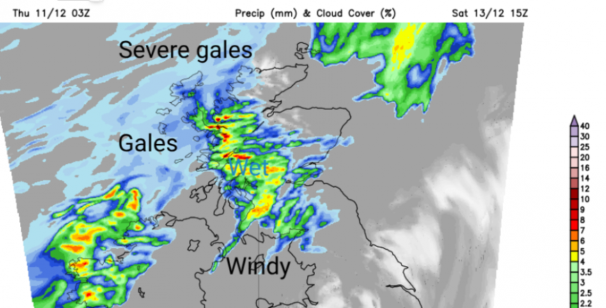
Saturday starts off fine and sunny but wet and windy weather from the incoming frontal system will edge into western Scotland with travel disruption possible due to southerly gales even severe gales. There will be quite a difference with calm, sunny weather for SE Britain and wild, windy weather for the west of the UK and increasingly across Scotland.
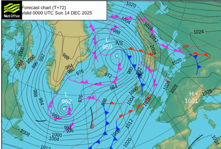
There is high pressure bringing settled conditions to mainland Europe and keeping the winds light for London and the Home Counties, but a succession of low pressures will be passing by Iceland and Scotland, bringing very windy weather. These lows bring bands of frontal rain which will reach western Britain and Ireland. However, at this stage, there is a lot of uncertainty about where and when they will waver southwards. So if you are looking on a weather app and it shows rain, say for Manchester or Leeds be aware that timings of these bands of rain may change.
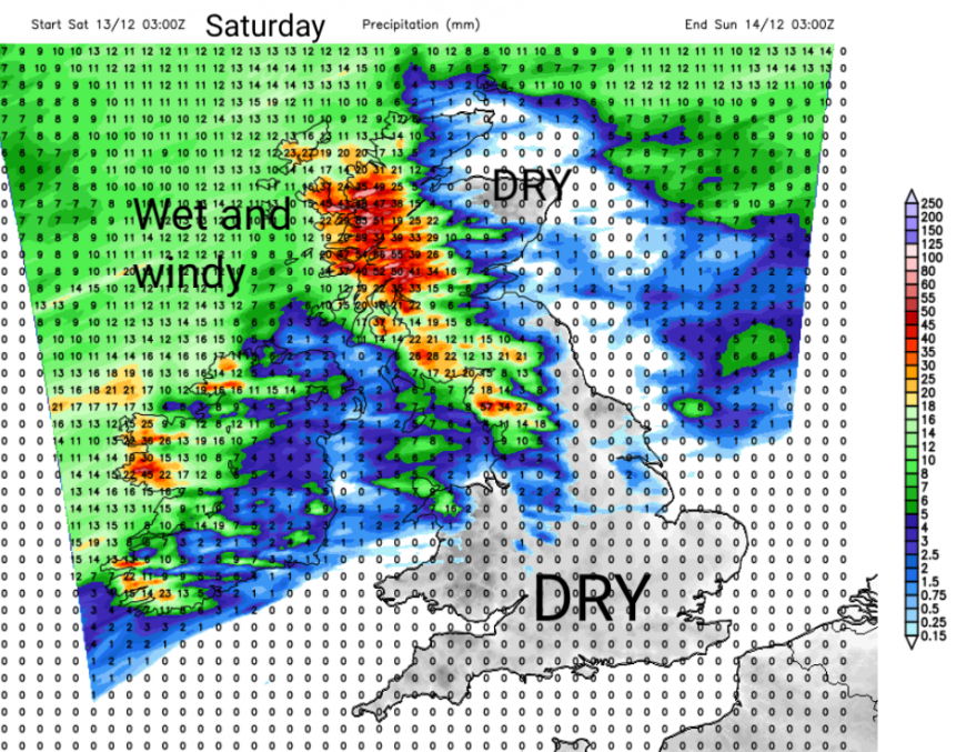
Overall, eastern and southern Britain will be more sheltered or avoid the rain from the northwest. Scotland will often be windy, as will Northern Ireland and there will be pulses of rain from the west reaching Wales, northwest England, western Scotland and Northern Ireland.
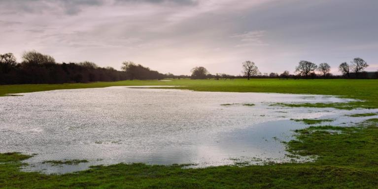
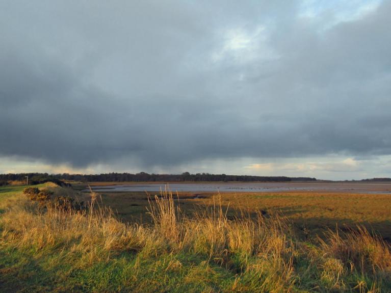
There has been a lot of rain recently, so there remains a low risk surface water and river flooding.
‘Local inland flooding is possible across parts of the North of England and across Wales, and possible but not expected more widely, on Saturday and Sunday.’ EA and NRW

Temperatures at the weekend will be between 8 and 14C so mild again away if you avoid the wind and rain.
Most of the UK will have a dry, chilly but clear Friday evening. There will be frontal rain clearing from East Anglia, north London and Essex early evening but it will still feel fairly mild. There will be blustery showers for the far northwest.
If you are off out early on Saturday to try to avoid the worst of the crowds, then it will be a fine start. It will be cold, with some fog for southern England inland but the day stays dry and fine for much of Egnland and Wales. For Scotland, Northern Ireland and Cumbria it will become increasingly windy with rain for western counties. The air will be mild enough but tempered by the wind. In this windy, mild and moist flow from the southwest, there will be shelter to the lee of high ground. For brighter, even sunnier areas, it will feel strangely mild. Northeastern Scotland could do well.
The frontal rain will be edging southwards through the day, so expect outbreaks of rain for northwest England by the evening with the blustery winds. Northeastern England should stay drier, sheltered by the Pennines but it will be windy, if your party hair could be impacted! Northern Ireland and Glasgow will also see outbreaks of rain for the evening. Elsewhere, it will still be fair but feeling cool for southern Britain, although with only light winds.
There is uncertainty as we head into Sunday about where the frontal rainbands will be reaching. Think of them as a rippling rope over the UK, with colder air to the north and a push of wet weather from the Atlantic reaching our western shores. It looks like western Scotland gets another bout of heavy rain early on Sunday and then the focus spreads over Ireland into southern Scotland, NW England, and Wales by the afternoon. Again with blustery winds blowing the Christmas decorations about and more of a breeze for southern Britain on Sunday.
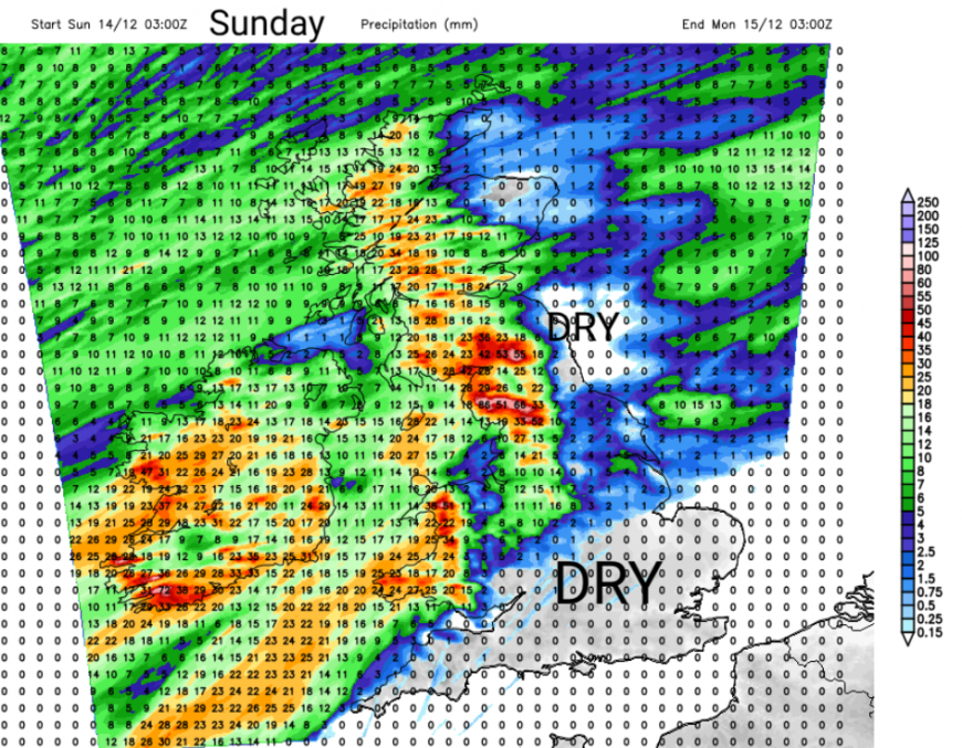
As the frontal bands nudge south on Sunday, there will be clearing skies for northern Britain and Northern Ireland. As the colder air arrives, it will turn chilly, especially in the wind. It looks like a southerly push on Monday will soon get rid of that cold air as things turn wet and windy again for the start of the working week.
No signs of snow, just more rain (mostly in the west) and a windy weekend in the north.
Loading recent activity...