We have a succession of low pressures coming at the UK from the Atlantic this week. This brings bouts of wet and windy weather with lulls in between. This damp air is cool, as you’d expect in early December, but not Arctic cold or particularly mild for the next few days. Friday morning looks chilly with a frost in places to start the day but the weekend turns milder.
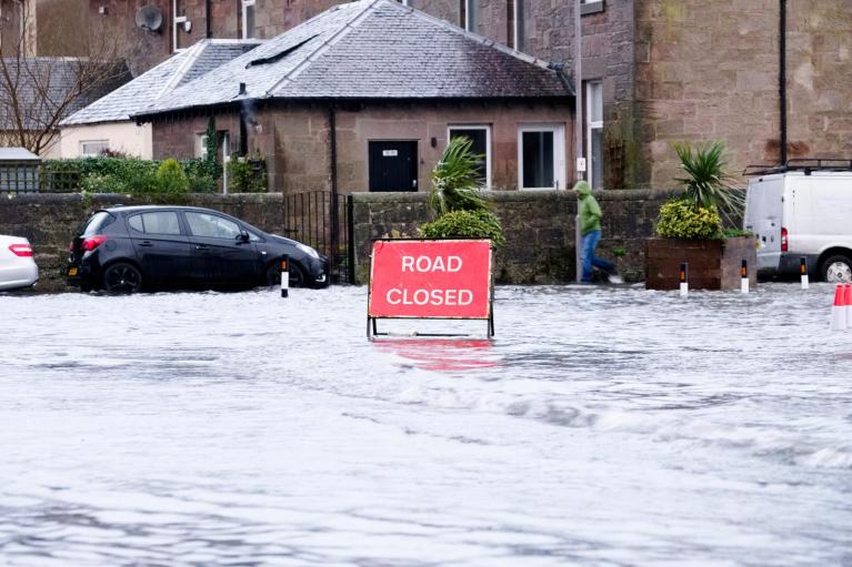
Northern Ireland is looking very wet early on Thursday. More frontal rain will approach Ireland and SW Britain on Friday afternoon. It has been very wet in some western parts already this week for Wales, the Cotswolds and the Lake District. There are still flood alerts from Natural Resources Wales with high river levels after the recent heavy rainfall. Some flooding concerns from the Environment Agency in England with usual spots seeing warnings along the rivers Derwent and Ouse in York.
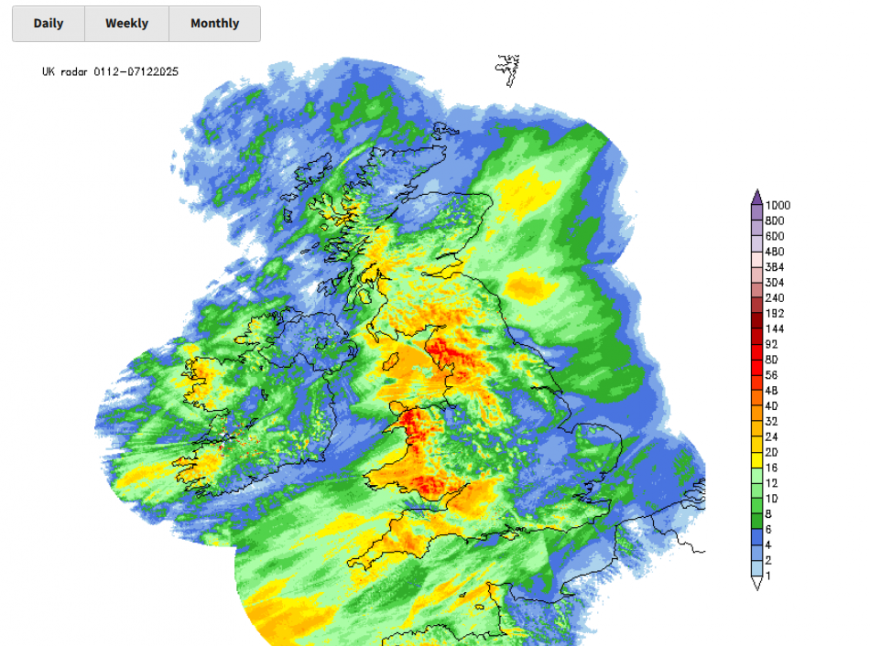
Rain (from radar data) for Sunday 30th Nov to Tues 2nd Dec
“Local inland flooding is possible across parts of England from Thursday to Saturday. Land, roads, and some properties will flood and there will be travel disruption.” Env Agency
These are always problems with winter weather here in the UK. It can be cold with frost and ice and occasional snow that quickly brings transport networks to a standstill. Or in milder weather, there is a lot of rain and we see river or surface water flooding and different kinds of disruption. Of course, at this time of year, we might also expect windstorms, named storms with coastal impacts as well as inland issues. All of this impacts the finances of local authorities and government, whether that is extra winter roads crews and cold weather payments, or flooding preparation and emergency response costs.
According to Met Office figures released earlier this week "Northern Ireland has recorded its third wettest Autumn since the series began in 1836, and Wales its tenth wettest." Autumn is the only season of 2025 to report above average rainfall. Winter (24/25), spring and summer were all below their respective long-term averages.
Some parts of the UK are still in drought. The latest Area Drought Status report for England (til 27th Nov 2025) showed no change in drought areas, which are defined when environment agencies ‘coordinate closely with water companies to implement statutory drought plans, taking necessary action to safeguard public water supplies’.

There are different types of drought, but it has to be viewed as a balance sheet. What will be needed, how much is stored, how much is forecast to come in. Not just that it has rained loads or very little in a certain area.
SEPA in Scotland are not issuing weekly reports now but the autumn “Water scarcity seasonal report” is due on Dec 4th.
In relation to the public water supply in England & Wales “Many water companies remain concerned about recovery of water resources over winter if conditions result in lower than average rainfall.” There is a lot of ongoing monitoring and information gathering with the next National (England) Drought Group meeting scheduled for 8 December.
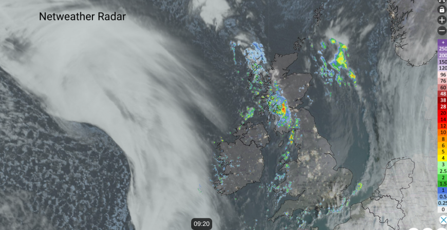
There is a lull today between systems but still a small occlusion is bringing a band of heavy showers across northern Scotland with a scattering trailing down over Cumbria into Wales. SE England is also catching a feed of showers today, running over Sussex and Kent as everything rotates northeastwards. Temperatures will be around 7 to 10C with plenty of fair, bright weather around in a light southerly flow.
You can see on the satellite image above, the mass of white frontal cloud over the Atlantic. This will bring more cloud from the west for Wednesday evening and showery rain into the night. Heavy rain will move up eastern Ireland, over Dublin and then on to Belfast and more of Northern Ireland before dawn.
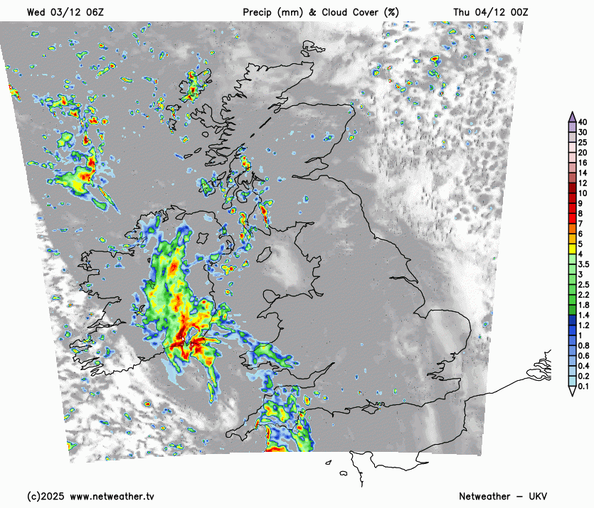
The frontal band will move over Wales and England on Thursday morning, with tricky conditions for Northern Ireland in the morning rush with plenty of surface water and spray. The winds will pick up with the rain band but then veer to a westerly as colder but sunnier conditions follow. Sunshine and showers weather follows into the southwestern half of Britain as other areas hold onto cloud and damp weather. Temperatures will be 6 to 8C.

A line of showers could cling to the coast of NE Britain into the evening as more showers linger near to Northern Ireland. These rotate northeastwards with clear and cold conditions taking hold. It will stay windy for northern Scotland but elsewhere the winds will fall light. There will be a frost, and fog forming inland. This could bring travel issues for Friday morning with dense fog in places, even freezing fog. Southeastern Britain looks most likely.
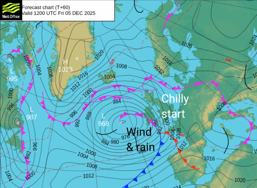
The weather will change again from the west during Friday as a new Atlantic low moves in with strengthening southerly winds and milder air.
Loading recent activity...