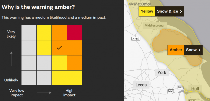
The cold Arctic flow continues on Thursday, bringing further snow showers to exposed parts of the UK. Northern Scotland has borne the brunt of the incoming snow, with plenty of wintry showers running down the east coast of England. There is an Amber warning for snow in force for Redcar and Cleveland, the East Riding of Yorkshire and North Yorkshire, with particular concerns over the Moors.
“Frequent wintry showers will feed inland from the North Sea, giving significant snow accumulations over the North York Moors and parts of the Yorkshire Wolds. By the end of Thursday, as much as 15-25 cm may have accumulated on hills above 100 m elevation, which is likely to cause substantial disruption. Gusty winds, giving occasional blizzard conditions, and perhaps a few lightning strikes” Met Office
Deep snow near Insch, Aberdeenshire (uploaded to the Netweather community by Scottish-Irish Skier)
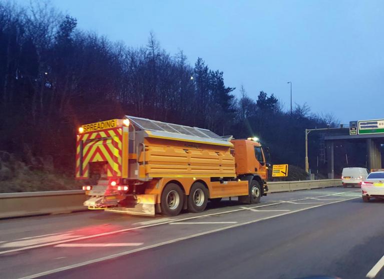
Schools have closed in Aberdeenshire, or have delayed opening and a lack of transport. There has been deep snow as showers and heavier bands piled in to NE Scotland overnight. There are schools closed in North Yorkshire too, as the Council's gritting crews continue their work treating the priority roads today.
Their advice is to consider if your journey is necessary and to drive with care, to the conditions.
“Gritting does not guarantee an ice- or snow-free surface. Sufficient traffic needs to drive over a gritted road to grind the salt in and activate it. Any fresh snow will land on top of a gritted road.”
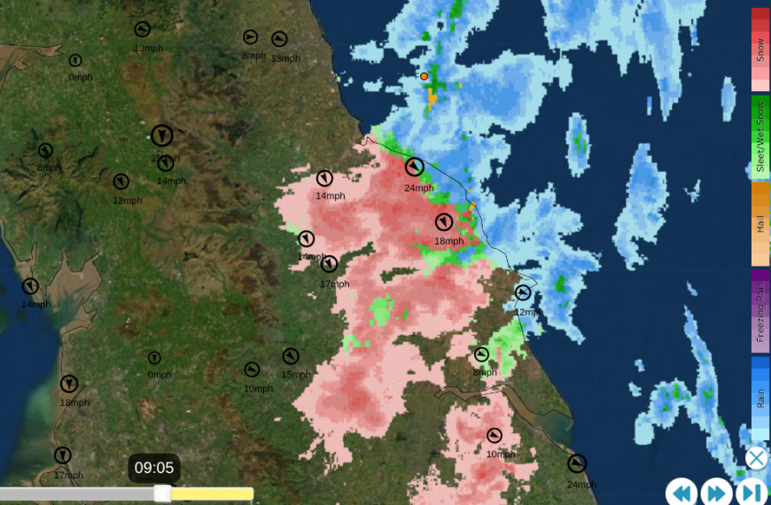
The seas have not cooled down yet, as much as they would by February/March time. The approaching air has plenty of moisture and would usually be falling as rain along the coasts with snow inland over the higher, colder ground. However, for eastern England, the wind is from the NNW and is directing the showers right along eastern coastal areas, over the cold land and depositing plenty of snow as this flow continues. The yellow warning area has been extended down into East Anglia for Thursday. All these areas have a risk of ice too.
On the other side of Britain, the Pembrokeshire Dangler continues to bring a mix of rain, sleet and hill snow. The west coast of Wales causes a convergence zone in the northerly flow and a line of showers persists, which is also reaching a zone of Devon and Cornwall. It is a very localised feature.
Northern Ireland has a yellow Snow and Ice warning but this only lasts until midday on Thursday as changes are afoot from the west. The wintry showers will subside with more fine, sunny but cold weather.
Many inland areas will miss the snow and just see another day of sunshine accompanied by a winter chill. Yesterday, a small feature interrupted that northerly flow and brought sleet and snow to other areas, including southeast England. That won’t happen today, this is just a simple northerly flow with showers.
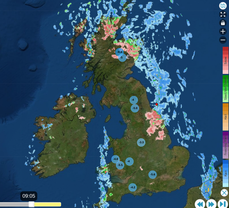
We are still in the very cold air and it feels extra cold in the brisk wind. The wintry showers will continue for eastern England into Thursday evening but there won’t be as many by Friday morning as high pressure topples in from the west.
It will be a cold, clear night with very light winds and a widespread frost. Temperatures over the snowfields of Highland Scotland could fall to -12C.
Some of the showers will have reached Suffolk and Kent overnight, and there will still be a few pestering North Yorkshire for the morning commute and the lingering icy conditions. Overall, Friday looks settled, sunny and cold but not as cold as midweek with very little breeze.
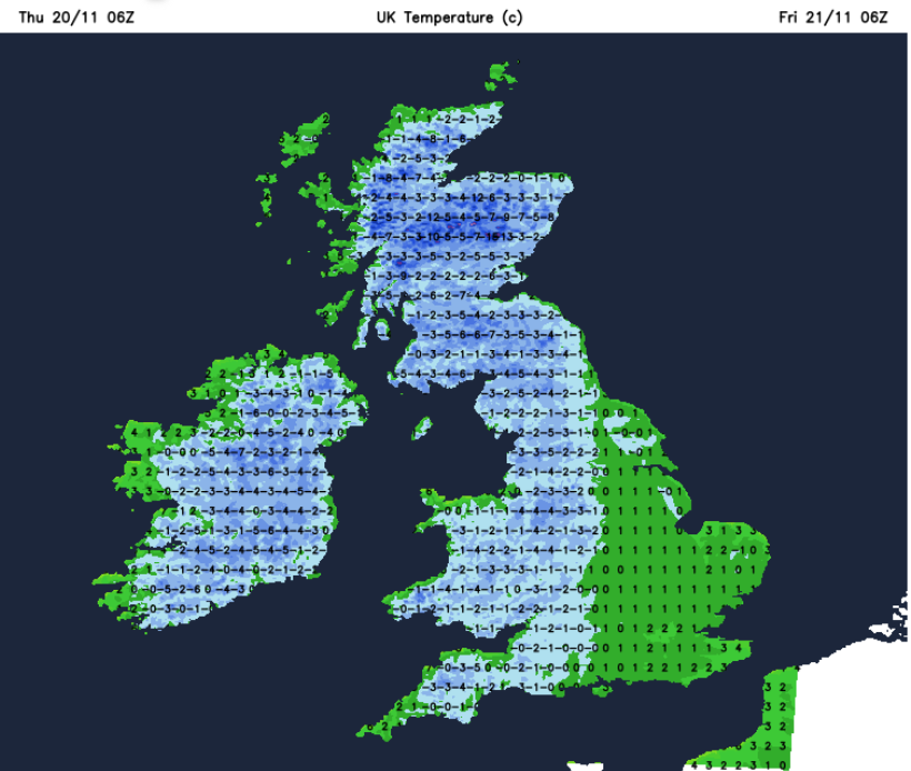
 Less cold air showing in green as a change from the Atlantic arrives later on Friday
An Atlantic frontal system will approach NW Scotland during Friday with freshening southwesterly winds, increasing cloud and later there will be pathcy rain. This will spill over western Scotland and Northern Ireland for Friday evening with more cloud ahead of it for Britain. There could be a bit of snow over the mountain tops on the leading edge but after a cold evening for Britain, milder air will follow. It will be eastern and SE England keeping a frost into the night before the cloud and rain move in on Saturday.
Loading recent activity...