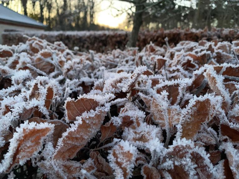
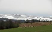
A cold arctic airmass is now firmly established across all of the UK. The coldest night since the 20th March over the weekend, with the temperature dropping to -7C at Tulloch Bridge in the Highlands early Sunday morning. Overnight, lowest low-level temperature appears to be Benson in Oxfordshire - falling to -5.2C. Even Bournemouth Hurn Airport, just inland from the south coast, fell to -4.1C.
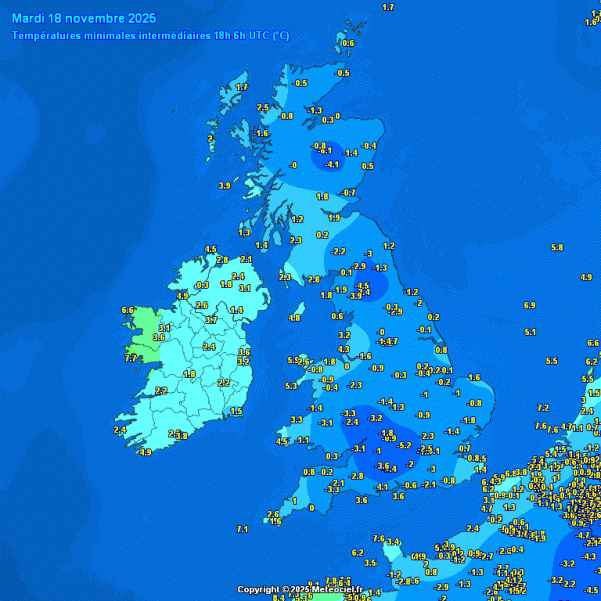
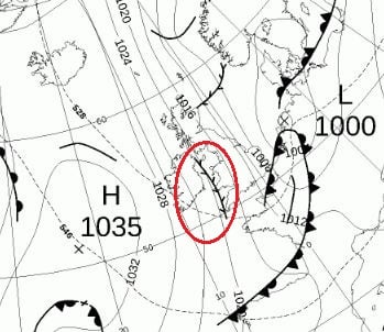
Nights will be cold until Friday, with a risk of widespread frost where skies clear this week, while daytime temperatures look to stay in single digits. Tomorrow and Thursday are forecast to be the coldest days of this week, as a surge of colder arctic air from the north arrives and spreads south behind an area of low pressure moving southeast today. Maximum temperature both days may reach 3-6C at best inland away from coasts. With the lower temperatures there will be a marked wind chill too in the brisk northerly wind.
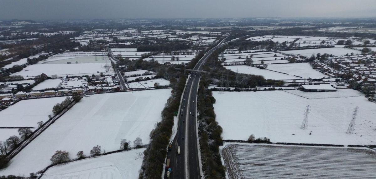
The area of low pressure moving southeast today will bring outbreaks of rain, sleet and hill snow across many areas. Settling snow mostly confined to northern hills and mountains during the day, but perhaps falling and settling to lower levels in the north at night too.
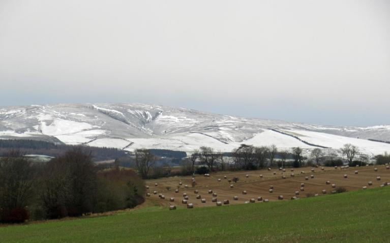
Rain, sleet and hill snow becoming confined to England and Wales overnight, before clearing Wednesday morning. Plenty of wintry showers will follow across northern Scotland and coasts of Scotland further south later today and then down eastern and western coasts further south across England and Wales on Wednesday and Thursday, bringing accumulations of snow over higher ground, perhaps to lower levels in Scotland. Mostly dry and sunny but cold away from coasts.
Wintry showers may organise near coasts, particularly across the far southwest, with what is known as a Pembrokeshire Dangler convergence zone setting up down the Irish Sea across SW Wales and perhaps Cornwall, denoted by the ‘twig’ on the fax chart for noon Wednesday.
Friday looks to see wintry showers die out and it will be mostly dry and bright or sunny, as brief ridge of high pressure builds in, turning less cold too. Rain preceded by hill snow spreading from the west later on Friday in the north and west and through Saturday morning elsewhere, further spells of rain or showers following through the weekend. Not as cold as the next few days, but temperatures still a little below average.
Some uncertainty by early next week, with developments over the Atlantic causing some differences between model runs. Basically, a low moves north from the mid-subtropical North Atlantic, east of Bermuda, on Friday and over the weekend. It gets picked up by the jet stream over the weekend, rapidly deepening, then gets carried quickly east towards western Europe. However, the models diverge over how far north or south the low will track into western Europe. 00z GFS furthest north and deepest too, taking the low across south Wales and England next Monday, as quite a deep low, with gales on its western flank as it clears. 00z ECMWF & UKMO and now 06z GFS take the low further south. 06z GFS a rather nasty intense low moving into NW France, with a severe northwesterly gales punching in across the Atlantic coast of western France.
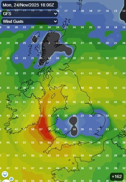
We need to keep a close eye on developments to the west over the North Atlantic over the weekend, as a potentially deep low could still track further north across southern UK and bring a risk of gales and heavy rain, with a risk of flooding.
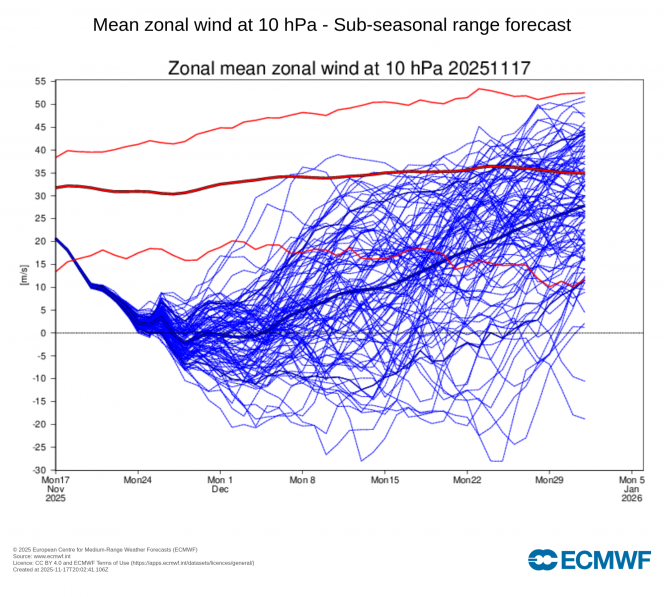
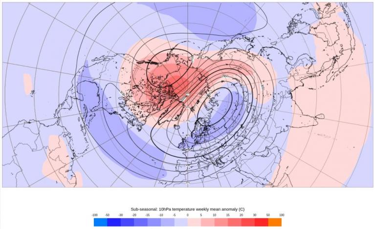
Looking further ahead towards the end of November, there is growing confidence that an unsually early late November Sudden Stratospheric Warming event could take place in the polar stratosphere, with the ECWMF ensemble mean showing a reversal of zonal (westerly winds) to below 0 m/s for a few days. GFS has been getting close to a reversal at times on the operational runs and ensemble mean, though not as enthusiastic. ECWMF probably the best model for forecasting the stratosphere. ECMWF weeklies continue to signal high latitude blocking too in early December, interesting times ahead if you want a greater chance of cold and wintry weather, but no guarantees.
Loading recent activity...