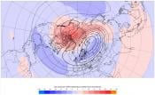
We have cold Arctic air coming down from the north this week. It will cross the Norwegian Sea, bring plenty of moisture and snow is in the forecast, but not for everyone in the UK.
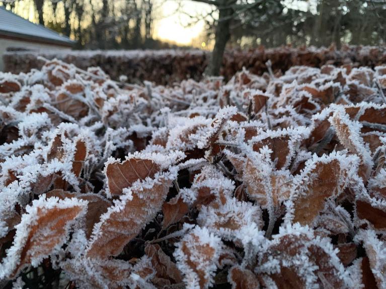
UK temperatures are well down into single figures by day and sub-zero by night with the risk of frost and icy patches. Many places will be dry and sunny by day but those clear skies mean cold nights, especially when the chilly breeze drops out.
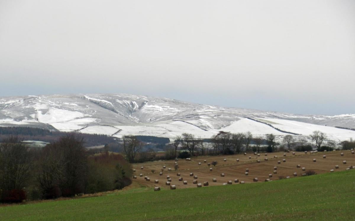
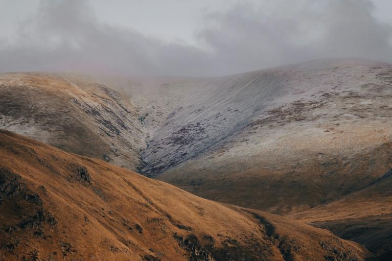
If you are looking for snow, it is mostly about the wind direction. The northerly flow will bring showers to northern Scotland, which is the first bit of land it encounters. The Northern Isles, Caithness &Sutherland, Moray and northern Aberdeenshire into the Cairngorms will all be exposed to showers of rain, sleet and hail but increasingly to snow by midweek. Even to low levels.
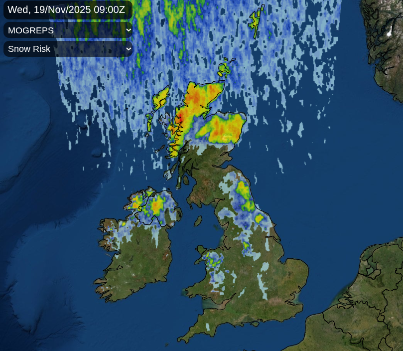
We will also see showers running down to the northern counties of Northern Ireland, into north Wales, which are also exposed to the N or NNW flow. Eastern Britain will also see plenty of showers this week, continuing to skirt along the coasts of NE England, around the Humber into Norfolk. The North Yorkshire Moors look prone to snow showers by midweek.
This pattern is often referred to as a wishbone. As showers move down the Irish Sea in a northerly they can continually move over western Wales as a “Pembrokeshire Dangler” bringing wet or snowy weather.
This is the main background picture for this week, increasingly cold air from the north with showers for exposed north-facing counties and showery feeds down the east coast of western fringes. There is one interruption and it arrives early on Tuesday, with plenty of uncertainty.
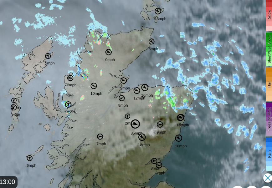
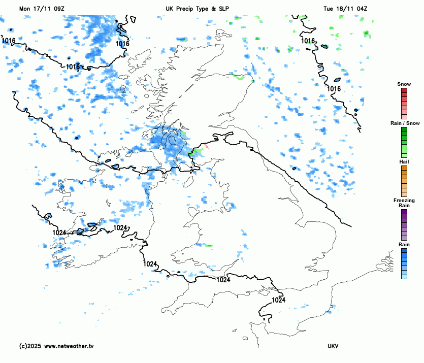
Netweather Radar (Extra) showing sleet and rain showers over Aberdeenshire. Clear skies and sunshien for the Central Belt, more cloud for NW Scotland with a scattering of rain, sleet & hill snow showers. Winds too Monday 17th Nov 1pm
On Monday night, the winds will fall light and temperatures will fall under clear skies. There are Met Office warnings appearing for Ice and Snow but it is hard to decipher where each one covers and which timeframe as they layer up on top of each other on the Warnings page.
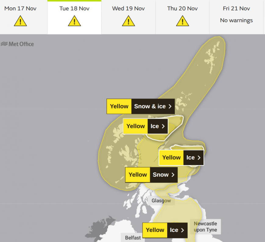
Where there have been showers on Monday, the Met Office has highlighted a risk of Ice, for the tips of northern Scotland during Monday night and first part of Tuesday morning. In this cold Arctic air any dampness will freeze overnight.
The complication, the interruption for Tuesday is a small feature running down from the northwest and over the UK. This small low will bring cloud and precipitation as it moves south. Also, blustery winds in the west and northwest.
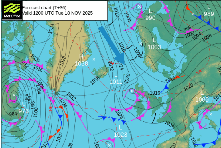
The area over northern mainland Scotland runs from Monday night until Tuesday evening
“A period of snow on Tuesday could bring some disruption to transport and infrastructure across higher parts of Scotland”
There is also an Ice warning as people begin to get moving early on Tuesday morning, through the higher part of the Central belt into the Southern Uplands and Pennine routes into the Yorkshire Dales.
This will be a tricky mix of rain, sleet and snow with the risk of ice. The main focus of the wintry mix will be over NW England and western Scotland on Tuesday morning. One pulse looks to move across the Pennines, Cumbria Fells and the Yorkshire Dales in the morning. This could move across to the North Yorkshire Moors by lunchtime with snow over the hills and high-level routes. There will be a host of rain showers swirling around the low centre, over Northern Ireland, the Irish Sea into Wales and southwest England. Further inland and for eastern Britain, there will be bright spells and lighter winds.
As the little low pressure continues southeastwards, there will be plenty of showers coming into NW England and western Wales leaving a risk of ice through Tuesday night. Behind the low there will be colder air from the north with a greater chance of snow from any precipitation over northern Britain.
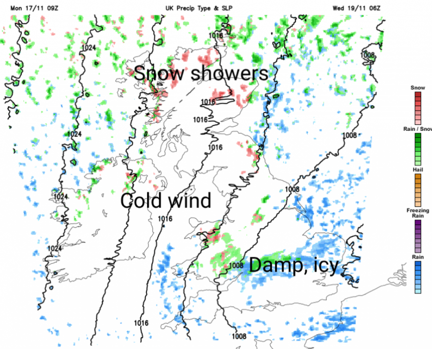
Through the Midlands and southern England, East Anglia, there will be bands of cloud, rain and sleet moving southwards before dawn on Wednesday. Over any high ground, there could be a slight covering of wet snow. It's the kind of setup that might bring an ill-timed bit of snow for the morning rush hour but it won’t last long
Everyone will notice the cold north wind on Wednesday. It will feel much colder than the air temperature values of 4 to 7C. As the cloudy, damp bands move southwards over London and the Home Counties, much of the UK will be left with bright, sunny skies on Wednesday, this cold wind but a feed of showers from the north.
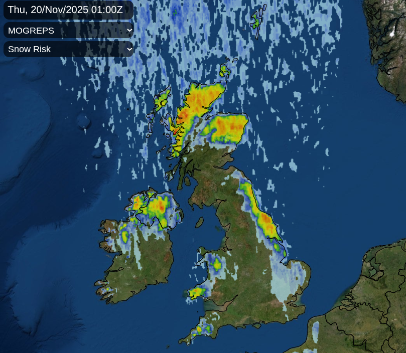
Sleet and snow showers for the northern counties of Northern Ireland, northern parts of mainland Scotland and the Islands and also coming down the east coast of England.
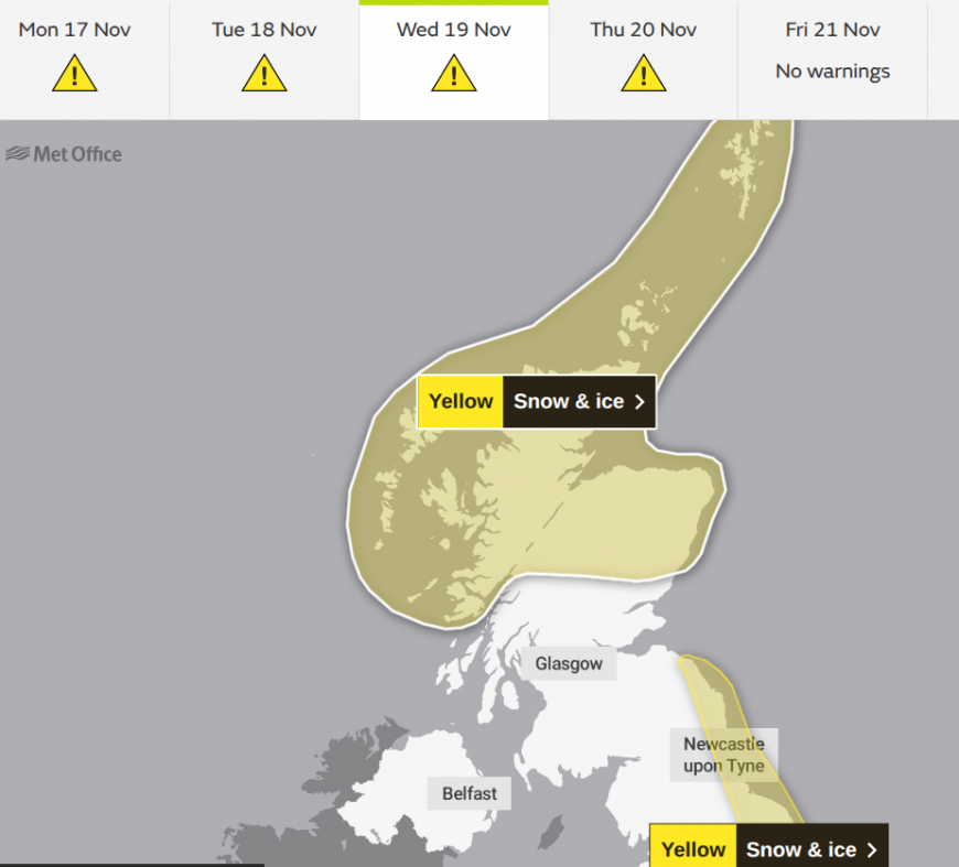
The Met Office has another warning for the middle of the week, a widespread, longer warning of Snow & Ice from Tuesday evening through Wednesday and Thursday. This covers the northern third of mainland Scotland and the Islands. And another for coastal eastern Britain from the Scottish Borders down to the Humber as wintry showers feed off the North Sea.
For modest hills, there could be 2-5cm over Moors and mountains, a further 10 to 20cm of snow for areas exposed to the northerly flow. And there will be snow showers to lower levels in these exposed areas, adding to the wintry feel on Wednesday and Thursday.
Eastern England could see a lot of mixed showers on Wednesday afternoon with Pembrokeshire also seeing lots on the other side of Britain.
Through Thursday, the showers will fade over Northern Ireland with more sunny, dry weather across the UK as the cold wind eases. The snow showers over northern Scotland will fade but the icy rain showers for eastern England will take longer, with further snow for the North Yorkshire Moors. Will it snow?

Thursday night turns clear and cold for a time with light winds. There will be a change for the weekend as the winds turn to a westerly, then a southerly and an Altnatic front arrives from the west. This will bring cloud and rain, but could bring a time of sleet and snow over the high ground of Britain as it hits the cold air. That will be a change away from the cold northerly of midweek.
Loading recent activity...