The Spanish Met. Service (AEMET) has named a large low pressure in the eastern Atlantic which will bring heavy and persistent rain to the UK in the next few days. This is Claudia, rather than the next name from our list (which would have been Storm Bram) as the Algarve, Portugal sees a red rain warning on Thursday and Spain faces torrential rain, thunderstorms, high winds and flooding from this low. There are Amber rain warnings for E/SE Wales, the Midlands into eastern England with warnings from the Environment Agencies for flooding.
"Widespread flooding is probable from surface water and possible from rivers across England on Friday, properties may flood and there may be travel disruption...River flooding impacts may continue through Saturday." EA
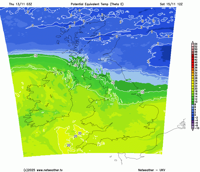
There will be more heavy rain on Friday, but the weekend does look drier across the UK, and it will turn colder. Cold air from the Arctic is just beginning to spill over Scotland on Thursday and will make its way southwards for the end of this weekend. It will ebb and flow over central parts of the UK as a frontal band tries to keep mild air over southern Britain for a bit longer.
This airmass battleground is slowing the progress of numerous rainbands which are soaking parts of Britain over several days.
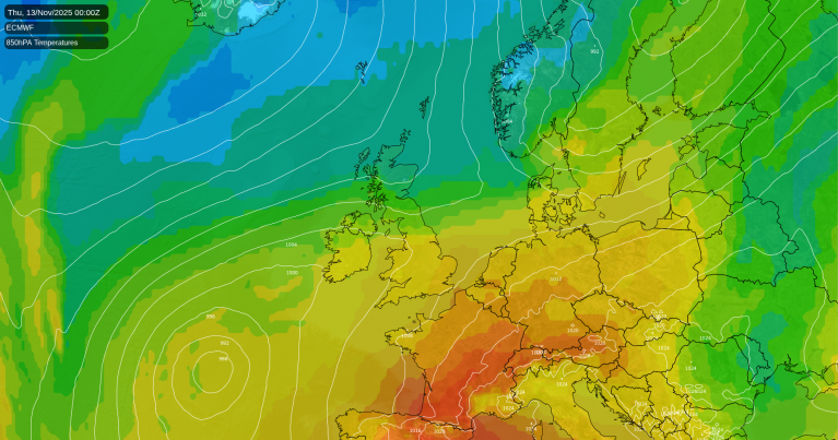
We have got used to the very mild conditions of November 2025, even when heavy rain has set in, it still hasn’t felt that cold yet. Temperatures will fall to where they should be in November and there will be some frost but still, a good deal of cloud. It has been rather grey and gloomy this month.
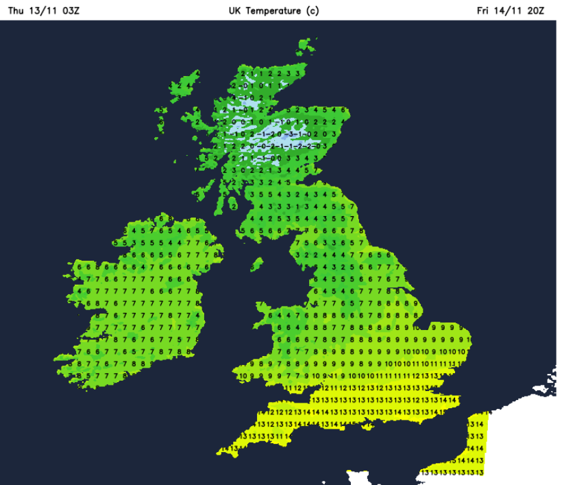
Leeds and Birmingham will see temperatures falling from 14C on Thursday down to 9C by Saturday, lower for Leeds by Sunday. Cardiff and Oxford will drop from 15C today to 11C at the weekend, after a wet Friday. For London and the Home Counties, the brighter skies of Thursday could allow temperatures of 16 or 17C in the mild air but by the weekend, it will be closer to average at 12C.
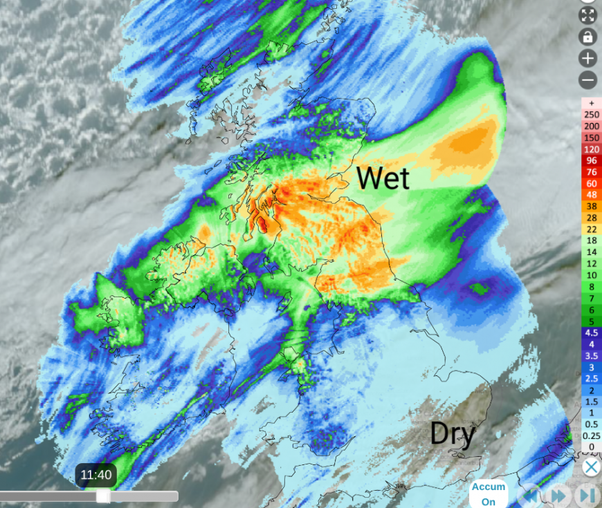
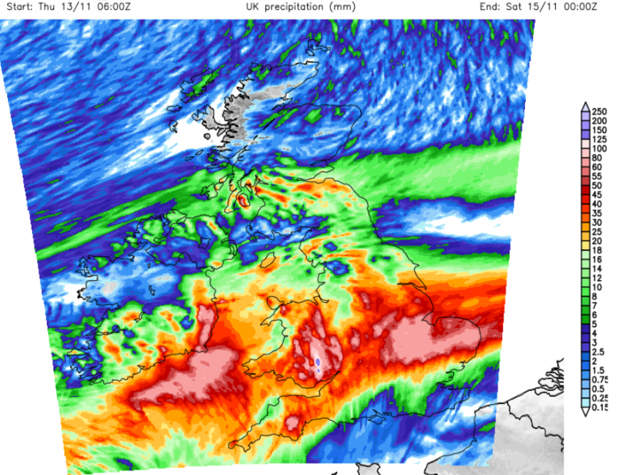
Netweather Radar accumulated rainfall totals 12 hours to 11:40am Friday 13th
There will be zones of wet weather to end the working week. For Thursday, this has been the Central Belt of Scotland, southern Scotland, northern England, Northern Ireland (particularly northern counties). This is the main frontal boundary between the mild air in the south and the cooler conditions in the north. There have been some wintry showers coming into northern mainland Scotland and the Northern Isles, and a dusting of snow has been reported over the Cairngorms.
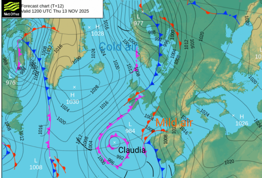
High pressure will be anchored to the south of Greenland, steering the cold air southwards to the UK on Thursday but as the high extends our way on Friday, the cold Arctic plunge will shift over Scandinavia. With pressure rising over Scotland, it will be drier, sunnier but feel cool in an easterly flow and a few wintry showers for Grampian. Spain and Portugal have seen wind and rain warnings from (Storm) Claudia, the large low in the eastern Atlantic. This storm has been named by the Southwestern Group (rather than the Western naming group that the UK is in).
This system and its warm front will edge northwards across the English Channel on Thursday night as the frontal band of rain over central Britain sinks southwards allowing the cold air in. These two frontal bands will merge on Friday and bring more heavy rain to areas such as Wales and SW England which have already been soaked this week.
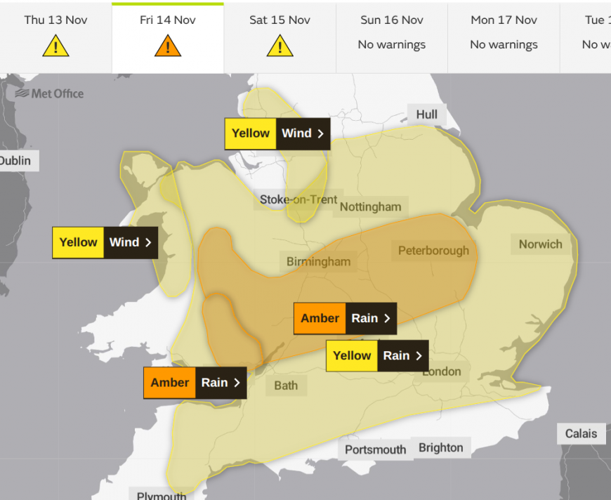
Much of southern Britain including the Midlands, is covered by a Met Office yellow rain warning and recently there are Amber rain warnings too. There could be over 100mm of rain in places.
"Storm Claudia is expected to bring heavy rain leading to flooding and disruption on Friday" MO
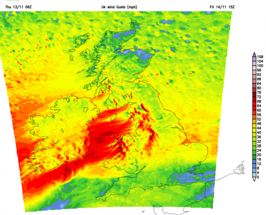
Added to that, there will be freshening easterly winds, with strong lee gusts (see red areas) making Friday afternoon and evening really miserable. To the lee of the Pennines and Welsh mountains there will be sudden gusts, over 55mph. It will feel cold and be wet and windy with tricky conditions on the roads for the evening rush hour. Further north in the clearer air, it will be cold.
This zone of wet and windy weather will continue into Friday night, with pulses of heavy rain and the risk of flooding. It will be worth keeping an eye on the flood watches and warnings and signing up for updates from the Environment Agencies. The rainfall accumulation predictions from the UKV model show heavy, welcome rain for eastern England but there are concerns for SE Wales into the Midlands.
"On Friday, widespread flooding is possible from surface water and rivers in south-east Wales, many properties may flood and conditions may be dangerous to life. Whole communities may be affected. There may be disruption to travel and essential services" NRW
There will be some improvement by Saturday morning. The strong, gusty winds will be easing down, although western Britain and Northern Ireland will stay blustery. The heavy and persistent rain will also ease as the frontal band turns to patchy rain and drizzle as it edges over northern England and Northern Ireland. SW England could see a scattering of heavy showers but everything continues to quieten down on Saturday. There will be some bright or sunny breaks appearing in the cloud cover, more likely for Scotland and western Wales as the easterly wind continues.
By Sunday, the northerly influence is back and after a frosty start for parts of Scotland (depending on the cloud cover) the cloud, damp weather from Saturday will sink southwards, allowing brighter skies for the Lake District, the Peaks and Dales. Southern England and south Wales will keep the cloud for a bit longer but it will be a fair day and better without the persistent rain.
A band of showers will move down from the Norwegian Sea in the northerly flow, reaching Scotland on Sunday afternoon. Otherwise, there will be a lot of fair weather but a cool NE breeze for East Anglia and SE England.

This leaves the UK in the colder air for the start of the working week. Through Monday night, there looks to be a higher likelihood of snow showers from the north affecting northern Scotland and possibly continuing into the middle of next week. Elsewhere, it will feel cold but at this stage, snow is unlikely.
Loading recent activity...