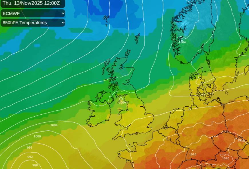
There has been a lot of rain this week in parts of the UK. We have two frontal zones on Wednesday, one adding more rain to saturated ground in the southwest of Britain and the other in the far north which will allow colder air to reach the UK later this week.
Southern Wales continues with a low risk of surface water and river flooding which could cause travel disruption. There is also a risk of localised flooding for SW England and both areas are covered by an ongoing yellow rain warning from the Met Office.
If you are wondering about clearing skies for this evening and the chance of seeing the Aurora, it will be southeastern England and East Anglia with a higher chance of cloud breaks. Heavy rain will move from the Irish Sea over western Wales and northern England tonight before one pulse heads off over the North Sea. There will be a lot of cloud for Wednesday evening.
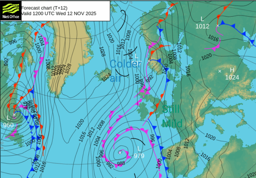
There is another low centre further north which will move from Orkney towards western Norway with its occluded fronts trailing back over Scotland today. The frontal boundary from this low links back across the North Sea, over England as a warm front to another low out in the Atlantic.
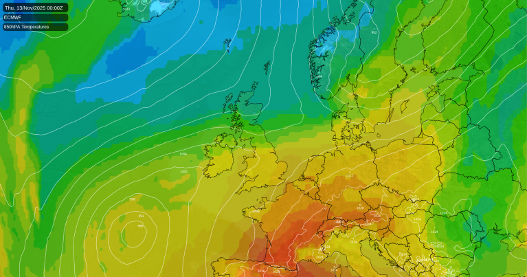
Southern rain and mild air
To the south of this front is the very mild air which has been over much of the UK for the start of November, allowing temperatures to reach 15 to 18C at times. This southern frontal boundary will attempt to cling on, into the weekend with the mild air lurking over southern counties of England and the English Channel.
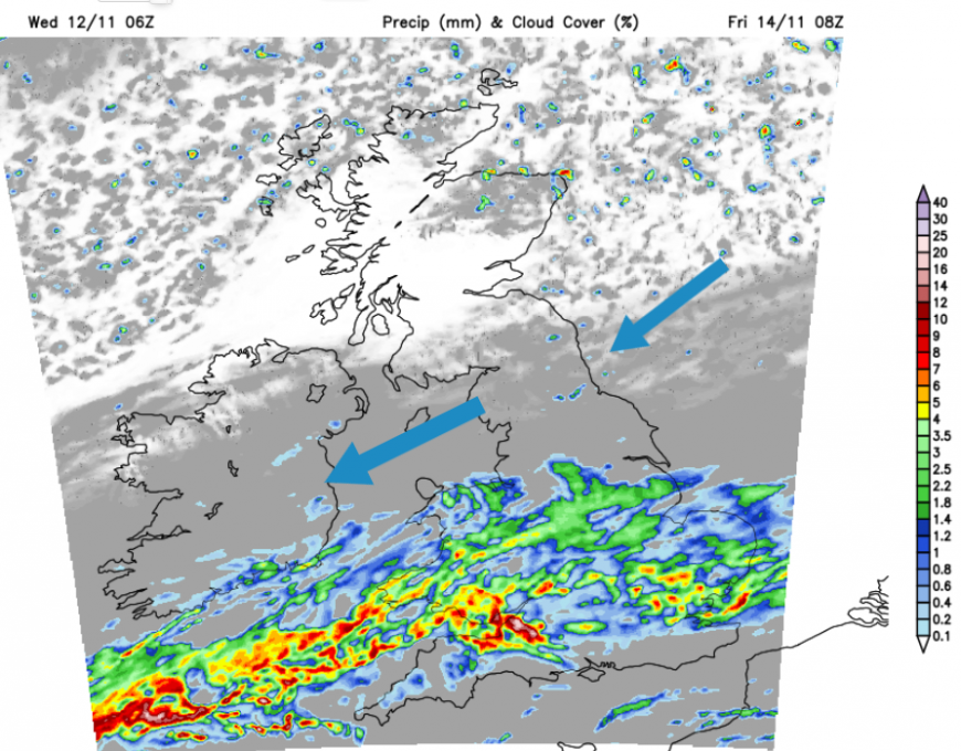
These fronts will bring more persistent, sometimes heavy rain starting on Thursday night which has led to the Met Office issuing further yellow rain warnings last into early Saturday. These cover much of inland southern Britain but there is some uncertainty about where will be impacted.
“Heavy and prolonged rain…may lead to some flooding and disruption… potentially in excess of 100 mm over east-facing hills in southeast Wales…Although some uncertainty exists in the areas of heaviest rainfall, impacts appear more probable across southeast Wales, the Midlands and parts of southern England.”
Northern cold and drier outlook
To the north of the midweek frontal divide, there has been a lot of cloud but a northerly flow from the Arctic will start to make its presence felt. At times, this will just bring temperatures back to where they should be at this time in November with a bit of frost in the north. By next week, it looks like the colder air and more northerly flow will win out with chillier weather on the way.
The path to cold air
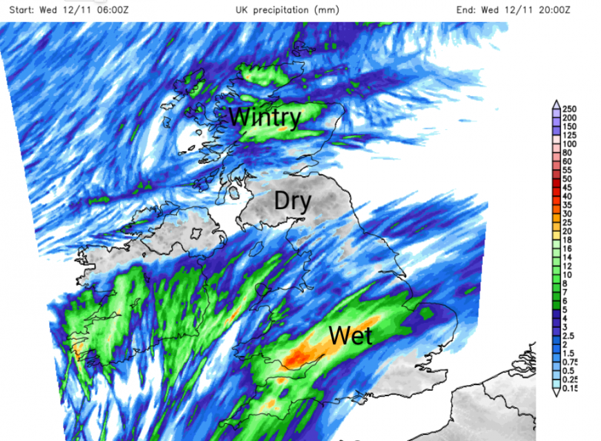
By Thursday morning, the old occlusion will be stretched across the UK with rain over Northern Ireland, the far north of England, the Central Belt and southern Scotland. So a miserable wet and grey start here with a cold northeasterly wind across Scotland.
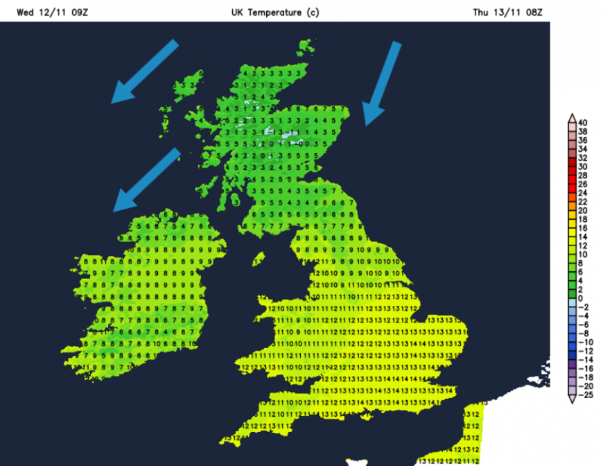
To the south of this band it will be mild with lighter winds and brighter even sunny weather. So respite, briefly, from the wet weather for those areas with rain warnings and flood alerts.
To the north of the frontal rain there will have been snow over the mountain tops in the small hours and along wintry flurries for higher routes across the Central Belt. It will feel different with a scattering of rain and sleet showers coming into northern Scotland with temperatures around 7C. Thursday will see the band of wet weather across the UK with brighter skies to the north and fine weather to the south. By Thursday evening, Northern Ireland, Cumbria and Northumberland will all be into the colder air with a damp evening adding to the chill.
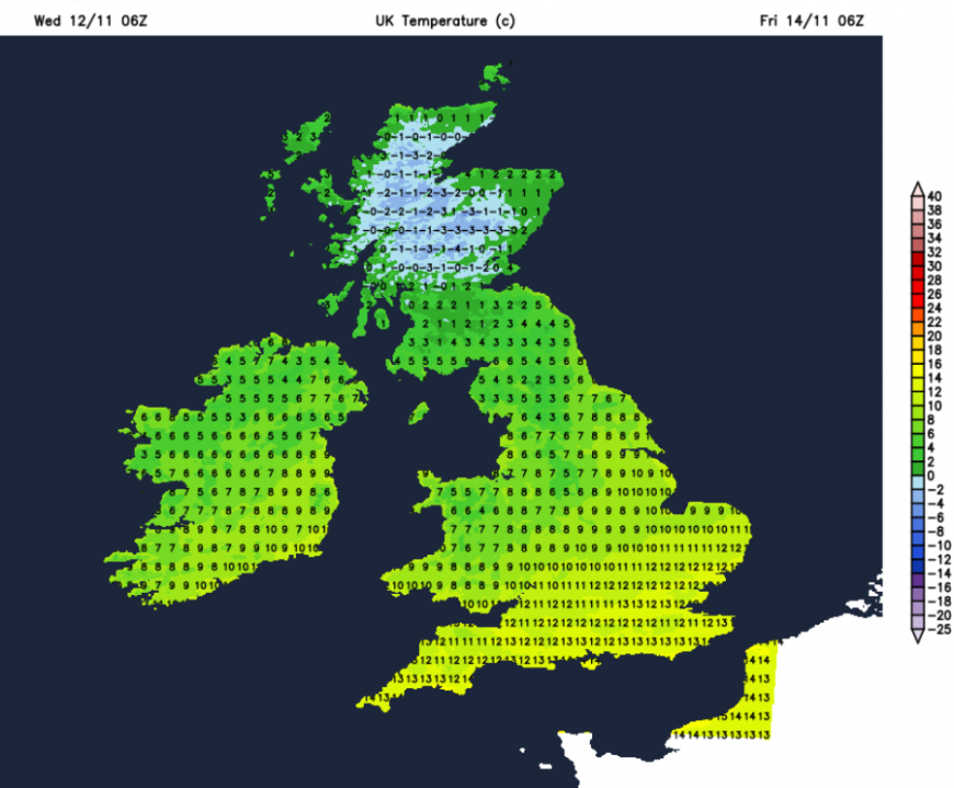
As the winds fall light over Scotland, there will be a widespread frost inland and the colder air will sink a little further south over northern England. In the south, it will still be mild but the next band of frontal rain will wave back north. This is the one linked to the yellow rain warnings later this week.
So the working week ends with mild air still over southern England, more wet weather with the risk of impacts from more heavy rain but this colder turn just reaching more of the UK from the north. Friday will become wet for much of southern Britain and begin to feel colder as the NE wind digs in. Northern areas will be brighter. There could be further wintry flurries for Grampian as a few snow showers appear on the chilly N/NE breeze.
Loading recent activity...