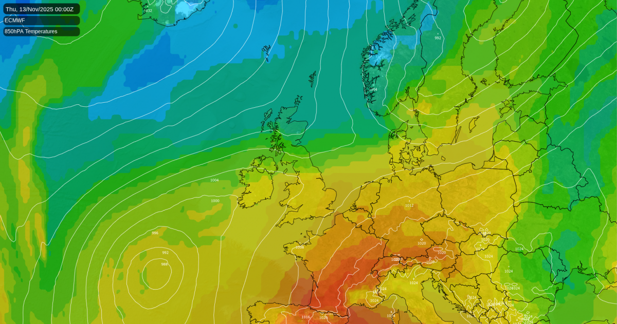
This week begins with mild air over the UK, temperatures perhaps reaching 17 or 18C in the south. We have seen a very mild start to November but there are signs of a change from the north later this week. Something colder with a frost risk in the north and even snow showers for Scottish hills but really it will just pull temperatures to where they should be at this time in November. Southern Britain could hold onto the milder air even into the weekend.
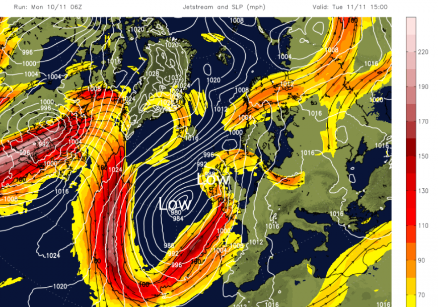
There will also be a lot of rain for parts of the UK, mostly for western areas as low pressures rattle in from the Atlantic. A large meander southwards in the jetstream will continue to feed low pressures past western Europe to the UK.
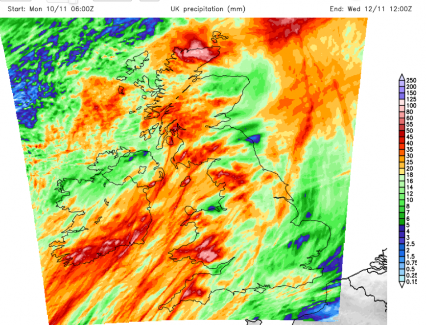
South Wales and southwest England will be wet especially over the Brecon Beacons, Dartmoor and Exmoor. High rianfall totals this week for the Cumbrian Fells, Yorkshire Dales, Snowdonia, also Dumfries & Galloway into the Pennines. The far north of mainland Scotland could see some very wet weather on Wednesday but then looks drier in the colder northerly flow.
The very mild air continues over the western Mediterranean, Spain and France but on Monday, there is a more westerly influence for the UK coming off the Atlantic. So it's not as mild as it was last week but still above average. There are still large swathes of cloud as one area of rain clears from northern Scotland and another appears for England and Wales. This will bring showery outbreaks of rain edging northwards towards Yorkshire through the afternoon.
In between these two rain areas, there is sunshine with a large gap in the cloud cover. So a mixed picture for Monday with light winds and temperatures around 10 in Northern Ireland but 11 to 13C for Britain. There will be a lull tonight, with clear and calm weather. It will feel cool after the dampness of the day as temperatures fall into single figures with fog patches in the north.
A larger low pressure will approach from the southwest in the early hours of Tuesday. There will be freshening SE then S winds as frontal rain reaches Northern Ireland and Wales before dawn.
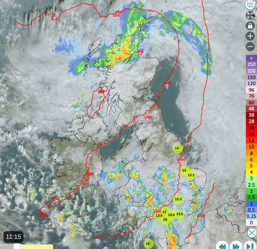
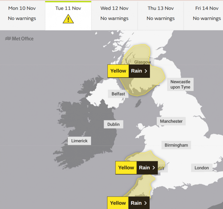
Through this week, we will see a difference of cooler air in the north as the mild air stays in the south. For Tuesday morning, northern Scotland will start off chilly but see a fine, sunny picture. Elsewhere, there will be milder air, a freshening southerly wind and rain with thickening cloud. Tuesday looks wet for parts of the UK as the warm front sweeps northwards and the cold front rainband reaches County Down and the Irish Sea. Much of England will have a grey, but mild afternoon in the warm sector. If breaks do appear in the cloud then the temperatures will leap up. The cold front rain will move in from the west during Tuesday evening with strong and gusty winds for Wales and western England, particularly southwestern Britain. There will be heavier downpours, even line convection, when there can be sudden intense rainfall, which would cause tricky conditions on the roads with poor visibility and surface water.
The Met Office has issued yellow rain warnings for three areas in Britain on Tuesday.
“Heavy rain during Tuesday afternoon and evening could lead to some flooding and disruption in places.” Wales.
England will be windy, whereas Northern Ireland and Scotland will have light winds but some showery outbreaks of rain as the low centre heads towards the Hebrides.
There will be further bouts of wet and windy weather as the whole lot moves northwards over the UK. By dawn on Wednesday, the low centre will be near northern Scotland with the rain in the far north with a colder northerly wind. Elsewhere, it will be a bright or sunny start, so quite a change.
However, the trailing front could still be over southern counties of England with more cloud and showery outbreaks of rain for Wednesday morning. The fair weather in the middle stays but both areas of rain will develop. The southern band will edge over more of southern England into south Wales with more cloud as the low centre for northern Scotland could bring more rain over the mainland and blustery winds. Caithness could see some intense rainfall. Along with that colder northerly flow.
The two rainbands begin to close together later on Wednesday with more cloud for central parts as the sunshine appears for SE England. Depending on the timings, London and the Home Counties could see 15 to 18C so another mild day.

There will be more rain over central and perhaps southern Britain on Thursday but there will be a dig of colder air from the northeast. Over the highest peaks of northern Britain, there could be snow and wintry showers following for Scotland as the day progresses. Thursday night looks colder and clear with light winds for northern parts of the UK, with an air frost for inland Scotland.
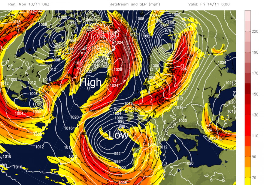
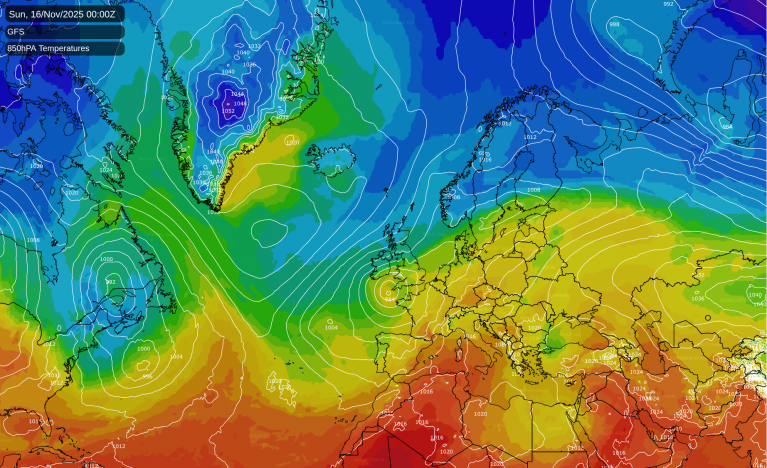
There will be a change for the jetstream as the giant meanders get cut off and a loop away to the north brings more influence. With high pressure building close to Greenland, a northerly flow will reach northern Britain but it will be a balancing act for the end of the week and the weekend. Southern Britain could hold onto mild air and the mainland European influence. However, with an easterly wind by Friday it could feel cooler in the gusty and damp conditions. The West Country could see some lee breaks. There are signs of another frontal band of rain for southern counties of England on Friday, which will please Water Companies as drought orders continue.
Flood concerns this week - “Land, roads and some properties may flood and there may be travel disruption.”
Environment Agency - England. “Local flooding is also possible from rivers and surface water across parts of the Southwest of England through Tuesday and Wednesday, and possible but not expected more widely across parts of England from today (Monday) until Thursday.”
Natural Resources Wales. “Local flooding is possible from rivers and surface water on Tuesday and Wednesday across parts of Wales, and possible but not expected more widely from rivers and surface water from today (Monday) until Thursday.”
Scottish Flood Forecast. “Localised impacts from surface water and small watercourses flooding are likely across parts of the south and central areas on Tuesday due to persistent and heavy rain. This will bring difficult driving conditions during Tuesday evening. Some isolated minor surface water impacts are also possible across the north on Wednesday due to further heavy rain.”
Loading recent activity...