For some lucky sky gazers, there were incredible aurora sightings in the early hours of Wednesday, 12th November.
There had been forecasts from the NOAA NWS Space Weather Prediction Centre and the UK Met Office Space Weather service but it is always a balance here with the cloud cover and whether to stay up late, just in case, on a school night.
Region 4274 on the sun had produced an X5.1 flare, "one of the strongest flares of the (Solar) cycle." This led to predictions of Geomagnetic storms of G1 to G4 (with the scale peaking at G5 like back in May 2024) potentially affecting the Earth.
G4 would be a Severe geomagnetic storm when there is a major disturbance in the Earth's magnetic field.

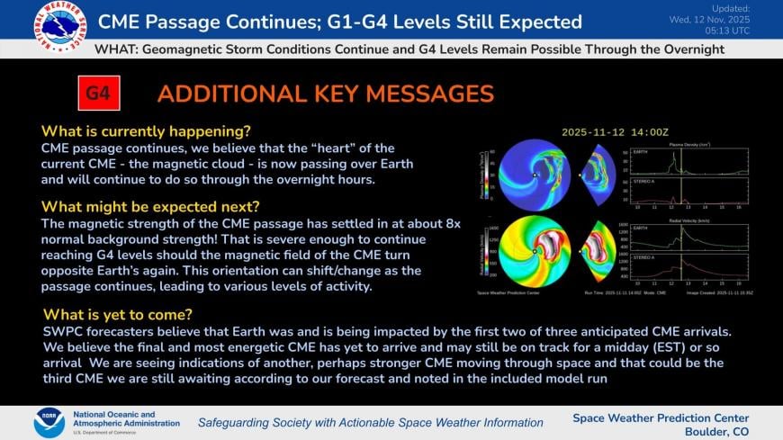
"G4 (Severe) Watch now posted for 12 Nov. The recent, fast CME (Coronal Mass Ejection) is anticipated to arrive about midday on 12 Nov and G4 potential exists."
The forecast for UK cloud had looked mixed with an area of clear skies promised within a huge swirl of thick cloud cover.
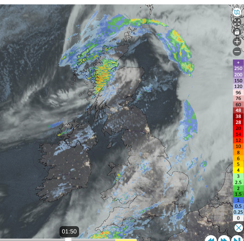
Observed cloud and rain from Netweather Radar around the time of the Aurora show, dark areas show clearer skies, white = more cloud
Space weather predications “provide 1-4 day advance warning of solar wind structures and Earth-directed CMEs that cause geomagnetic storms. Solar disturbances have long been known to disrupt communications, wreak havoc with geomagnetic systems, and to pose dangers for satellite operations.”
And then it arrived.
"G4 (Severe) storm levels reached! 12 November at 0120 UTC (8:20pm EST)! Geomagnetic storm conditions are anticipated to continue into the night"
These geomagnetic storms can produce the stunning Northern Light shows. If you get to see them depends on pesky cloud cover, whether you stay up late enough or respond to an Aurora alert. Also, if it's daylight when the storm hits.
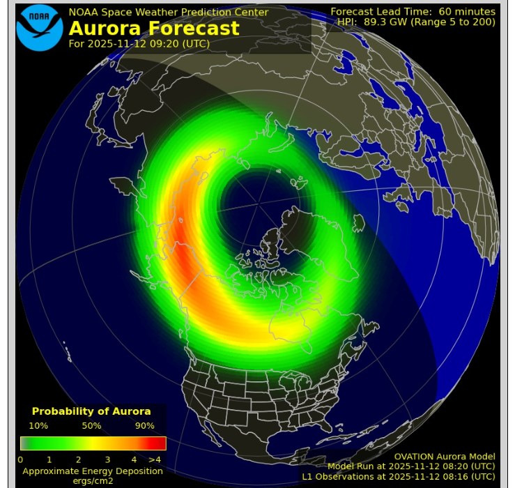
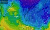
Auroral oval by Wednesday morning 08:20 UTC
There could be another opportunity by Wednesday evening but the timing may not work for the UK and NW Europe.
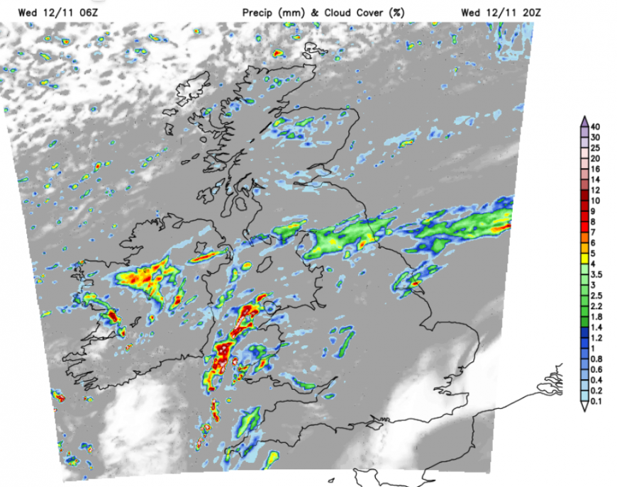
There will be a lot of cloud over the UK as two frontal systems come together. There is an Atlantic low which is throwing a mass of cloud over England and Wales this morning with more rain. This is hardly moving but will edge over a little further north by tonight. This could allow clear spells for southeast England, even London by Wednesday evening and perhaps later into south Wales. Further north, there is a low pressure centred near to the Northern Isles with a wrap-round occlusion bringing rain and blustery winds.
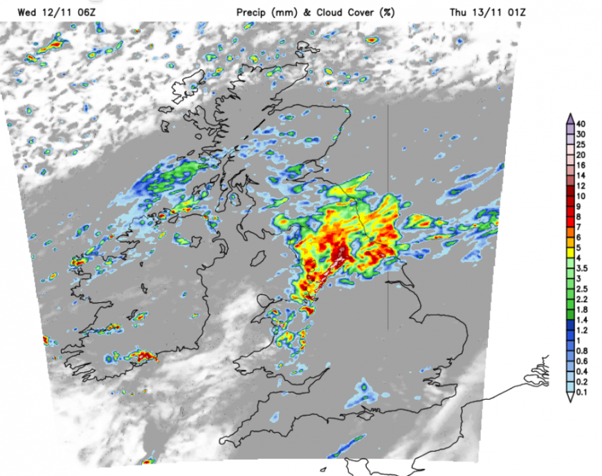
A colder northerly flow is going to take hold later this week and the start of that begins later today as the occlusion heads southwards. So there will be more cloud with showery outbreaks of rain over more of Scotland as the southern frontal rain reaches the Irish Sea, County Down, western Wales and northern England. The far north of Scotland will see clearing skies so there is a better chance of good views here, if anything does appear.
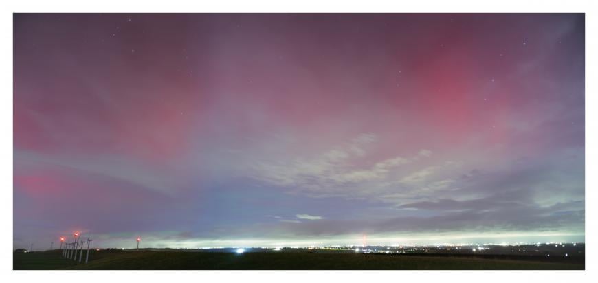
Forum member GreyCrag in the Peak District last night got lucky
"It wasn't my original choice of location but looking at the MetO Cloud Forecast showed a bit of clear skies towards the Royd Moor area (south of Holmfirth) and ... I decided to chance it. Fighting against high winds, clouds, city lights, moonlight, occasional drizzle, all it took was just a few momentary breaks in the cloud to get a glimpse at what was going on above."
More discussion in the Solar and Aurora Activity thread on the Netweather Forum
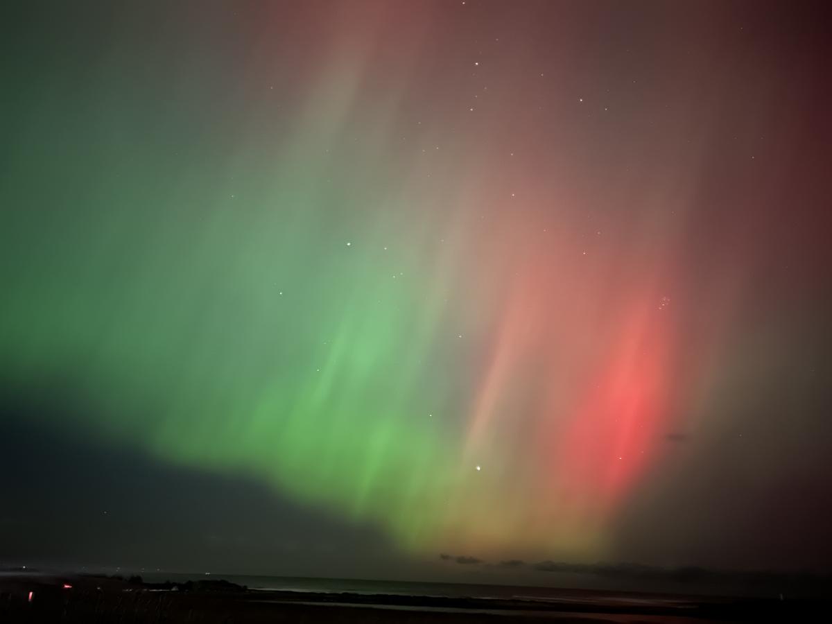
Top image red/green aurora from May 2024
Loading recent activity...