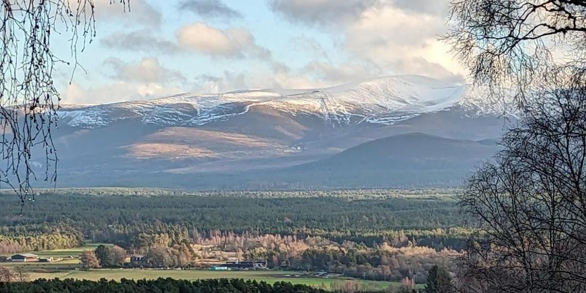
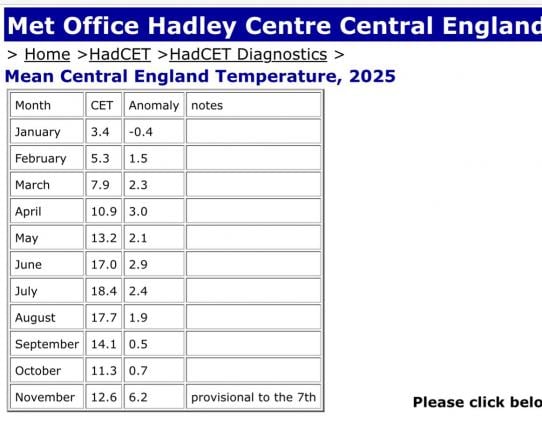
The UK has been basking in unseasonable warmth since the start of the month, the mean Central England Temperature (CET) for the first 7 days of November is an astounding 6.2C above the 1961-1990 average.
More warmth on the way for England & Wales and much of Europe next week too, with temperatures on the rise again into the second half of the week, as winds back from southwesterly to a southerly direction, drawing in unseasonably warm air up across western Europe. Temperatures over France look to reach the low twenties by mid-week, the mid or perhaps even high teens across southern England.
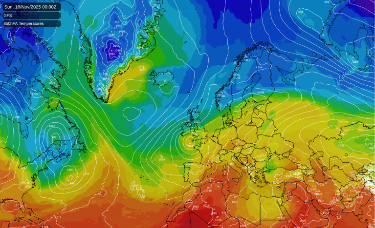
Unseasonably warm air spreading north during the coming week
However, changes are forecast to occur upstream over N America and the far N Atlantic that could start to bring much colder conditions to all after mid-month, starting in the north later next week.
The change looks to occur due to a wedge of cold arctic air plunging southeast across the eastern half of North America all the way deep down into the southeast states of the USA. This cold arctic plunge over eastern North America looks to amplify the current zonal jet stream here and across the North Atlantic into western Europe, creating a deeply wavy / meridional jet pattern which subsequently leads to anticyclonic wave-breaking over the far north Atlantic. This leads to the development of a blocking area of high pressure over southern Greenland.
Cold plunge over eastern N America will make the jet stream more wavy, leading to anticyclonic wave breaking over the far N Atlantic
The blocking high forecast to develop in the vicinity of southern Greenland will force the zonal jet stream reestablishing across the North Atlantic further south, after the anticyclonic wave break occurs, with areas of low pressure moving east over the Atlanitc guided by the jet stream on a more southerly track in across western Europe. This leading to cold arctic air being pulled southwest towards NW Europe. However, there is still uncertainty between models and runs of each model over how far south these lows track into western Europe. And this will determine how far south cold arctic air will get across the UK from next weekend.
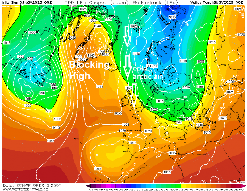
There looks to be an attempt at colder arctic air pushing south next weekend, as the blocking high starts to build centred just south of Greenland and near Iceland. This will force further Atlantic lows trying to move in southeast into France and Iberia rather than east across the UK, which will pull a northerly or northeasterly flow down across the UK through the weekend. The flow could become cold enough for showers blowing down across the north to turn increasingly wintry in nature, with perhaps snow falling over hills in the north by the end of the weekend or early next week.
There is a lot of uncertainty between models this far out how long the much colder incursion from the north or northeast will last and how far south wintry precipitation may reach. GFS cuts off the cold flow early in the week following next weekend, as the blocking high drifts west towards northern Canada, allowing low pressure systems over the Atlantic to move back northwest towards the UK, introducing milder and wetter conditions. However, the overnight ECMWF run continues the cold northerly flow through much of the week following next weekend, as it keeps the blocking high over Greenland, rather than it drifting further west.
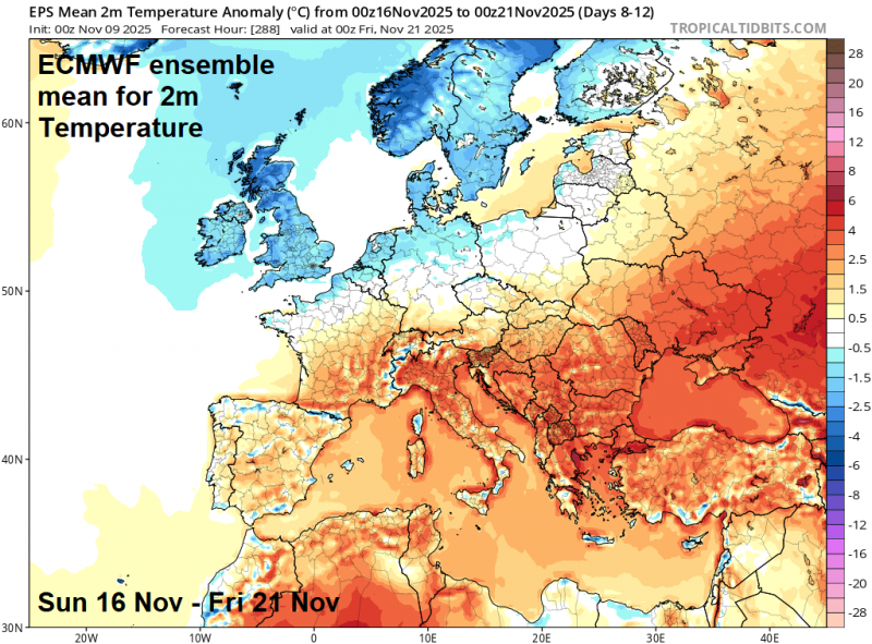
So, a strong signal for it turn colder from next weekend, with a risk of overnight frost where skies clear, risk of wintry showers in the north, falling as snow over higher ground and perhaps lower levels in Scotland. No signal for snow in the south for now, though turning noticeably colder than this coming week, which will see temperatures in the mid or even high teens! How long the colder conditions last is uncertain, depending on how long the blocking high to the northwest remains close enough to keep the cold flow going and prevent Atlantic lows moving northwest towards the UK.
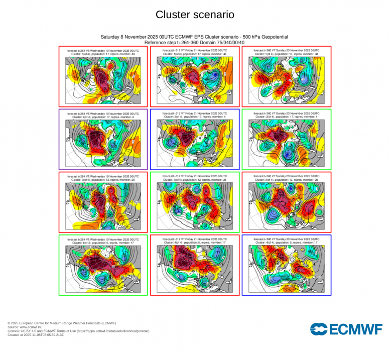
A look at EC ensemble clusters for days 7-10 indicates a Greenland / far North Atlantic block is favoured through early week 2, maintaining a cold northerly flow. After that, it gets more uncertain, though it does seem to signal the Greenland block influence waning / weakening allowing low pressure over the Atlantic to gain more latitude, bringing wetter and milder conditions.
Loading recent activity...