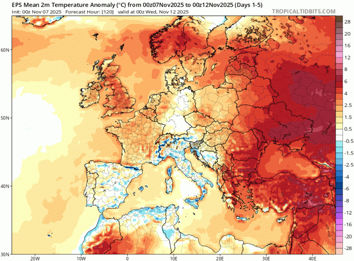
It’s been very mild for the time of year this week, on Wednesday the temperature reached 19C in Plymouth, Devon – well above the average high of 12C. while Thursday saw a high of 18C at Bude in Cornwall.
It will remain mild to end the week, not as mild as the last few days, but still above average – thanks to a lot of cloud and moisture around in the Tropical maritime southwesterly flow.
The weekend will be on the mild side too, with the flow continuing from the southwest. Saturday is looking the better day, with most dry with some bright or sunny spells developing from the west after a grey and damp start in the north and east. Sunday looking cloudier and wetter for northern, central and western areas, with outbreaks of rain spreading east.
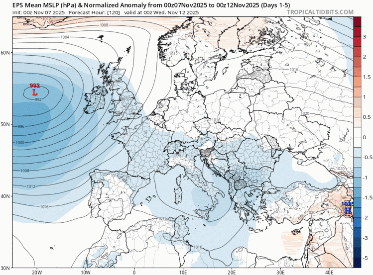
Low pressure remains in charge close to the west over the next 5 days at least, so there will be some rain occasionally, though also some drier weather
It will continue to be mild for the time of year over much of northern Europe over the next 5 days at least ...
Parts of Scotland have the greatest chance of remaining dry with some sunshine on Friday. Further south, some showers will spread north across England during the day, most frequent towards the east. Some sunny spells likely too. Meanwhile, a frontal system moving in from the southwest will bring outbreaks of rain in across SW England, Wales and N. Ireland by early evening, before spreading east across England in the evening, but tending to weaken and fizzle out in places. Temperatures still reaching 15-16C widely across the UK away from higher ground.
Through Friday night, the front continues to weaken as it moves east, bringing a lot of cloud and some patchy light rain or drizzle towards northern and eastern areas, turning drier in the west, perhaps with clear spells developing in the southwest later in the night. Some mist and fog patches developing in places because of all the moisture in the air, which could linger Saturday morning. Also a grey start with some patchy light rain or drizzle across northern and eastern areas, before drier and brighter conditions in the west spread across all parts through the day. Temperatures again rather mild, reaching 13-15C widely.
Sunday should dawn mostly dry and bright, before cloud and a band of rain moves in across the west through the morning then across most of the north, central and west of the UK by mid-afternoon. Eastern England staying mostly dry and bright or sunny until dusk. Rain reaching eastern England Sunday night.
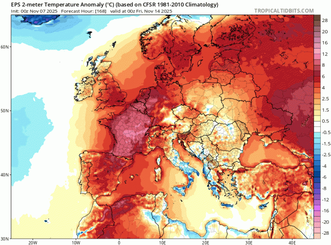
Next week looks to remain mild and changeable and often unsettled, thanks to low pressure close to the west throwing frontal systems northeast across the UK and Ireland, bringing spells of rain at times. Monday looks to a frontal system with a developing area of low pressure embedded move northeast across England and Wales, bringing a spell of rain. The rest of the week sees further frontal systems move north, bringing further rain, particularly in the west, while the east is often drier with more chance of sunshine. With winds backing more southerly through the week, it will become very mild again for the time of year, with temperatures once again reaching 16-17C.
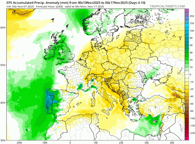
Rain likely at times next week for all, especially in the west
Potentially turning very mild again later next week, as winds turn more southerly
However, there are hints from the extended range of weather model output over recent days for the potential for a change to much colder conditions after mid-month, as blocking high pressure looks set to establish over Greenland, potentially pulling cold artic air south or southwest across the UK and Ireland. This would bring the potential for wintry precipitation and risk of overnight frosts. More on this over the weekend.
Loading recent activity...