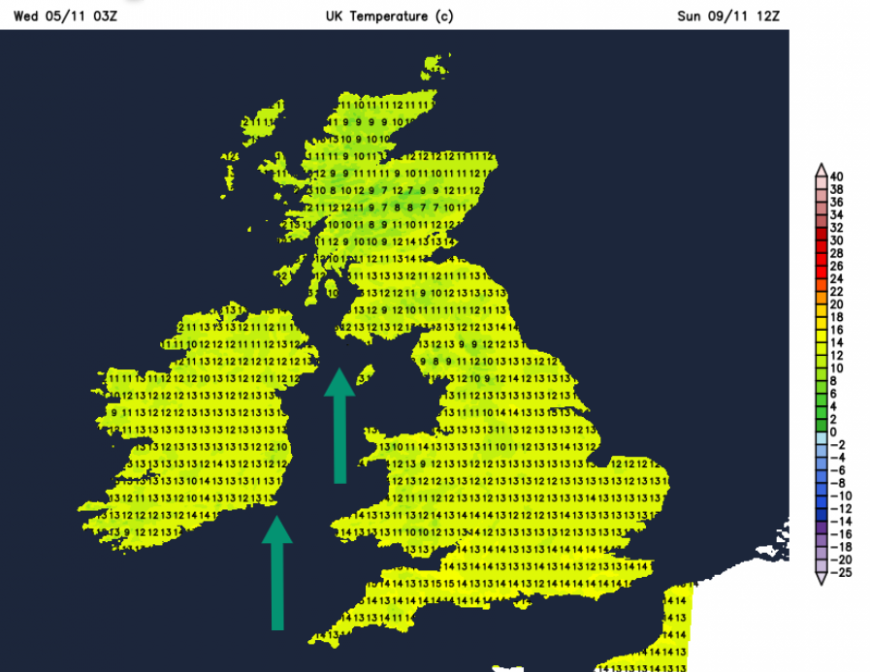
The weekend won’t be as mild as it has been midweek. Temperatures have been widely in the teens, with some spots up to 17C. This is well above average for the first part of November. Remembrance Sunday can bring wind and rain, warm southerly air or bitter cold and even snow. This time of year is highly variable depending on the air mass and wind direction. The weekend doesn't look particularly cold but it may feel cooler due to the higher temperatures of Wednesday and Thursday. And of course it depends on your location, if it is a windswept coast or hill top rather than a more sheltered high street or in central London.
This week’s weather has been dominated by a succession of low pressures coming in off the Atlantic. It has been very wet in some parts of western Britain already this week. For Sunday, there is another incoming low pressure over the north Atlantic, which will be throwing its weather fronts our way.
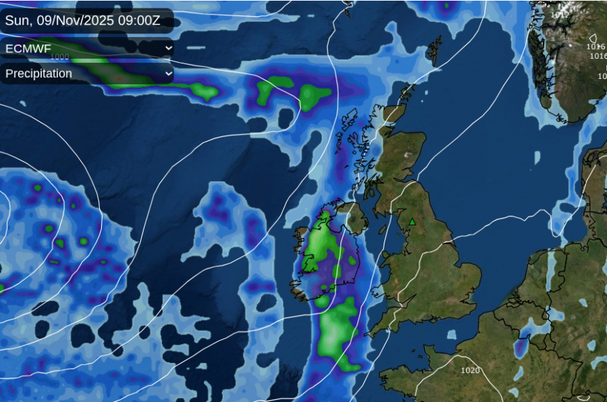
ECM model with a distinct rain band over Ireland for Sunday morning and tighter isobars showing a brisk southerly wind
If you are looking at a weather app for a specific time slot on Sunday morning, bear in mind that there is a band of rain to the west of Ireland on Saturday night.
For Sunday morning, it looks most likely that the rain will have reached Northern Ireland but that eastern Britain will be fine and dry and also bright with light winds.
Further west, the southerly winds will freshen, especially around the Irish Sea as the rain band arrives. Stronger winds make it tricky to hold flags in parades.
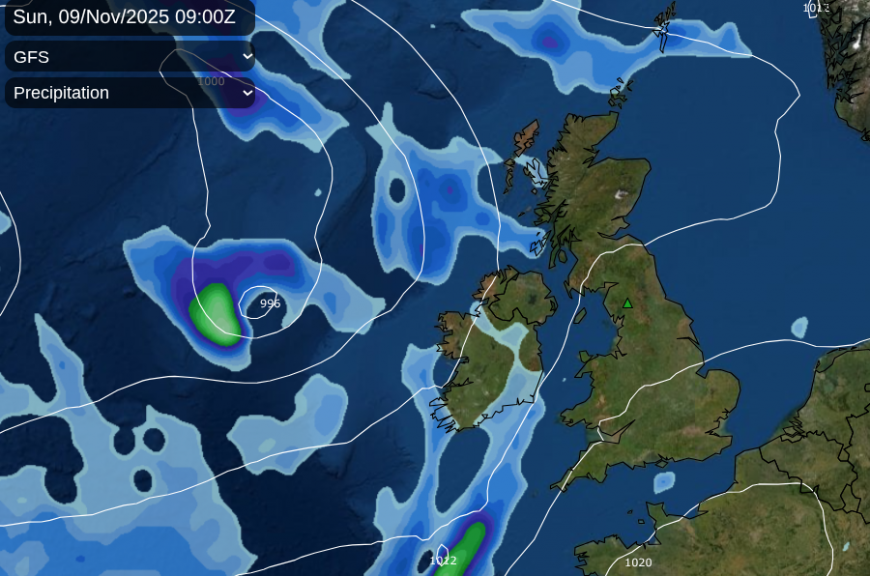
The GFS model shows a more fragmented rainband and more spaced apart isobars, so not such a wet and windy threat from the west
At this stage, four days ahead, it is worth considering the overall picture of the weather over the UK rather than just focusing on individual symbols. It could be that by Sunday, the rainband has sped up, or become more fragmented. There is a strong signal for a band of rain from the west and further east over Britain looks drier.
Central London could have a fine Sunday morning with bright even sunny spells. York also looks fine at 13C. Edinburgh should remain dry but with increasing cloud at 12C. With current timings Manchester should stay dry for Sunday morning. For Anglesey and Gwynedd the rain maybe be edging closer over the Irish Sea but the UKV model keeps it dry for now, although it looks windy.
With 11 o’clock being the focal point of Remembrance Services, this rainband might have reached western Wales, SW England, the Isle of Man and the Hebrides.
It will be mild with temperatures around 11 to 14C but feeling cooler in any rain or brisk winds.
Loading recent activity...