It’s a week of autumnal low pressures arriving from the southwest but scooping up mild air from the south. Monday morning ihsa been very mixed with showery outbreaks and grey cloud but sunny spells for some northern areas. It does not feel cold, and the nights won’t be cold or frosty.
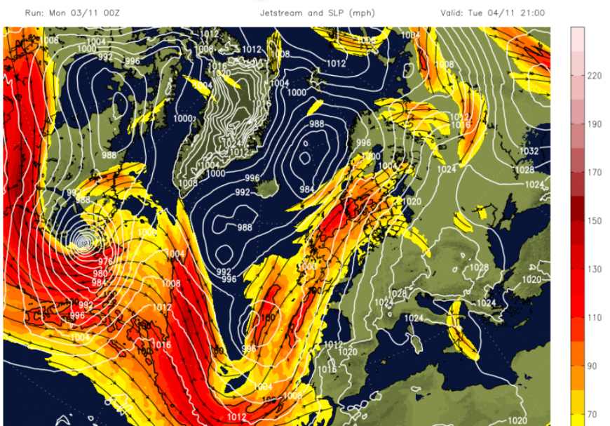
The jetstream helps a succession of low pressures move across the Atlantic towards the UK and western Europe all week. For the start of the week, Northern Ireland and western Britain are expected to experience heavier rain with strong winds, including coastal gales, on Monday into Tuesday. The low centre closer to Iceland is ex-hurricane Melissa. This was the Category 5 cyclone that devastated western Jamaica last week. Don't worry, it has changed greatly on its journey northwards, transitioning into an extra-tropical low.
To start the week, there will be heavy rain for Wales, more for the Cumbrian Fells and western Scotland with clusters of heavy showers from Northern Ireland into Monday evening. Everywhere will experience a blustery Monday, with the mild flow from the southwest. Temperatures across the UK will widely be 14 to 16C. In the drier, brighter areas, you will really be able to appreciate this mild November air, and there will be some sunshine, for NE/E Scotland and developing in SE England.
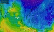
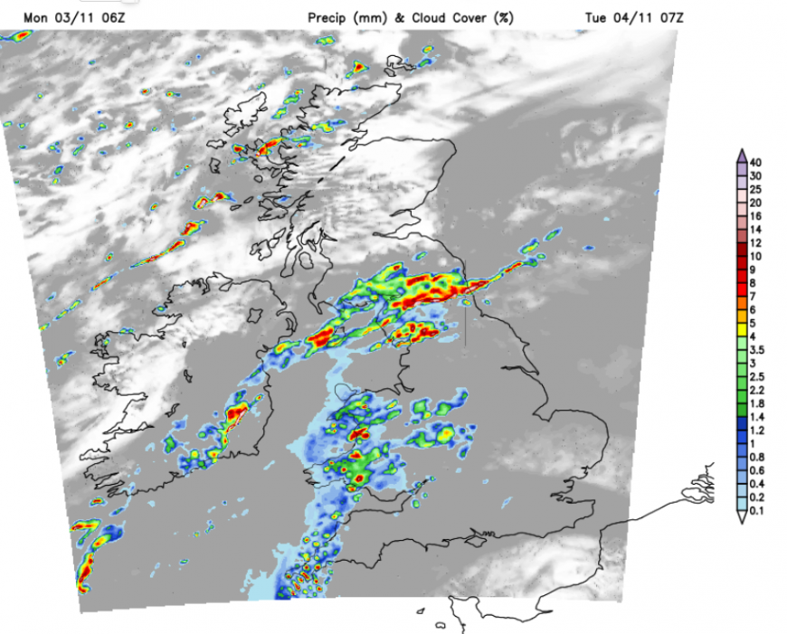
 Netweather Radar showing top ten temperatures, plenty of cloud across the UK, although thin in places and heavy rain for Cumbria
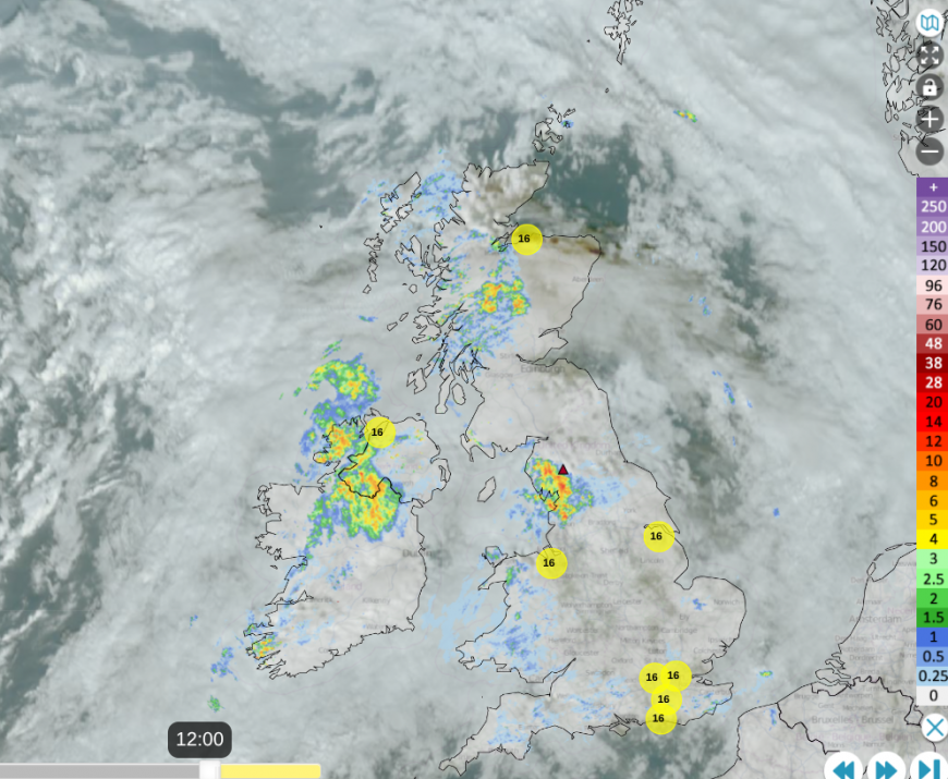
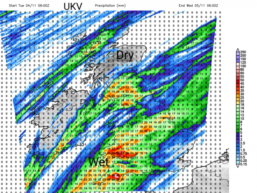
The Met. Office has issued a yellow rain warning for Cumbria which includes Shap (red triangle) near where a train derailed today, with Network Rail confirming a landslip in the area. The Environment Agency has highlighted " Local flooding is probable from rivers and surface water on Tuesday across Cumbria" and the Rain warning states
"Further persistent, and at times heavy, rain is expected on Tuesday, on top of Monday's rainfall which has been heavy in places" MO
There will be strong and gusty winds with the downpours over the NW Highlands later today but clearer skies overnight for Northern Ireland and Scotland.
A sunny start for Scotland and Northern Ireland on Tuesday but heavy rain along a frontal band over Cumbria, the Pennines and around the Solway Firth. Wales will also see more rain and frontal rain will soon cover southwest England and set in for Tuesday. London, the Home Counties and East Anglia could miss the rain for much of the day. It will still be breezy from the south but not as windy as Monday.
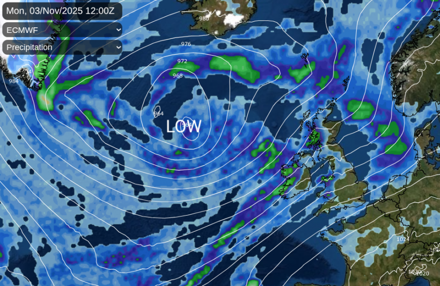
Frontal bands will drape themselves SW to NE across the UK and Ireland, joined by new fronts from the SW on Tuesday with another low approaching on Wednesday. These frontal bands will waver and so there is some uncertainty about which parts of Britain will be under a rainband at a specific time and where will be a bit drier. An area of heavier rain does look like it will move over SW Britain on Tuesday evening, soaking the Moors and south Wales. This then heads over the Midlands and away from eastern England. The winds will ease for Wednesday for another mild day when temperatures could pass 17C.
It’s hard to put details on the outbreaks of rain later this week. Thursday shows a band of rain moving northwards, allowing more sunshine in the south. Again, it will feel mild, even warm in any sunny spells. Friday, perhaps not as warm but again a mix of sunny spells, scattered showers and areas of cloud and rain as low pressure swing bands of rain and showers in from the west.
We have a few supermoons this autumn, with the midweek full moon appearing the largest this year. The moon is slightly closer to the Earth on its elliptical orbit and so appears brighter and larger. Clear skies are going to be in short supply as these frontal bands feed in. Wednesday night starts off cloudy but skies clear for southern Britain for the early hours of Thursday.
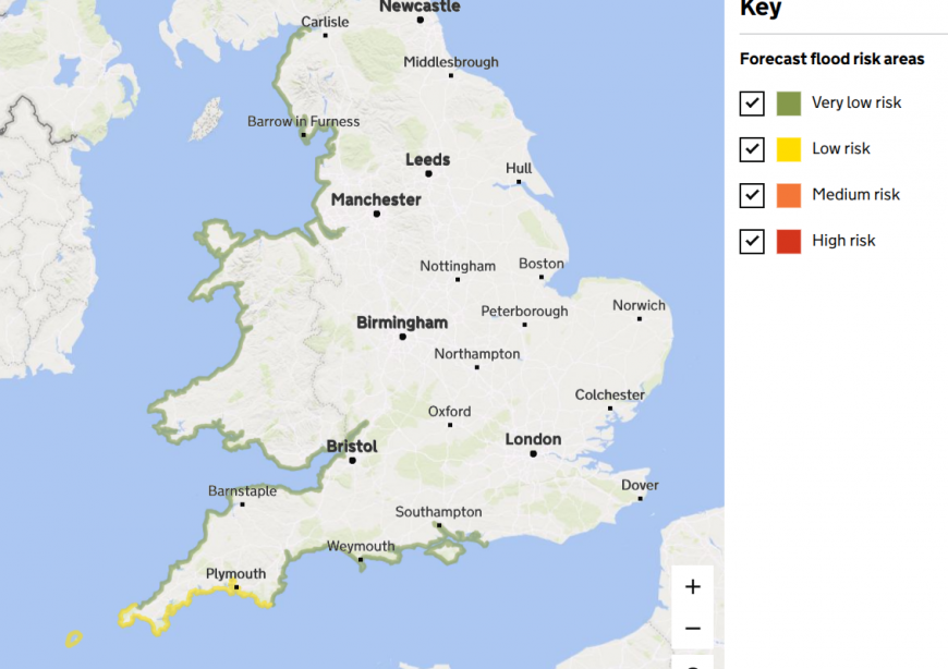
There will be spring tides this week as a low pressure approaches from the southwest. The risk of “Significant coastal flooding impacts” is being highlighted by the Environment Agency for SW England on Wednesday. There could also be “Minor inland and coastal flooding impacts” at other times with the southerly onshore flow and spring tides on Thursday.
Loading recent activity...