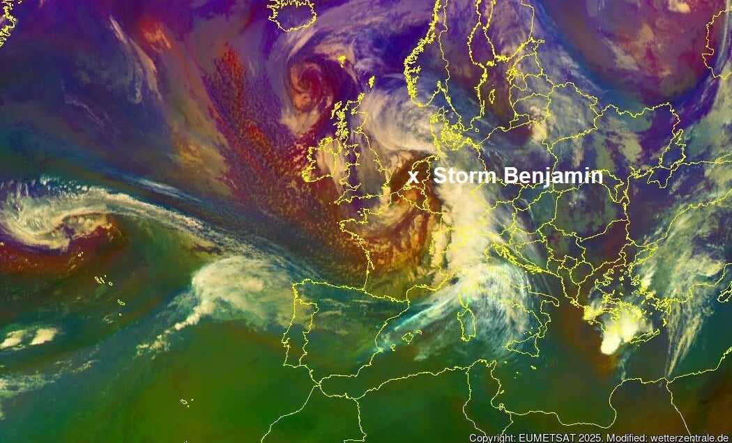
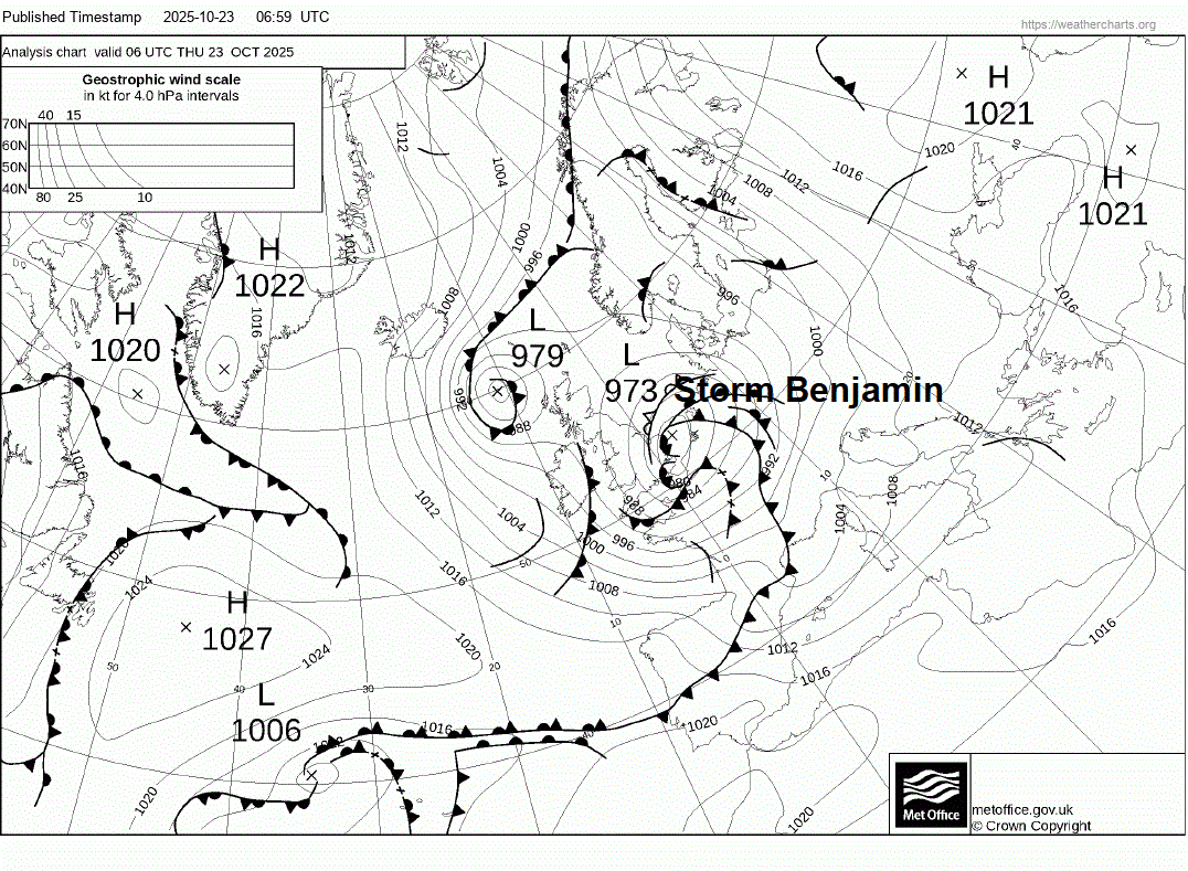
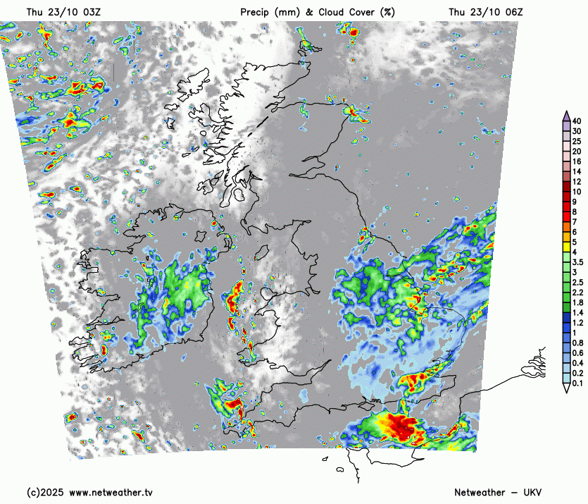
Storm Benjamin moved northeast up through the English Channel overnight, deepening on its journey towards the southern North Sea, the centre of the low over the southern North Sea between East Anglia and the Low Countries at breakfast time.
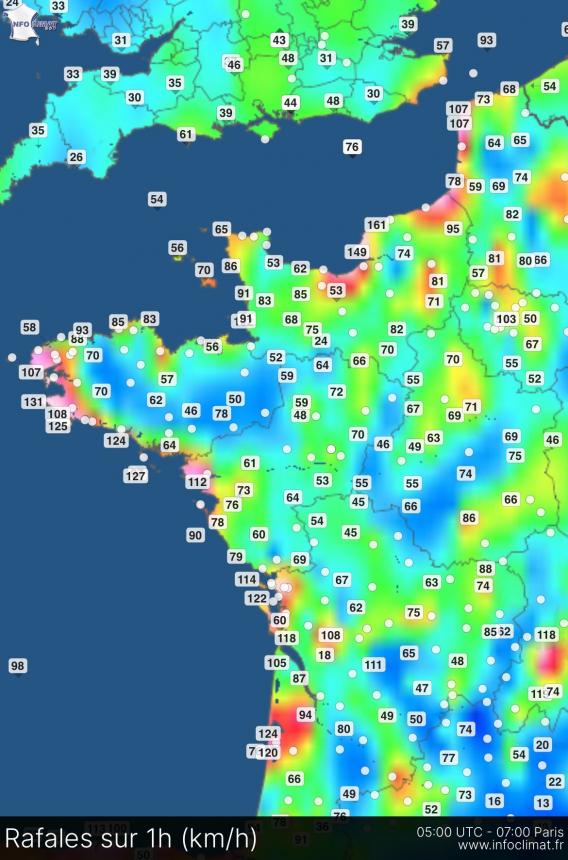
Strongest winds have been on the southern and southwest flank of the low across the English Channel coasts of northern France and Atlantic coasts of western France, with a 100mph (161 km/h) gust at Fécamp and 92mph (149 km/h) gust at Cap de la Hève earlier - both on the Normandy coast. More recently, gusts of over 80mph along more exposed parts of the Atlantic coast in western France. The coast of Cantabria in northern Spain has seen gusts of 70mph too.
Although the winds haven’t been particularly strong so far here, it has been a wet night across S England, particularly south of London from the Isle of Wight to Kent - where 20-30mm has fallen in the last 24 hours widely, locally over 40mm towards the East Sussex coast, e,g. 46mm at Pevensey.
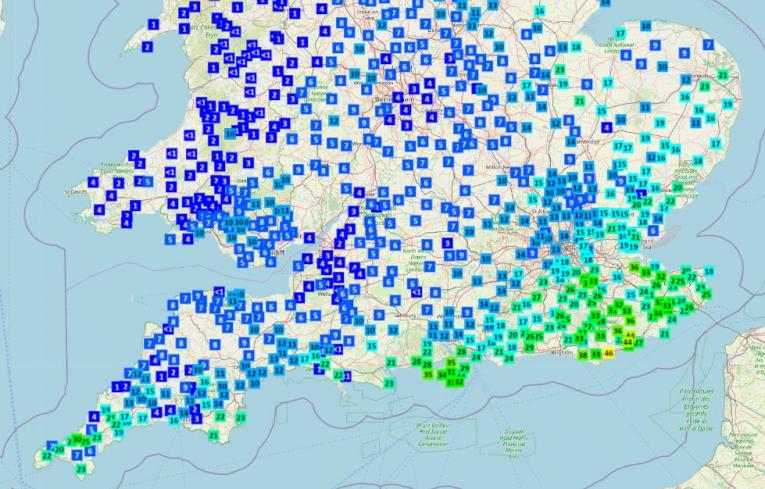
Last 24 hour totals from rainfall gauges - data courtesy of Starling Roost Weather
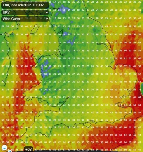
However, winds will strengthen through the morning as Storm Benjamin clears to the east, already gusting to 45mph across eastern England, with gusts of 40-50mph possible inland across eastern England from East Yorkshire down to Kent and Sussex, perhaps up to 60mph along coasts. Also, northerly gales will affect coastal areas of west Wales and the far SW of England, 50-60mph gusts possible here.
Cloud with outbreaks of rain will only slowly clear east from eastern areas of England through the day, perhaps not until mid afternoon does it clear East Anglia, followed by drier and brighter skies to the west. After a grey and damp start, central areas of England joining the rest of the UK to drier and brighter conditions with sunny spells, however, there will be some heavy showers affecting Wales and SW England, these perhaps reaching the Midlands and central southern England too. Scattered showers elsewhere around coasts. Feeling colder than recent days though in the northerly wind, temperatures reaching the low teens at best.
Winds easing inland across England and Wales tonight, but still remaining windy around coasts - where showers will continue too. Mostly dry with clear spells inland and turning chilly - temperatures widely falling to around 4-6C in the countryside, locally lower.
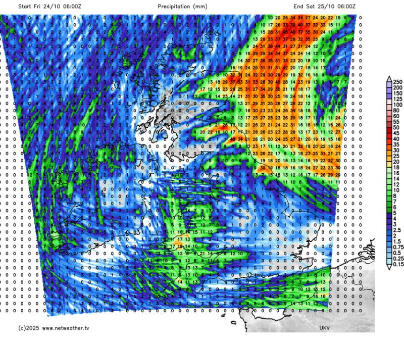
The low pressure remnants of Storm Benjamin will still be lurking to the east over the North Sea on Friday with rain and gales wrapping around the low spilling in across eastern Scotland and eventually NE England through the day. Elsewhere bright and breezy, with scattered showers, mostly towards the west, quite windy across Wales and SW England - with gales along coasts. Temperatures reaching 10-12C, a little below average for the time of year.
Remaining on the chilly side as we go through the weekend, with low pressure to the east and high pressure to the west of Ireland pulling a cool north to northwesterly across the UK. It will be quite windy on Saturday, with gales along North Sea coasts, most places will be dry and bright or sunny away from western coasts and NE Scotland - which will see showers.
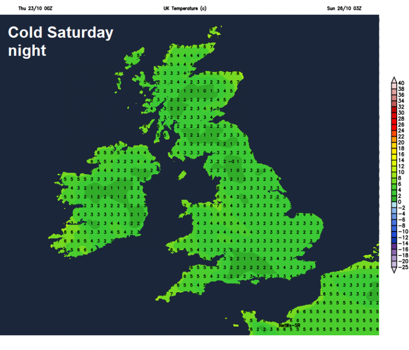
Clear skies under a polar flow Saturday night will allow temperatures to fall into low single figures widely away from coasts, so we are likely to see at least a ground frost in rural areas by dawn on Sunday. A cold start to Sunday, then a mostly dry bright or sunny day, bar coastal showers, before cloud and outbreaks of rain look to spill southeast across many areas during the evening.
It looks to remain generally unsettled next week, with a mobile westerly pattern, bringing further spells of rain off the Atlantic at times, but also there could be some drier spells, as high pressure tries to build from the south. It will, at least, turn milder next week.
Loading recent activity...