The weather will remain rather disturbed over the coming week, heavy showers and thunderstorms at times, while a spell of wet and windy weather with gales is expected on Sunday into Monday and again next Wednesday. Signs of high pressure building later in the month.
Sunshine and heavy thundery showers is the theme for many today and tomorrow,, showers blown through by a brisk southwesterly wind today, so fortunately not lasting long for most.
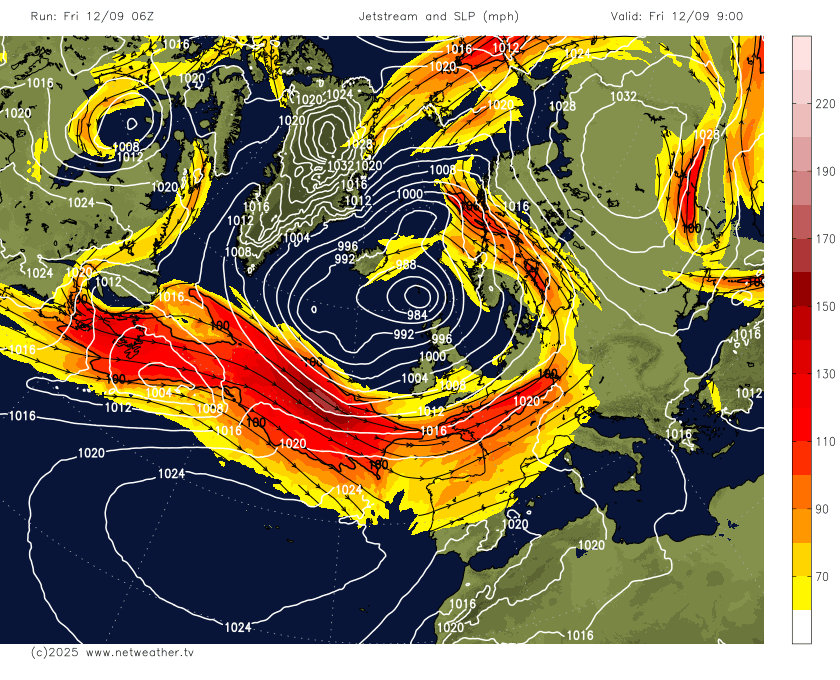
Meanwhile, an area of low pressure southeast of New Foundland at lunchtime Friday, will deepen as it tracks east across the Atlantic over the weekend under the developmental right entrance to a strong 180mph+ jet streak crossing the North Atlantic towards western Europe.
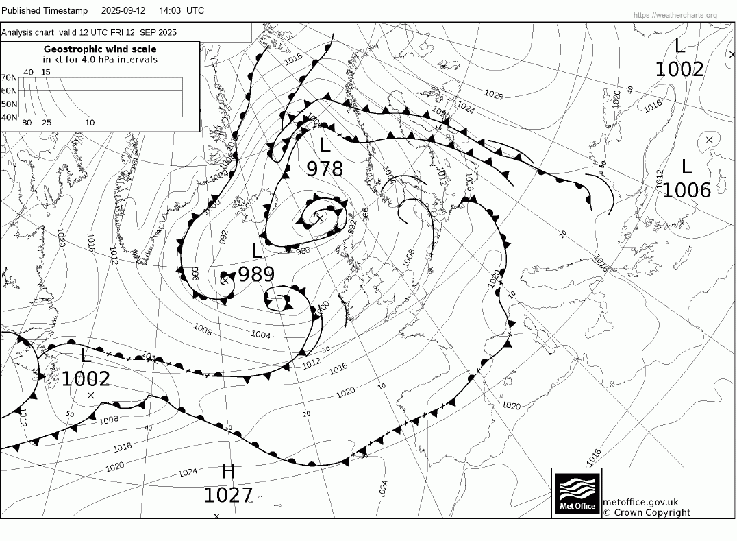
The deepening low looks to reach its deepest phase as it arrives to the northwest of Ireland on Sunday afternoon, with central pressure forecast to fall to around 980 hPa, before the low starts to fill as it moves away from the jet stream as it crosses Scotland Monday morning.
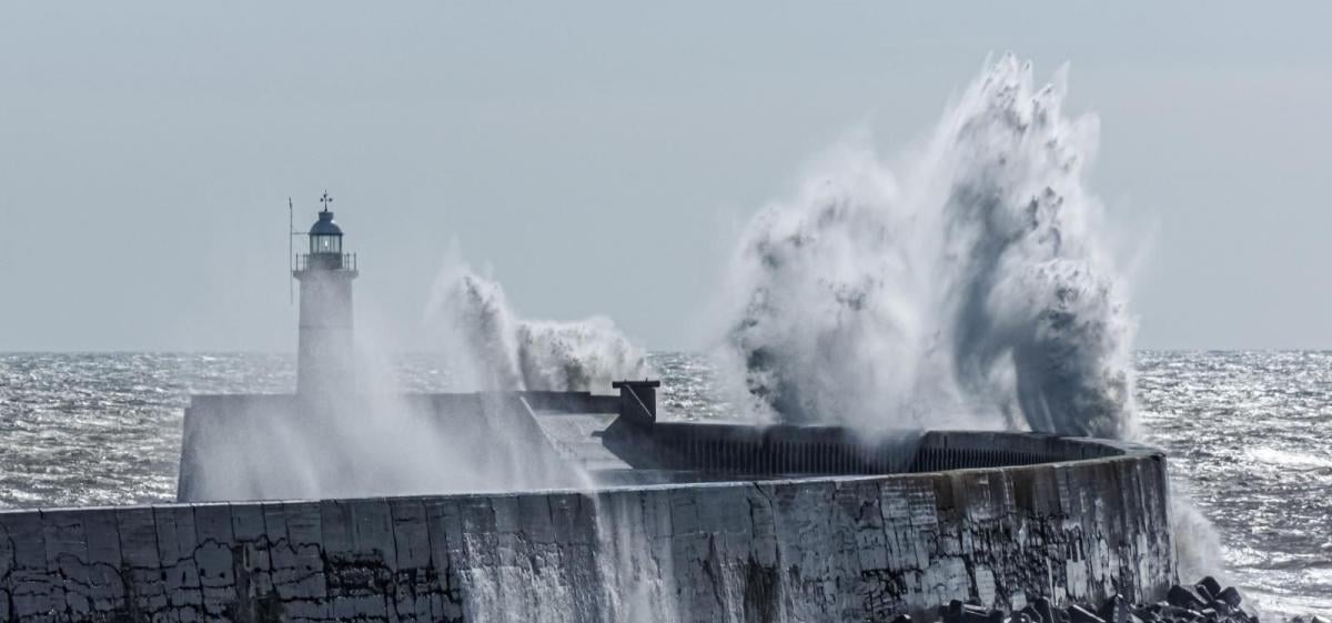
A frontal system moving east ahead this low arriving to the northwest on Sunday will bring a spell of wet and windy weather from late morning across the southwest then all parts through the afternoon and into early evening, after a dry and bright morning in the east. Squally rain clearing east during the evening to clear skies with blustery showers in the west, but winds will increase further from the west overnight and through Monday morning, as that low tracks east over Scotland.
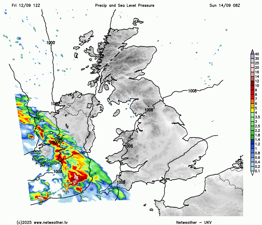
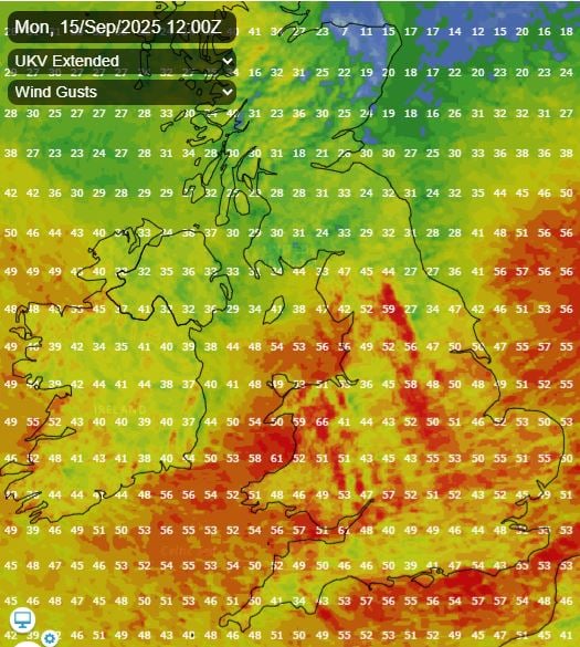
Strong southwesterly veering westerly winds on the southern flank of this low tracking northeast will arrive across Ireland then western UK Sunday evening, before spreading east across all the UK Sunday night and through Monday morning. Winds gusting to 50-60mph across southern and western coasts, perhaps 60-70mph with exposure in the west, such as western Ireland, west Wales and along/through the Bristol Channel. Gusts of 40-50mph locally inland across England and Wales Monday morning, so could be some disruption to rail from falling trees and flights to bear in mind.
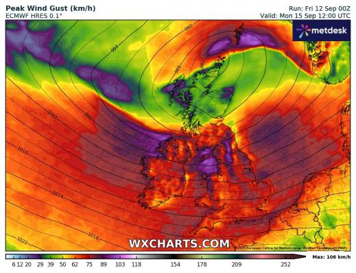
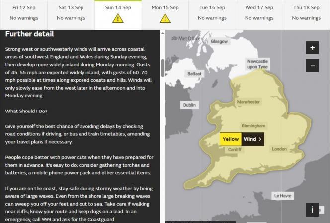
The Met Office have updated their yellow wind warning to include most of England and Wales in force between 8pm Sunday and 6pm Monday. The wind gusts have been reduced a little compared to yesterday, which reflects a reduction in gusts shown by weather models this morning. No mention of gusts of 70-80mph with exposure now.
So a windy day on Monday, with gales possible over England and Wales, especially towards coasts and over hills, sunshine and showers for many, but perhaps some longer spells of rain over Scotland in association with low pressure crossing here.
Another deep low arriving for Wednesday to bring a spell of wet and windy weather?
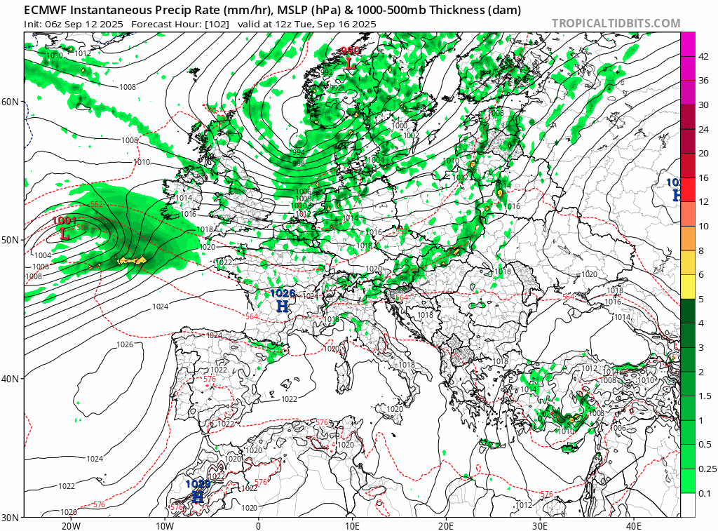
The rather unsettled theme continues for the rest of the week, sunshine and scattered showers on Tuesday, then we are keeping an eye on another deep low that’s been forecast by models for several runs now to cross somewhere over the UK on Wednesday. This time the track looks more likely to be further south than Monday’s low. The 06z GFS and ECMWF take the low east across Wales, Midlands and exiting east Anglia. Uncertainty over track and depth this far out, but could bring another spell of wet and windy weather with gales to Ireland, England and Wales, particularly south of northern England.
Wednesday low followed by a northwesterly flow, but winds easing, a brief ridge of high pressure builds in for Thursday. Another spell of wet and windy weather may arrive off the Atlantic to end the week though, followed by windy and showery conditions into next weekend. However, there are hints that high pressure may build for more than a few days the following week, bringing drier, warm and more settled conditions. But uncertainty over this outcome for now.
Loading recent activity...