The main weather event this weekend will be an approaching Atlantic low pressure which will bring rain on Sunday and windy weather into Monday.
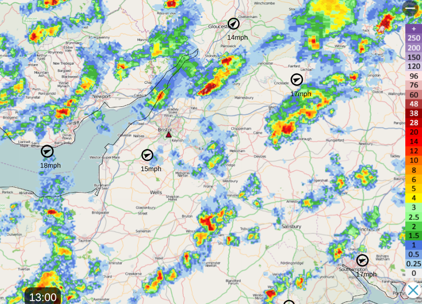
Saturday will be another day of bright or sunny spells and hefty showers. These will come and go on blustery winds and it will be hard to forecast exact timings if you are wondering if you will be caught in a downpour.
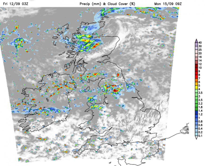
The Netweather Radar is very useful in these situations. You can click Play or ‘Anim on’ for animation on and see how the individual downpours are moving. You can add your postcode to highlight on the map where you are, and ‘Lightning On’ will show any lightning strikes (sferics).
The showers will fade overnight, leaving a fine, sunny start on Sunday if you are up early enough. It will be a cool start for those with sunshine, even some early morning mist patches for inland NW England and SW Scotland. A hint of picturesque autumn before the change to wet and windy weather.
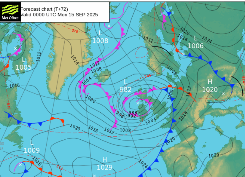
An Atlantic low pressure will end up north of Northern Ireland, then move over Scotland. It’s frontal rain will work its way northeastwards over the UK on Sunday, followed by brighter skies and heavy showers with windy weather. These strong winds will last into Monday until the low moves away over the North Sea.
Scotland and eastern England will see a fine, dry morning with increasing high cloud. In the southerly breeze, temperatures will lift into the high teens. The frontal rain will reach Northern Ireland, Wales and the rest of the West Country with heavy downpours by lunchtime.
There will be three zones: the fine weather in the north and east, the frontal rain bringing a wet spell with increasing winds, and then a brighter clearance from the southwest with showers and sunny spells but blustery winds. The various forecast models have come into agreement about the progress of the front and the deepening of the low pressure. At this stage, there is no sign that this low and it's wet and windy weather will become a named storm. The first one would be Storm Amy. This looks like a bout of unsettled, even wild weather, as you might expect in autumn. There could be more midweek for southern Britain as the next low pressure arrives.
The frontal band will make steady progress north and east through Sunday, reaching western and SW Scotland in the afternoon as the SE winds strengthen, especially over hills and around coasts. The frontal rain will move over more of England, reaching eastern and northern parts and pulling down the temperatures. The heavy rain then moves northwards over NE England into more of Scotland with easterly winds. As the winds veer to the southwest, there will be bright or sunny spells with a scattering of heavy showers. By Sunday evening, the frontal rain band will be over northern mainland Scotland with the hefty clusters of showers rotating around the low.
For Monday, there are three more zones: the frontal rain band still present and lingering over northern Scotland with a strong north wind. Heavy, even thundery showers over Northern Ireland and a central/northern swathe of Britain although the winds will be lighter in the middle of the low. Over the southern half of Britain, there will be a good deal of fine weather and sunshine, but ongoing fresh SW winds. The Met Office has a yellow wind warning.
“Strong and gusty winds are likely to cause some disruption to travel and interruptions to power.” MO
The trees are still in full leaf and we haven’t seen much windy weather over recent months. Storm Floris impacted more northern areas back in early August. Be prepared for a windy Monday until the low pressure eases away and fills over Scandinavia on Tuesday.
Loading recent activity...