In the second half of the week, there will be bands of rain and clusters of showers and a cooler feel to the air. Many parts of the UK are still crying out for rain, lasting and sustained rainfall rather than passing showers.
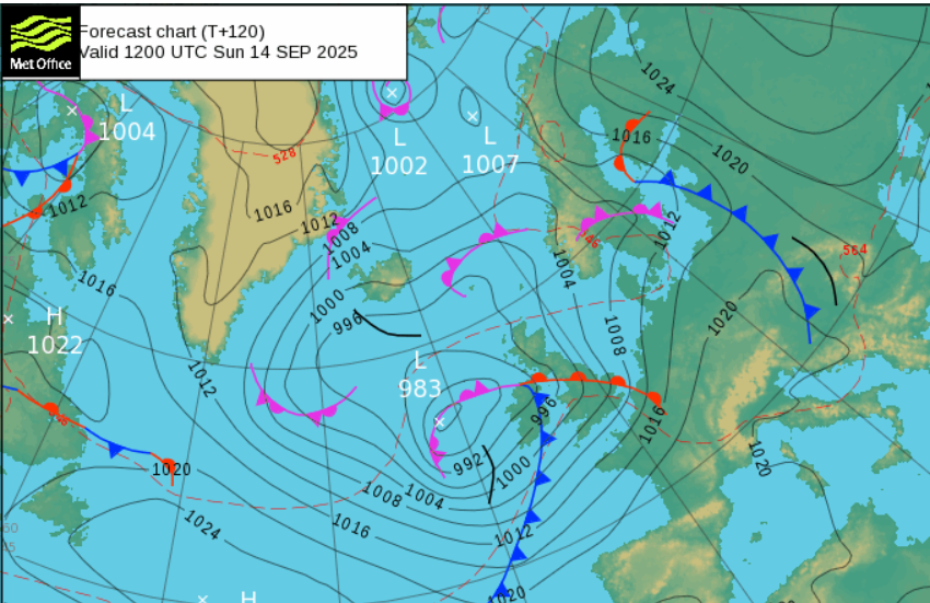
There is a deepening low pressure which is being highlighted for later this weekend. This will bring rain and strong winds but there is still uncertainty around its path. Saturday looks like being another day of blustery showers and sunny spells. For Sunday, the wet weather should move up from the southwest but it might be the evening or overnight into Monday before the strongest winds really set in.
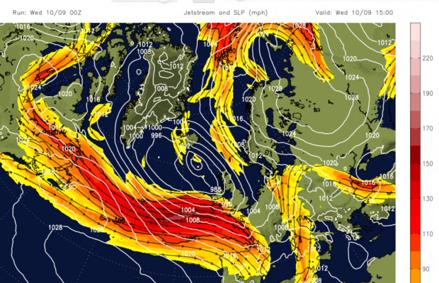
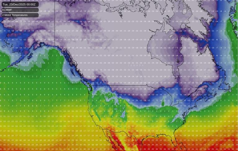
The jetstream is strengthening as the temperature contrast over North America begin to deepen in autumn. There is a low pressure to the northwest of the UK for Wednesday with plenty of showers and the frontal bands rotating across all parts today.
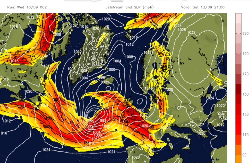
The strong jet brings the weekend low pressure our way over the next few days. The GFS model shows the low pressure developing, deepening as it moves to the cold side of the jet. This would lead to wild weather over the northwest of the UK and a wet and windy Sunday for much of the UK. The latest Met Office model kept the low further south without the development on the cold side of the jet. This could still bring unsettled weather to southern Britain but not the gales in the far northwest. If you do have travel plans this weekend, keep an eye on the forecast.
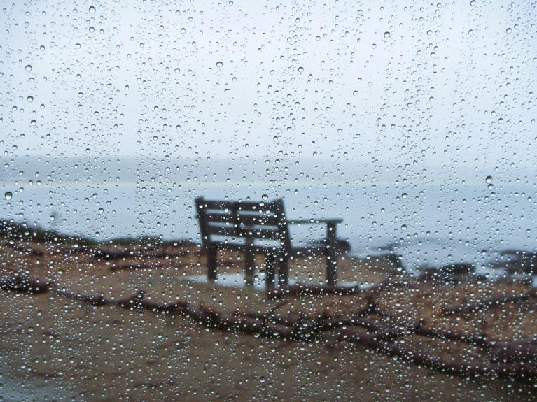
Coastal conditions today
After the Corn red moon (and lunar eclipse) on Sunday, there are spring tides today. The next three full moons will be Supermoons,
“The distance between the Moon and the Earth varies, because the Earth is not right at the centre of the Moon’s orbit and the Moon’s orbit is not a circle (it’s an ellipse). The moment when the Moon is closest to the Earth is called a lunar perigee. If the lunar perigee occurs very close to a full Moon, then we see what is sometimes referred to as a supermoon.” Royal Observatory Greenwich
There are flood warnings and alerts about coastal flooding, especially around the times of very high tides. There is a bit of extra surge with the low over the Atlantic and the onshore wind for western Britain and the Western Isles.
Wednesday
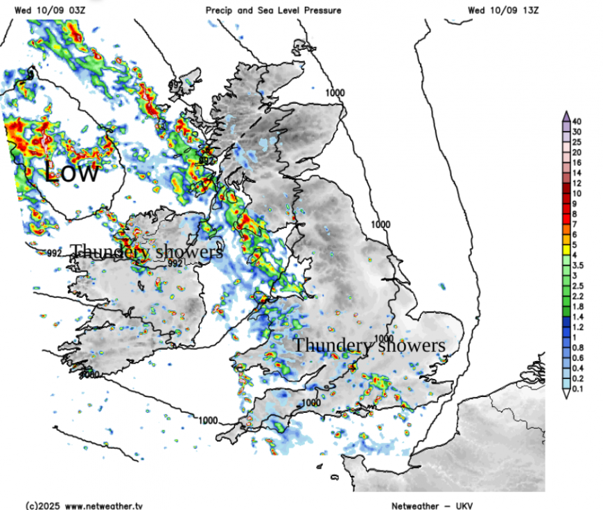
There will be a main frontal band bringing rain over Northern Ireland this morning, the Irish Sea into SW/W Scotland. NW England and Wales this afternoon. Behind that and over central England there will be scattered heavy showers, some will be thundery and the day will suddenly change as these arrive. From bright skies to blustery, wet weather with more cloud. The UK temperatures will be 15 to 20C with a cooler feel in the west, more chance of reaching 19 or 20C in eastern Britain today.
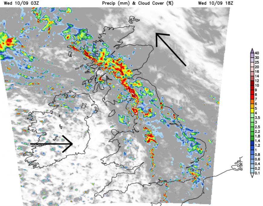
The main band of rain and hefty downpours will move northeastwards with the Moray Firth and Northern Isles having a fine day. The same for eastern England, there will be a lot of dry weather for the main part of the day, just a change this evening. There will be some heavy rain before midnight as the occluded front curls around the low pressure. There will be clearing skies with evening sunshine following the front but it will feel cooler in the westerly wind. The rainband will clear from eastern England, take its time for northeastern Scotland as wet and windy weather returns to the far northwest. This will stick over the Western Isles until Thursday morning.
Thursday
It will be a sunny but cool start on Thursday for many but showers will be appearing from the west. These will be brought inland on the westerly winds, resulting in another blustery day with bright spells and showers, again some heavy and thundery.
Loading recent activity...