Thundery downpours spreading north across the west and north today, dry and warm in the east. Showers in the west early next week, drier and sunnier in the east, before showers or longer spells of rain reach all parts from mid-week.
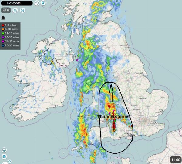
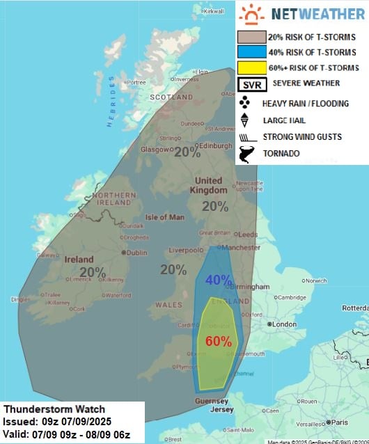
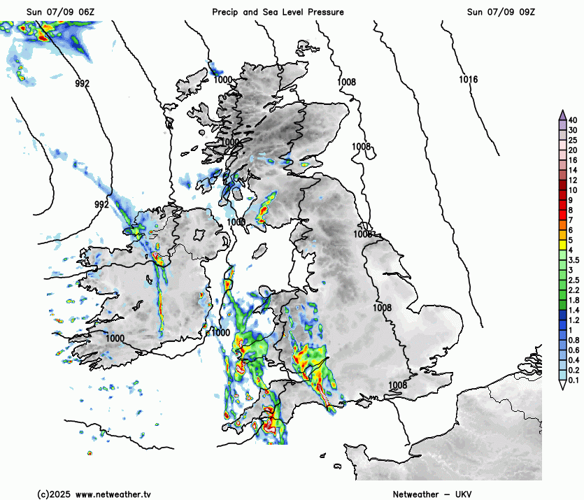
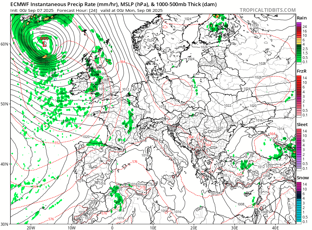
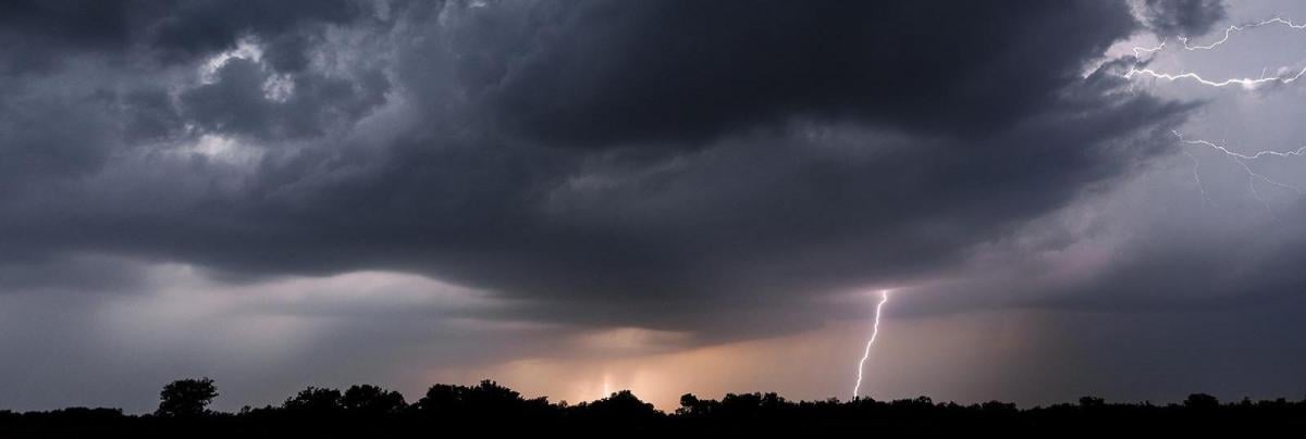
After a brief respite over the last few days from the wet weather that affected southern and western areas to end August and start September, the weather is taking a downward turn across the north and west this morning, as areas of thunderstorms across the southwest and outbreaks of rain elsewhere across the north and west spread north ahead and along a cold front moving in from the west. Rain and thunderstorms will continue to spread north through the day across Wales, the Midlands, northern England and Scotland, while turning drier from the south eventually across SW England - after the wet and thundery start for some.
It has also turned rather windy too for many, especially across the north and west, though strongest winds with gales becoming confined across the far north and northwest into the afternoon
The culprit for the change away from the fine weather of the last few days is a deepening area of low pressure moving away north to the west of Ireland, which has brought the windy conditions while also bringing a frontal system eastwards - bringing the rain and thunderstorms this morning across the west.
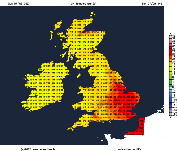
However, the strong south to southeasterly wind is drawing very warm and humid air from quite away south, sourced from the sub-tropical North Atlantic and Iberia, which will lift temperatures across the drier and sunnier eastern England into the mid 20s degrees celsius this afternoon. Perhaps the last burst of summer warmth this year.
Tonight, outbreaks of rain, perhaps thundery, will tend to ease away to the northeast from Scotland, becoming drier with clear spells across many areas, however, showers, heavy with the hail and thunder, will affect western coastal areas. Cooler than it was last night, as a cold front clears eastern England late evening, introducing cooler air.
Monday will start mostly dry with plenty of sunshine across many areas, however showers across western coastal areas from the word go will become more extensive across western areas, heavy with hail and thunder locally, with some developing further east too. Eastern Scotland and eastern England could stay mostly dry and sunny though. Temperatures reaching 17-19C in the west, 20-21C in the east.
Sunshine & showers in the west early in the week becoming more widespread from mid-week
Sunny spells and a few scattered showers around on Tuesday, mostly towards the west, but many staying dry, with showers not as heavy as Monday. Temperatures very similar to Monday, high teens in the west to low twenties in the east.
Wednesday might finally see some rain reach eastern areas, as a new area of low pressure arrives to the northwest of Ireland and more active forcing along associated weather fronts spreading east reaches here. Bands of showery rain, locally heavy with the odd rumble of thunder, look to spread eastwards across most parts through the day, after a dry and bright start.
Thursday’s looking, at the moment, to be a day of sunshine and heavy thundery showers, especially for England, Wales and western Scotland. Eastern Scotland, protected by the Grampians, may stay dry and sunny. Temperatures around average for early September, but windy, particularly in the north.
Friday perhaps seeing further blustery showers in the west, drier and sunnier in the east, but still windy for many.
Next weekend looks to continue the unsettled theme, with quite a strong jet stream racing across the North Atlantic and continuing to plough across the UK, with further showers or longer spells of rain, but also a drier interlude possible later on Saturday into early Sunday, before a potentially deep low arrives to the northwest on Sunday, with more wind and rain or showers, but a great deal of uncertainty this far off for now.
Loading recent activity...


.jpg?w=767)