Today looks like it will be the last widespread hot day across southern UK, with temperatures reaching 30C or more, however, it will remain very warm and locally hot over the weekend and into early next week across southern England, but 30C or more looks to become very localised to SW England.
The relaxation of the heat is thanks to high pressure building over northern UK pulling in an easterly or northeasterly flow over the weekend, away from the far southwest, where a southerly or southeasterly flow will pull in hot air from France still.
Easterly flow strengthening over next few days, so heat easing, becoming strong through the E Channel and far SW of England
It will be dry and sunny for the most part over the weekend, just the outside chance of a shower in Cornwall and eastern Scotland. Though despite the very warm or hot conditions in the south, it will become very windy through the English Channel and across Devon and Cornwall, as an easterly wind picks up, perhaps gusting to 40mph or more.
The dry and settled weather looks set to continue through much of next week too. Recently a positive NAO (North Atlantic Oscillation) has seen low pressure to the north and northwest and high pressure to the south or east, bringing hot weather at times. However, a pattern change will see northern blocking high pressure to the north and northwest and low pressure to the south and east evolve next week.
High pressure will be close enough to the northwest to bring mostly dry and settled conditions through next week. The exception will be across the far southwest early next week, as low pressure moving east off the Atlantic into France introduces a risk of showers for a time.
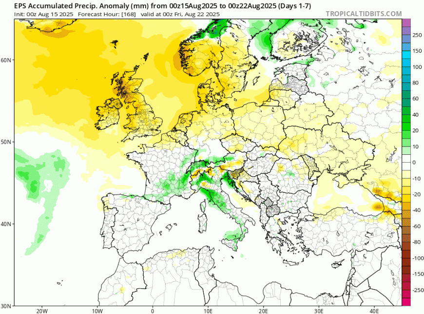
Dry across the UK and Ireland for the next 7 days
It will turn gradually cooler for all though next week, thank to blocking high pressure to the northwest and low pressure to the east pulls down cooler polar air with lower humidity across the UK from mid-week. This will mean temperatures will fall to around or perhaps slightly below average, with temperatures reaching the low twenties in the south and high teens in the north from Wednesday – according to ECMWF. However, GFS keeps it very warm or hot in the far south, though looks on the warm end of GFS the ensemble spread.
Turning cooler from the north next week
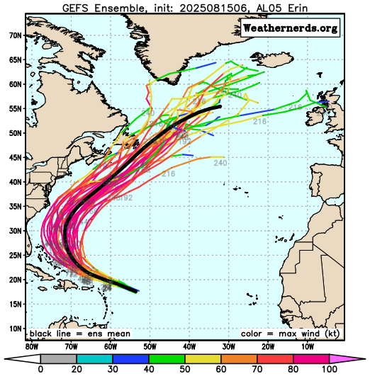
We may see the weather patterns over the North Atlantic and Europe change again by the end of the Bank Holiday weekend, as the remnants of soon-to-be Hurricane Erin eventually move into the far north Atlantic after recurving north from north of Bahamas then northeast away from the eastern Seaboard – where it looks not impact directly.
The remnants of Erin could inject a lot of tropical energy (i.e. latent heat) into the flow across the north Atlantic by the Bank Holiday. This may mean a major strengthening of the jet stream off eastern Canada towards the end of next week, as the remnants of Erin get picked up by the upper westerlies here, with a strong zonal jet stream pushing east towards western Europe over the Bank Holiday weekend.
There is divergence between the models for now, GFS operational runs turn it unsettled over the BH weekend, while ECMWF retains high pressure over the UK, keeping a breakdown at bay.
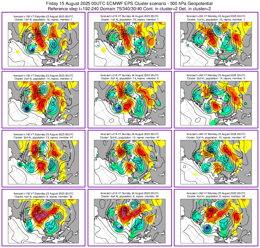
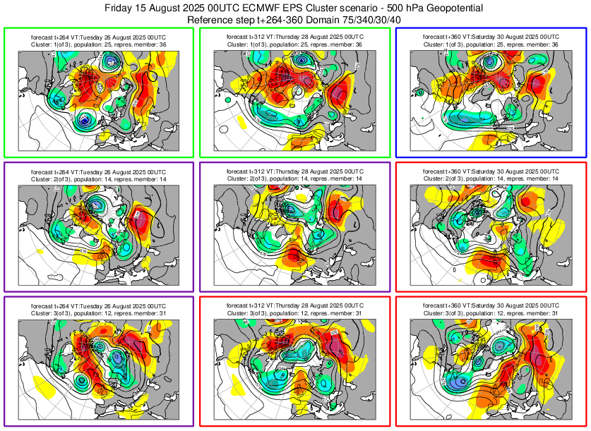
A look at the 00z EPS clusters, above, show around half the members supporting high pressure hanging on through the BH weekend, while the other half introduce low pressure from off the Atlantic by BH weekend, with a resultant deterioration in weather from the west. Into the last week of August, there is general signal from the clusters for unsettled conditions to take over, as areas of low pressure move in off the Atlantic, bringing spells of rain or showers and perhaps windy conditions too.
Loading recent activity...