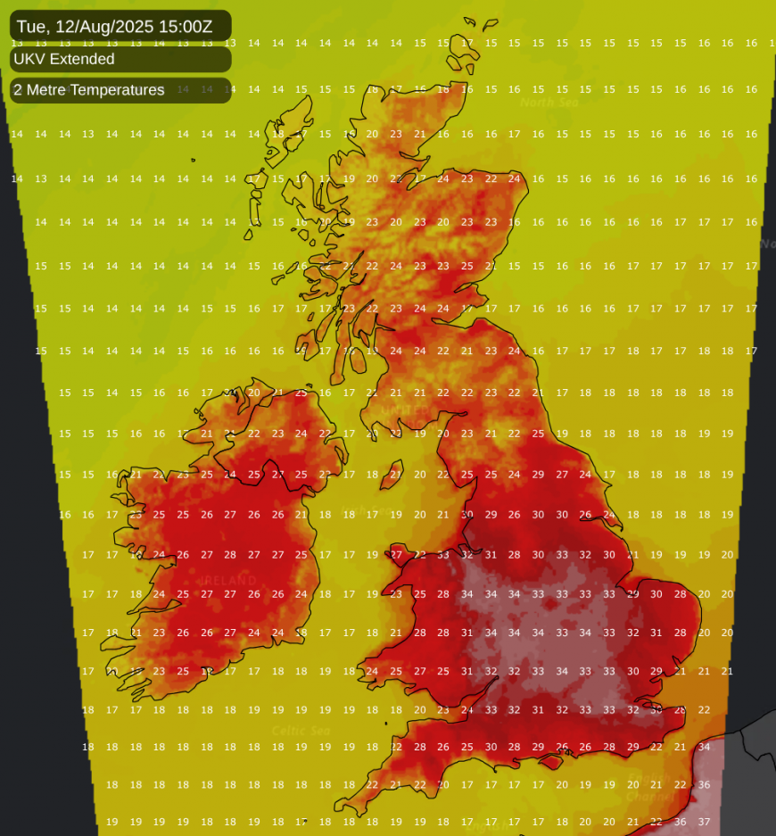
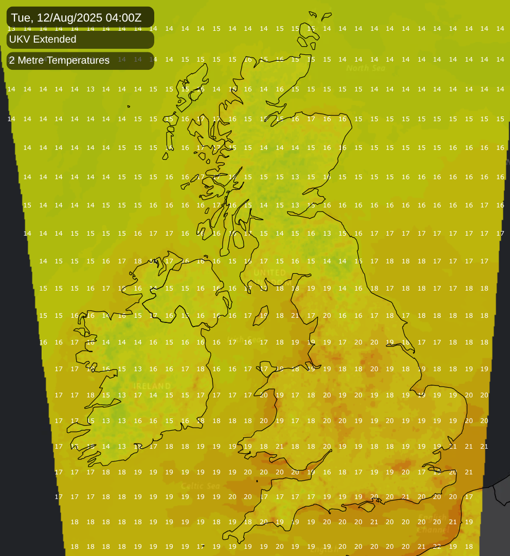
After a pretty ordinary spell of weather in recent weeks, it looks set to get hot for a time into early next week. While it won’t quite be a repeat of the record smashing heatwave of 19 July 2022 which saw 40C reached in some parts of the country for the first time, temperatures could hit 35C in places next Tuesday, as well as creeping into the low 30s Celsius on Monday and Wednesday.
Until about 10 years ago, temperatures of around 35C were still generally regarded as pretty exceptional, but recently those sort of temperatures have become more common. The synoptic setup looks potentially conducive to produce some thunderstorms as the heat breaks down from the west, but currently the forecast models are divided on this potential, with some models showing little or no thundery activity, and, for some, little or no rain.
Often the more dangerous aspect of hot weather is the warm nights rather than the hot days, and the upcoming heat could see temperatures not fall below 20C in parts of England overnight Monday/Tuesday, potentially including parts of the Midlands and north, especially in our major cities. The hot weather has potential to hang on in East Anglia and south-east England until the end of the week, when there is potential for thundery outbreaks to move in at times from France.
However, as has often been the case in recent hot spells, it looks like the notable heat will be largely limited to England and Wales (the eastern half of Wales may widely hit the low 30s Celsius on Tuesday). Tuesday and Wednesday could see parts of Scotland hit the mid-20s Celsius, which, while above the seasonal norm, will not be as exceptional as seeing temperatures approaching 35C in parts of England.
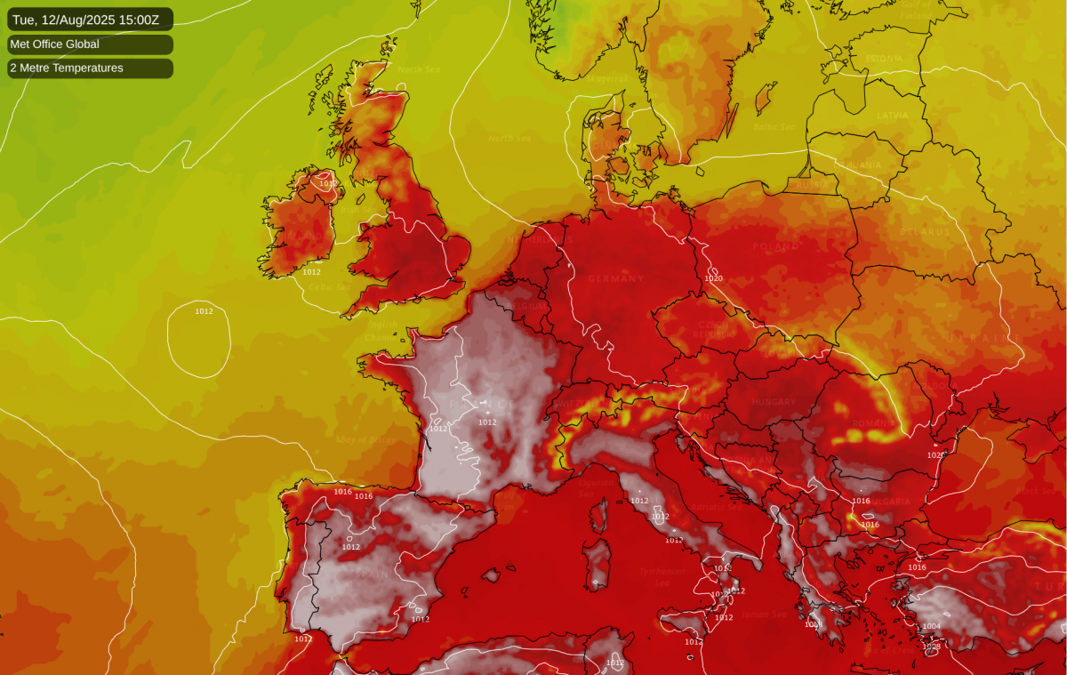
England and Wales will essentially lie on the periphery of more intense heat that is currently building over France. On Sunday, temperatures may nudge 40C in the south of France, with temperatures reaching around 30C in northern France. But on Monday the heat will intensify, particularly affecting the west and south of France, where temperatures of 40C and above look set to be widespread, and the national temperature record could be threatened, with highs of up to 45C indicated for south-western France by the American GFS model, although the ECMWF model is suggesting that the heat may not be quite that intense (but still exceeding 40C).
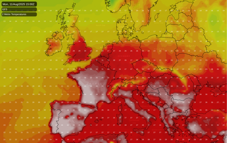
On Tuesday, a large area of central and northern France has potential to see highs creeping just above 40C. Although the heat in France will subside after Tuesday, temperatures approaching 40C are expected to persist in the south through to the end of next week.
Again, this sort of heat in France used to be exceptional, but not as unusual in recent years, as the hot summer extremes have been increasing faster than the summer mean temperature. Warm nights will also be an issue for much of France, with large areas set to fall no lower than 20 to 22C overnight on two or three nights next week over a large area. Along the Mediterranean coast in the south-east, overnight temperatures have potential to hold up above 25C. Meteo France has a number of warnings out for la canicule (heatwave),
As we head into next weekend, it looks probable that high pressure will build from the south-west, while the heatwave in western Europe is looking likely to subside as these regions temporarily pick up northerly winds, though it looks like remaining hot for the time of year in the Mediterranean. This means that as we head into mid-August we can expect predominantly dry sunny weather and moderate warmth/heat, with temperatures staying mostly above average for the time of year but not exceptionally so, perhaps mid to high 20s Celsius by day over a large area.
For the UK as a whole, the hottest summers on record are strongly clustered - in the Met Office temperature series from 1884, 2018, 2006, 2003, 2022 and 1976 all recorded a mean temperature of between 15.70 and 15.76C. In parts of western Britain, the hottest summer on record was that of 1995, but 1995 had a relatively cool June in the east, and so came in with a mean temperature of just over 15.6C for the UK as a whole. Of these summers, 1976 was widely the most remarkable because it happened at a time when global and regional temperatures were widely much lower, but the most remarkably hot high summer period (July/August) was widely that of 1995 (the heat of 1976 especially peaked towards the end of June).
Loading recent activity...