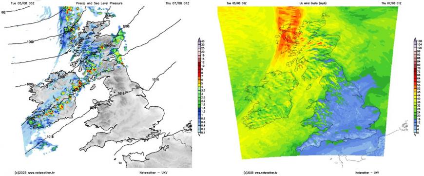
Storm Floris caused widespread disruption across Scotland and Ireland on Monday, with wind gusts reaching up to 82mph at Wick Airport, provisionally equal to the record for UK wind gusts in August. Also, Storm Floris provisionally brought the lowest mean sea level pressure in August across NW Scotland and Orkney since 1992.
The very strong winds led to fallen trees and power lines, with more than 53,000 homes in Scotland and Ireland experiencing power outages.
Travel was significantly affected, with all rail lines north of Scotland's Central Belt closed, over 150 flights cancelled, and the majority of western Scotland ferry services suspended. Disruption to rail and ferry services is likely to continue into Tuesday, with some ferry routes potentially affected until Wednesday.
Storm Floris has moved away and is now moving across western Norway. There is still a strong westerly wind across the north in its wake, reaching gale force towards coasts in the northwest, but winds should ease through the day.
It will be a blustery day everywhere in the brisk westerly wind, feeling cooler and fresher than yesterday too across the south. The brisk wind will blow in blustery showers, locally heavy, across western Scotland, NW England, north Wales and N. Ireland through the day, a few perhaps making it over to eastern Scotland and the east side of the Pennines. Elsewhere mostly dry and sunny. Temperatures reaching 17-20C in the north, 20-22C in the south.
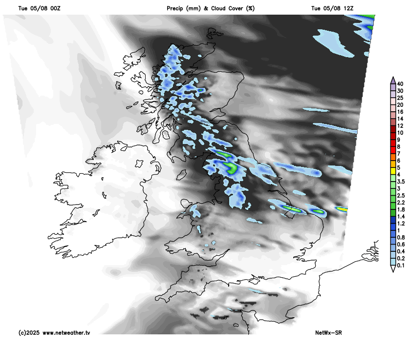
Showers tending to die out in the northwest overnight, to leave a largely dry night with clear spells for many, though cloud and patchy rain will affect northern Scotland overnight. Cool overnight, with temperatures falling to around 10-13C.
Wednesday’s looking mostly dry and sunny, as a ridge of high pressure builds in, temperatures reaching 18-23C. However, wet and windy weather looks set to return to the northwest late on Wednesday and overnight into Thursday, as a deep area of low pressure passes to the east to the north of Scotland.
Another spell of wet and windy weather early Thursday in the north, but not as bad as Storm Floris
A wet and windy start across northern UK on Thursday, gusts of over 50mph possible around coasts and over hills, turning brighter through the morning, with winds easing, but still windy with scattered blustery showers. A cloudier day for southern UK, as an occluding frontal system slips southeast, bringing cloud and some patchy rain.
Friday will be dry and very warm in the south, cloudier and windier across the north, with some patchy rain.
The weekend looks like better prospects for large parts of the UK, as a strong ridge of high pressure builds from the south and it will turn increasingly warm too, though Scotland, particularly the north, perhaps prone to cloud and rain off the Atlantic at times.
Ridge of high pressure builds in across the south this weekend
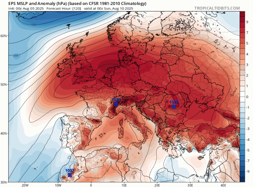
A new intense heatwave currently across Iberia, where temperatures look to reach the low 40s degrees Celsius inland across Portugal and southern Spain, looks to spread further northeast across mainland Europe later this weekend and through the weekend.
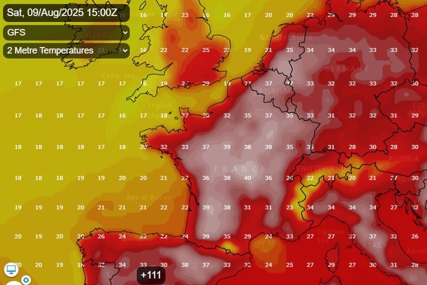
Temperatures across central France could reach 40C on Saturday, the low to mid-30s across northern France, Belgium, Netherlands and western Germany. This intense heat doesn’t look to reach southern UK, but it will become very warm, perhaps locally hot, across southern, central and eastern England over the weekend, perhaps reaching 26-29C. Not so warm further north and west, with high teens to low 20s.
The mostly fine and warm or very warm weather looks to continue next week too across southern UK, with high pressure looking most likely to be in charge. The north, more particularly Scotland, cooler and perhaps more prone to Atlantic fronts, bringing cloud and rain at times, but even here should see some fine and dry weather at times. No signs of another windstorm like yesterday - for now.
Loading recent activity...