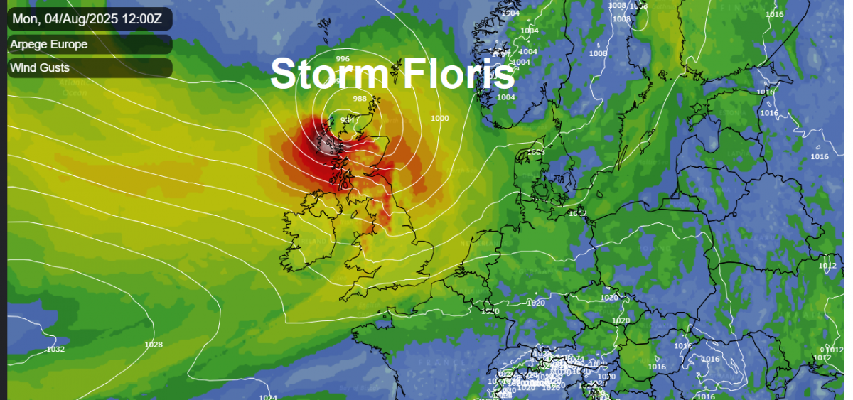
Storm Floris will track across the far north of Scotland tomorrow and bring unseasonably strong winds to Scotland and other parts of northern Britain on Monday. Northern Scotland will see the strongest winds tomorrow with an AMBER wind warning issued by the Met Office this morning for damaging gusts 50-70mph widely and 80-90mph on some exposed coasts, hills and bridges.
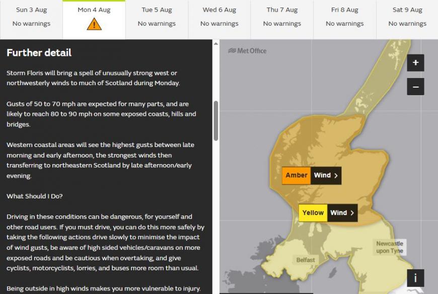
Strong winds will also develop across southern Scotland, Northern Ireland, northern England and north Wales - which are under a yellow wind warning. Here, many inland areas are likely to see gusts of 40 to 50 mph with 60 to 70 mph possible along exposed coasts and high ground, especially Scotland.
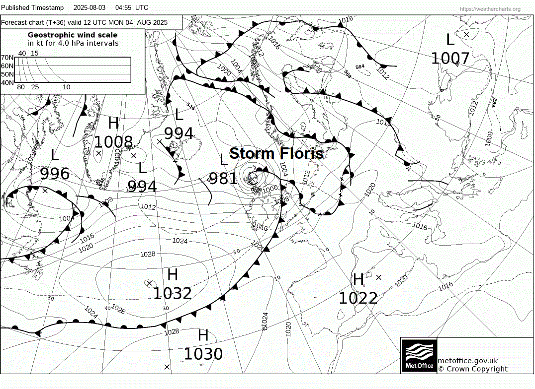
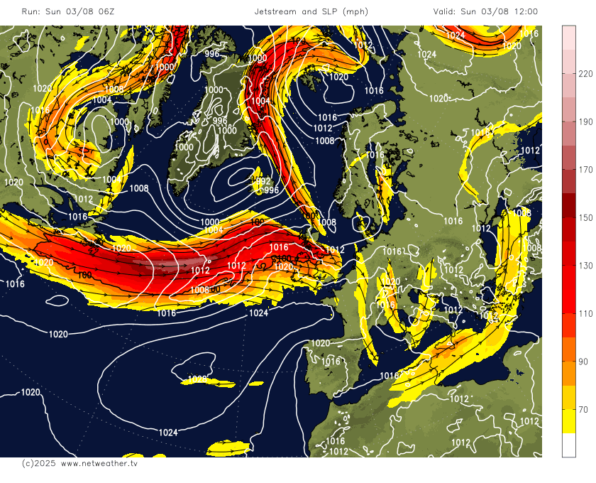
The low that will deepen into Storm Floris is currently looking fairly innocuous over the mid-North Atlantic on the warm side of a strong jet stream. But as it moves onto the cold side of the jet stream tomorrow morning, it will undergo RACY (Rapid Cyclogenesis) in the developmental left exit of the jet stream (where winds diverge aloft and converge at the surface lowering surface pressure) - as the low passes over northern Scotland.
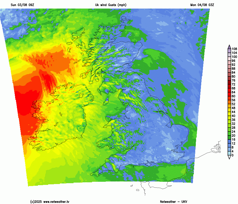
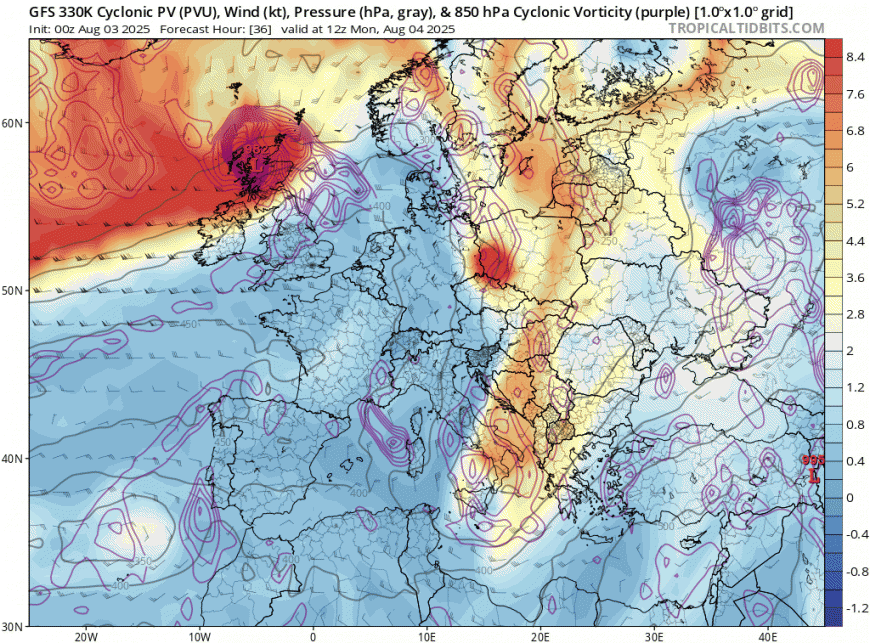
The UKV and ECMWF higher resolution models showing a swathe of 90mph+ wind gusts punching in across the far west of Scotland Monday morning, before a swathe of very strong gusts of 70-80mph punches east across northern Scotland into the afternoon. Possibility of a sting jet or rapid pressure rises in wake of the unseasonably deep low clearing east leading to these unusually strong winds for early August. The 330K potential vorticity chart below showing very high cyclonic vorticity at 850 hPa across west and northwest Scotland around lunchtime, a sign of a possible sting jet forming on the southwest flank of the deep low moving east. Sting jets can bring gusts of over 100mph, but are rare in summer.
So potential for damaging gusts causing major disruption to rail, sea and air travel under the Amber Warning from the central belt, including Glasgow and Edinburgh, northwards across northern Scotland on Monday. There is potential for structural damage, disruption to power supplies and, with trees in full leaf, toppled trees or branches broken off.
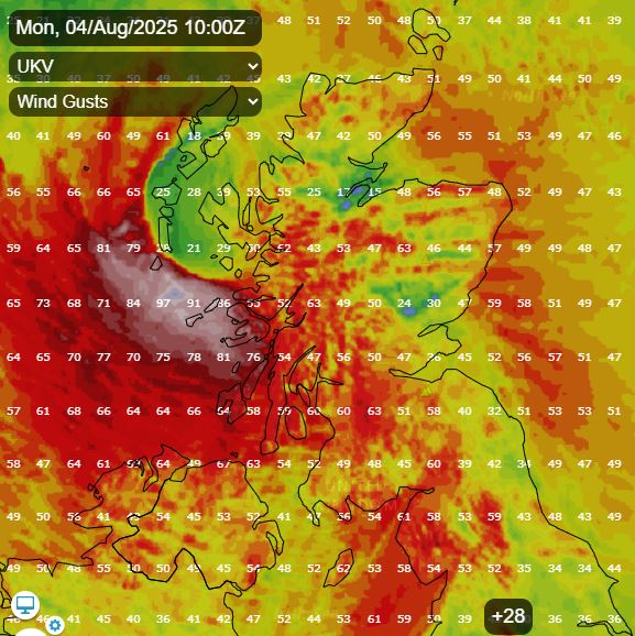
Strongest gusts look to arrive across western coastal areas of Scotland between mid-morning and early afternoon, perhaps gusting to 80-90mph over exposed areas, with the strongest winds, gusting to 60-70 mph, locally more over hills and coasts, then transferring to the north-east of Scotland, including Aberdeenshire during the afternoon and early evening. Winds will ease from the west later in the evening and overnight, but still remaining strong across eastern Scotland overnight into Tuesday
Further south, windy day for all, especially southern Scotland, but also northern England, N. Ireland and north Wales, with 40-50mph gusts possible inland, perhaps 60-70mph over exposed coasts and hills.
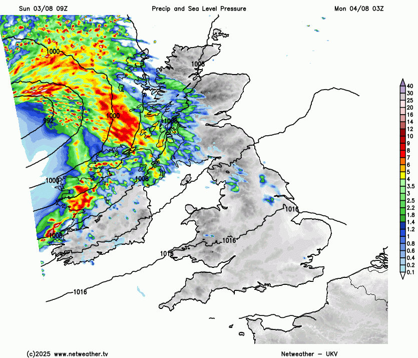
There will also be a spell of heavy and squally rain moving through across northern Britain during the morning, heavy rain lingering across northern Scotland - as a back bent occlusion wrapping around the deep low moving east loiters here. So there could be some flooding issues locally too, especially across northern Scotland. A cold front associated with Storm Floris will slip southeast across England and Wales through the day, bringing a band of rain, heavy in the north, but brief and lighter in the south as it clears through in the afternoon. Winds likely to peak in the south as the front and its rain passes through.
A strong west to northwest wind across all parts on Tuesday in wake of Storm Floris clearing east, which will drive in some squally showers towards the northwest. Mostly dry with sunny spells elsewhere.
Winds easing as we reach mid-week and a ridge of high pressure builds in, which will bring mostly dry and settled weather on Wednesday, with decent sunny spells and feeling warmer too, with temperatures in the low 20s.
Likely becoming changeable again across the north Thursday and Friday, with a few areas of low pressure passing close to Scotland bringing a few spells of rain or sunshine and showers, higher pressure towards the south could keep it mostly dry here with increasingly warm sunshine, perhaps reaching the mid 20s celsius, even high twenties in the southeast on Friday.
Loading recent activity...