The week ahead will see our weather off the Atlantic, with fronts bringing cloud and showery rain at times, more particularly Tuesday, Thursday and Friday. Mostly dry and bright or sunny on other days.
High pressure will not be too far away to the southwest through much of the coming week, but not close enough to prevent Atlantic frontal systems to slide southeast across the UK and Ireland from time-to-time, bringing a changeable theme of cloudy at times with some occasional showery rain passing through, but equally some drier spells with some sunshine.
Changeable this coming week, some days mostly dry and bright, but others, like Tuesday and later in the week seeing threat of rain
With the flow from the west or northwest between high pressure to the southwest and low pressure to the north and northeast, temperatures will be around average on the whole. Though perhaps the odd day with more in the way of cloud and greater chance of showers, such as Tuesday and Friday, temperatures will be a little below average for the time of year. But the odd day where there is more in the way of sunshine, it will feel quite warm and humid.
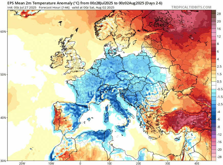
Temperatures close to the average this coming week, so high teens in the north to low twenties in the south by day. A little below average over large parts of Europe though.
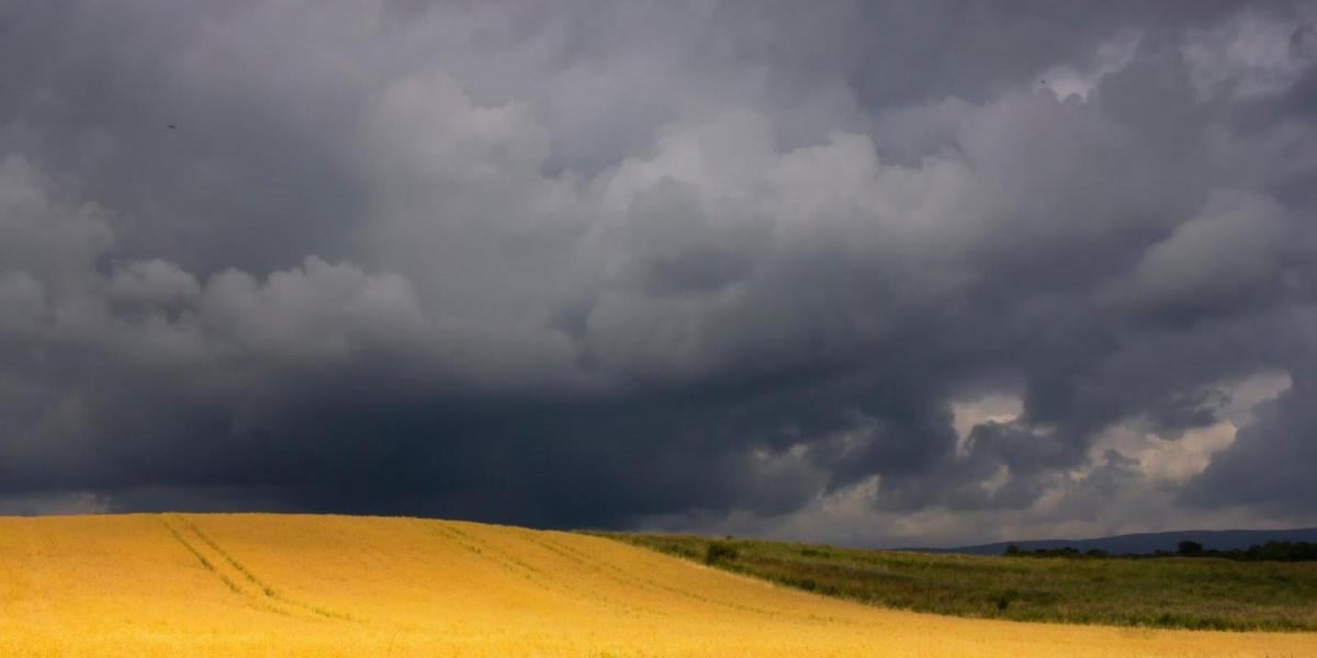
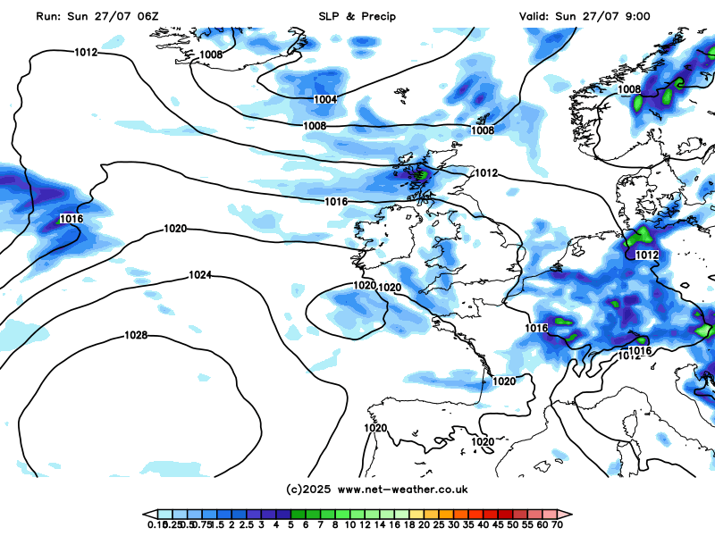
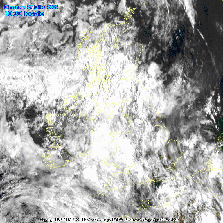
Sunday will see a lot of cloud spilling east off the Atlantic across the UK, thick enough to bring some showery outbreaks of rain at times, locally heavy, across Scotland, N. Ireland, Cumbria and west Wales through the day, while the rest of England and Wales will often be cloudy but with some breaks allowing some brightness or sunshine, but this may trigger some showers in places, especially across SE England later.Temperatures around average, reaching the high teens across Scotland and N. Ireland to low twenties across England and Wales.
A lot of cloud spilling east off the Atlantic on Sunday
Tonight: a few sharp showers at first across the far southeast, while more in the way of cloud across the far west will continue to bring some showers here, otherwise most places dry with clear spells.
Monday should see more sunshine and, as a result, a little warmer than Sunday, but cloud will bubble up to bring some well-scattered mainly light showers, but many will miss them. Temperatures reaching 18-21C in the north, 21-24C in the south.
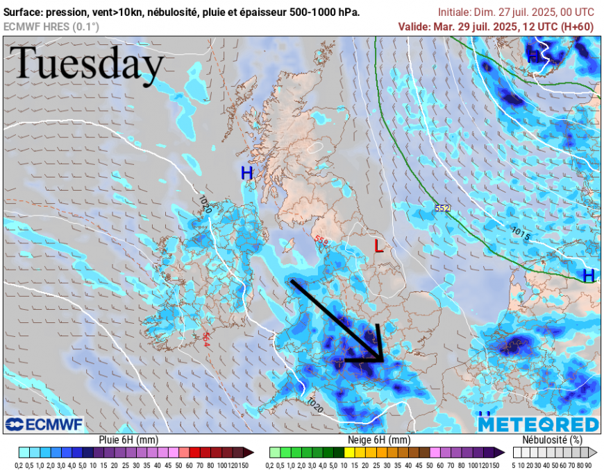
Tuesday will see more in the way of cloud and some showery outbreaks of rain spilling southeast across the island of Ireland, Wales and England, as weather fronts slide southeast off the Atlantic. Rain could be locally heavy and thundery across Wales and SW England. Drier across NE England and Scotland, with some sunny spells. Temperatures reaching the high teens to low twenties.
An improvement again on Wednesday, with a ridge of high pressure building in from the southwest temporarily, so most places will be dry and bright or sunny, though some mainly light showers are possible across eastern England and perhaps western hills. Temperatures a little higher than Tuesday.
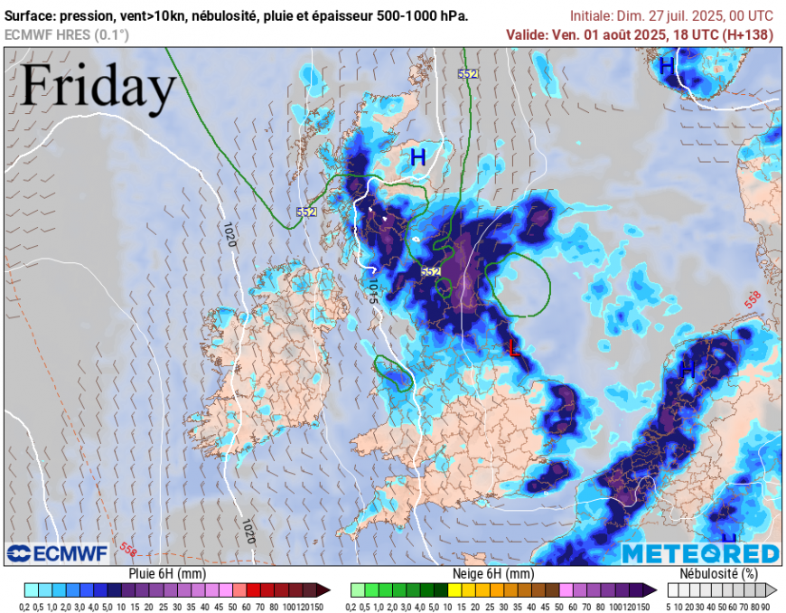
Thursday and Friday currently forecast to turn more unsettled and cooler for a time, as low pressure moves southeast close or over northern UK, with weather fronts spreading showers southeastwards across many parts, perhaps heavy and thundery in places. Winds turning more northwesterly or even northerly by Friday, bringing cooler air, though it may turn drier across the west, as high pressure nudges in here.
Some uncertainty for next weekend. GFS model overnight run shows high pressure making more inroads, promising drier, warmer and more settled weather for much of the south, though northern areas exposed to Atlantic frontal systems bringing cloud and rain at times. However, the ECMWF overnight run suggests a continuation of more unsettled conditions that end the week, it shows Saturday mostly dry but with a few showers, Sunday turning wet and windy.
More influence from the Azores high the week after this coming week?
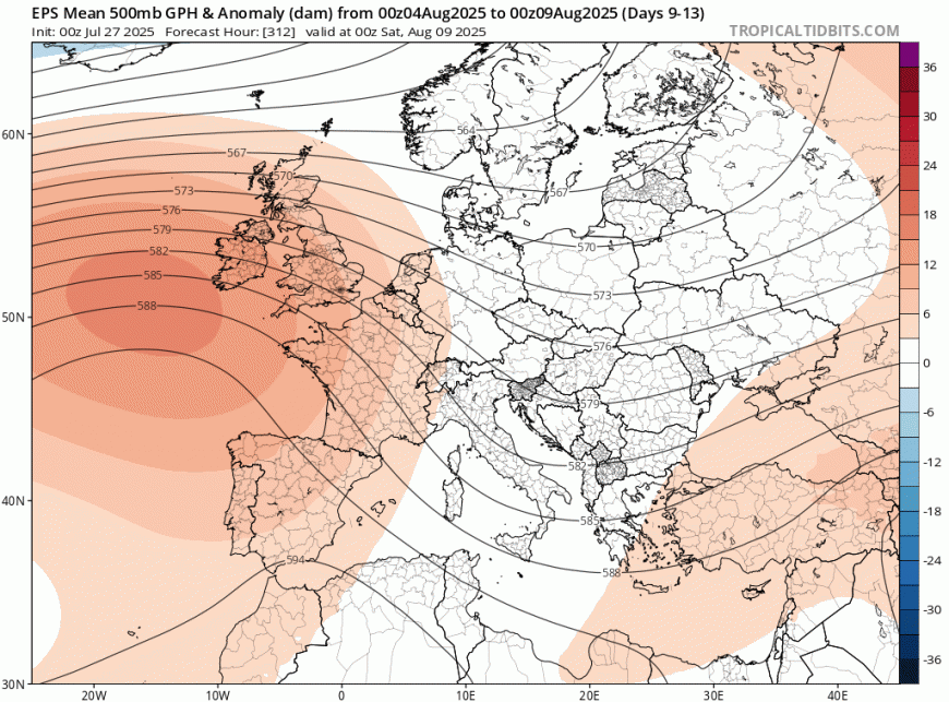
Deeper into early August, there have been hints from the ensemble guidance for the Azores high to have more influence, at least for England and Wales, bringing drier, more settled and warmer conditions, but it really is on a knife edge whether this will occur or the Azores high has less influence and we keep the more changeable theme of this week.
Loading recent activity...