Don't go looking for fine detail in the weekend forecast just yet. There will be clusters of heavy showers, even thunderstorms but in between, fine and warm weather after a hot and humid Friday.
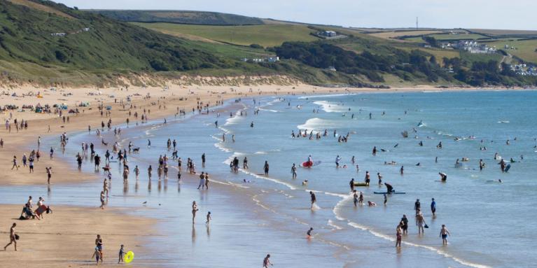
This weekend looks warm and showery. In dry and sunny spells, the temperatures will leap up and it could feel hot and humid. For Saturday, there will be clusters of heavy showers with large areas missing out. By Sunday, there will be more cloud cover and more showers, but still with gaps in between. This makes it a rather frustrating forecast with detail being hard to reach.
Don’t grip onto what a weather app may be showing at this stage. There will be a risk of showers, but no certainty that you will see a downpour. It could be a few miles down the road. It would be better to prepare for the chance of rain and be pleased if it misses your activity.
We are still in need of rain. There are hosepipe bans as NW England and Yorkshire are joined by the West Midlands and East Midlands with drought declared and South East water has a Temporary Use Ban (TUB) for Kent and Sussex starting on Friday 18th.
“A decision to declare drought is taken based on reservoir levels, river flows, groundwater levels, how dry soils are, environmental incidents and water resources position along with consideration of the long-term weather forecasts.” gov.uk
Environment agencies will declare a drought situation, but it is the water companies who issue the TUBs in line with their own drought plans.
Friday evening
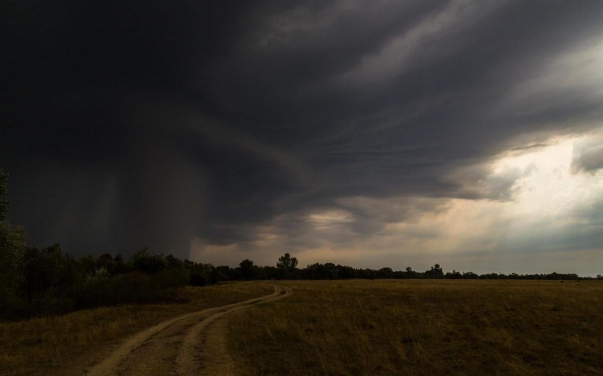
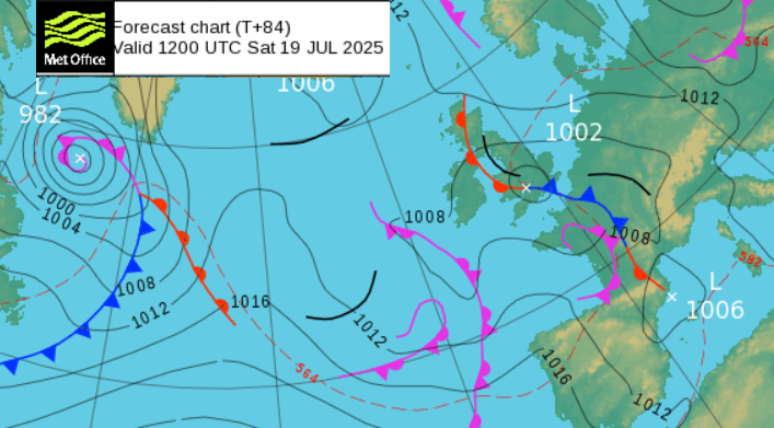
For much of Britain, Friday evening will be more settled, sunny and warm. There will be sharp showers continuing for Northern Ireland and the western half of Scotland but these will be well scattered. It will feel very warm and sultry for much of England, just a bit fresher for NW and SW England and Wales as a weak cold front moves eastwards. There could be a few heavy showers along this frontal band, from Devon, maybe the West Country, Yorkshire up to the Scottish Borders. This is a low risk, but the weakness exists with heat to the east.
France will be hot, and there is a signal for thunderstorms to develop and move northwards over the Channel to England during Friday night. It will be a warm, muggy night for central, eastern and southeastern England.
Saturday
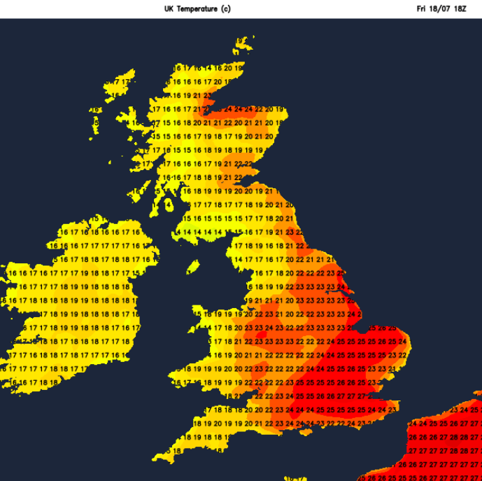
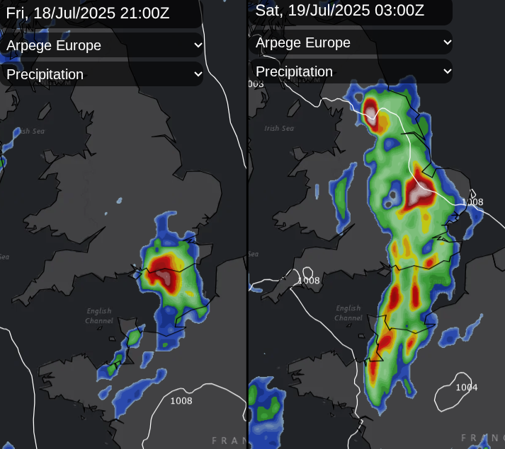
Saturday looks unsettled with pulses of heavy showers, even thundery downpours. There is uncertainty about how wide the areas affected will be. The clusters of showers will be reaching north through BRitain with an easterly breeze coming into the Thames estuary. This would lower the temperatures for London and the Home COunties, more cloud or showers would keep a lid on them. However if the showers are across more central parts of Britain and the sun comes out, it could be another very warm day for SE Britain.
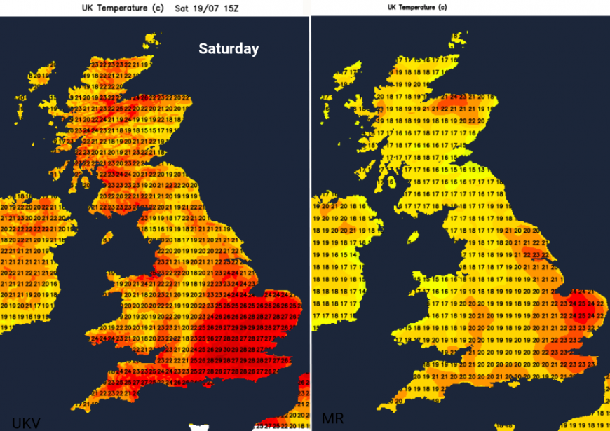
The UKV keeps going with the heat in the southeast for another day
Further north, the clusters of showers could reach the Central Belt of Scotland later in the day with a good deal of fine weather ahead, for Northern Ireland and much of Scotland on Saturday. It will be a hit-and-miss afternoon and evening, so keep an eye on the Netweather Radar for those showers.
The night should be less hot and less humid. Bands of showers begin to rotate across the UK as low pressure takes over.
Sunday
Northwestern Scotland could do well for a time on Sunday with sunshine and warmth, protected from the showers initially with an easterly wind across Scotland. Elsewhere, there has to be low confidence around the detail as bands of rain and clusters of showers swirl across the country, followed by gaps with bright spells, even warm sunshine. For England and Wales, there will be a light southerly flow with temperatures in the 20sC, perhaps reaching 28C in sunnier southern spots. However, more cloud looks likely for Sunday.
Loading recent activity...