The heatwave conditions are fading as the blue skies and sunshine of the weekend disappear. Many places felt different on Monday after the hot weekend, but still with an underlying muggy warmth being disturbed by the breeze. On Saturday, it was straightforward heat and sunshine with only a light breeze. Northern Ireland, Wales and Scotland saw their highest temperatures of the year so far with 30.0°C in Magilligan, 33.1°C at Bute Park, Cardiff and 32.2°C for Aviemore.
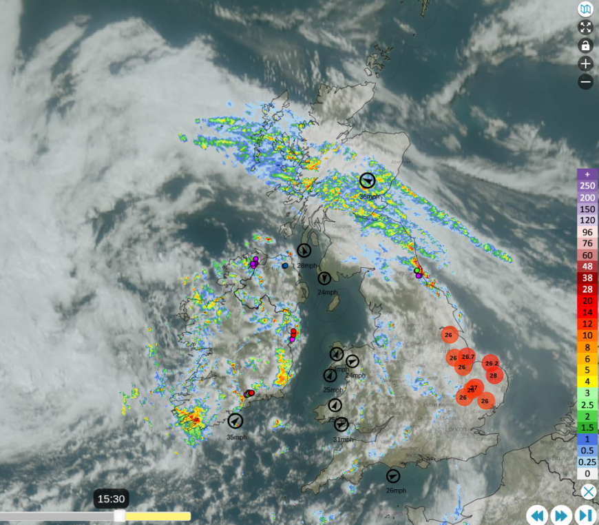
On Monday, a low pressure west of Ireland brought blustery SW winds across Britain with bands of heavy rain followed by hefty showers and some thundery bursts. Ahead of the cold fronts, temperatures in eastern England still managed to reach 26 to 28 °C.

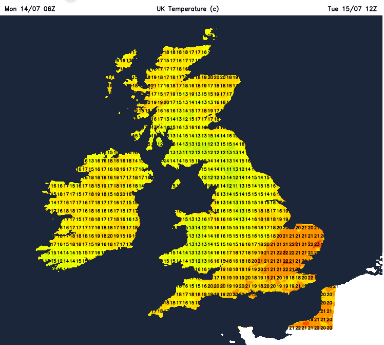
This same low pressure will bring a more widespread change for Tuesday, with heavy rain for parts of western Britain. Welcome rain but not enough for any difference to the hosepipe ban areas. The main rain areas will be around the Irish Sea in the morning: Co. Down, NW England, Wales and SW Scotland. The rain will move over northern England and the Midlands, to East Anglia by early evening, when it will be more showery in nature. It will be windy and the heatwave conditions will be wiped away. Even as the main rainbands move eastwards during the day, there will be heavy and thundery showers following. These will be mixed with brighter skies and brief, warmer spells for sheltered, sunny spots.
England and Wales will be windy in a moderate to fresh southwesterly wind. By mid-afternoon, a cooler north/northwesterly wind will reach Northern Ireland as the showers begin to ease. Southern Scotland will see some heavy frontal rain and then hefty downpours with thunderstorms that will be slow-moving in much lighter winds nearer the centre of the low pressure. The northern half of Scotland will see more sunshine with a light easterly flow. The Moray coast and NW Highlands could reach 22C and feel warm to the lee of high ground.

Eastern Norfolk and Suffolk and Essex could see 23C, so feeling pleasantly warm in any sunshine. 21C for blustery London.
By Tuesday evening, there will be a brisk onshore wind for western Wales and Blackpool, also up the Bristol Channel and along the English Channel. Clusters of heavy showers will continue for a central swathe of Britain into the night from the Lake District to the Humber and over the Peak District. Elsewhere will be more settled before the next frontal band reaches Cornwall on Tuesday night.
This rain will pester the tip of Cornwall on Wednesday morning and reach over more of Cornwall in the afternoon with increasing cloud for SW England.
There will still be a brisk westerly wind for London and the Home Counties first thing on Wednesday but lighter winds elsewhere and it will feel warm. Most of the UK will be fair and bright, however, the onshore northerly flow will cause showery outbreaks for the Scottish Borders, northeast England, the North Yorkshire Moors down to north Norfolk. These will become more scattered over northern England during the day. Southern England looks warm at 25C.
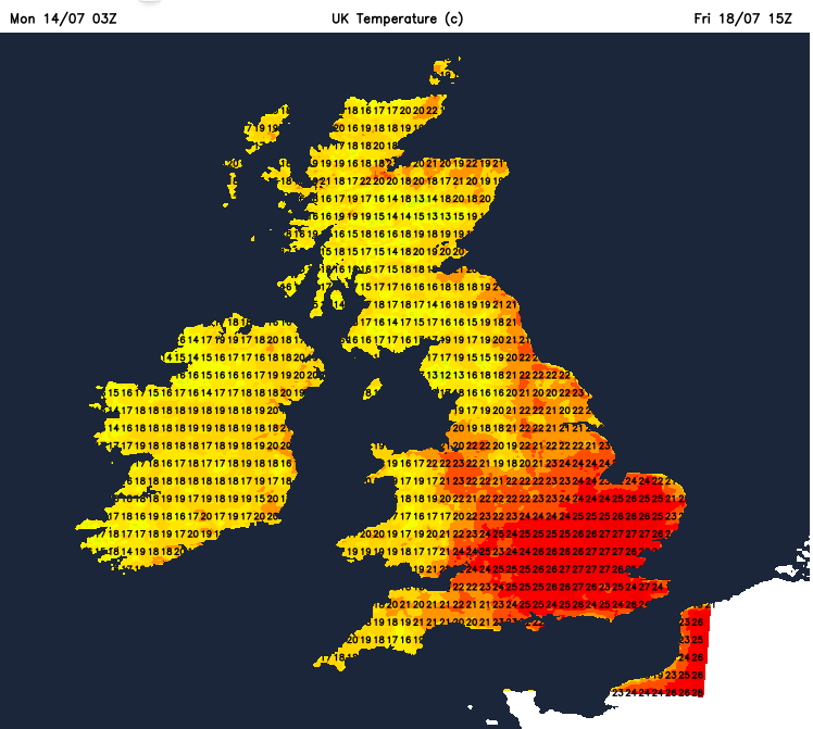
Thursday sees well-scattered heavy showers, again with the risk of some thundery downpours. However, it could feel close and warm in a more southerly flow. Southeastern Britain will feel very warm and humid, up to 27C.

By Friday, these downpours will be focused over Scotland with a scattering across the northern half of the UK. Southeastern Britain could be hotting up again by then, perhaps more of the UK as well, to end the working week. It won’t be the same settled sunshine, so there is uncertainty at this stage about the temperature rise.
Loading recent activity...