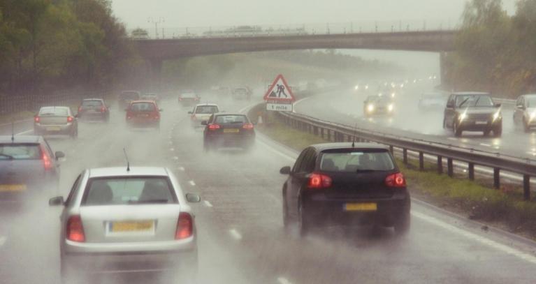
This week will be warming up with London and the southeast of England back to temperatures in the high 20s C for the end of the working week. It will also feel humid and muggy at times. A few locations might technically reach the heatwave criteria, but it won’t be the widespread heat of last weekend.
There aren’t any Heat Health Alerts this week, but it might feel rather uncomfortable with the high humidity, just sticky. There is also uncertainty due to variable cloud cover, when it breaks, the temperatures will leap up in any sunshine, making it feel hot. And as always, uncertainty around which areas will see any passing showers.
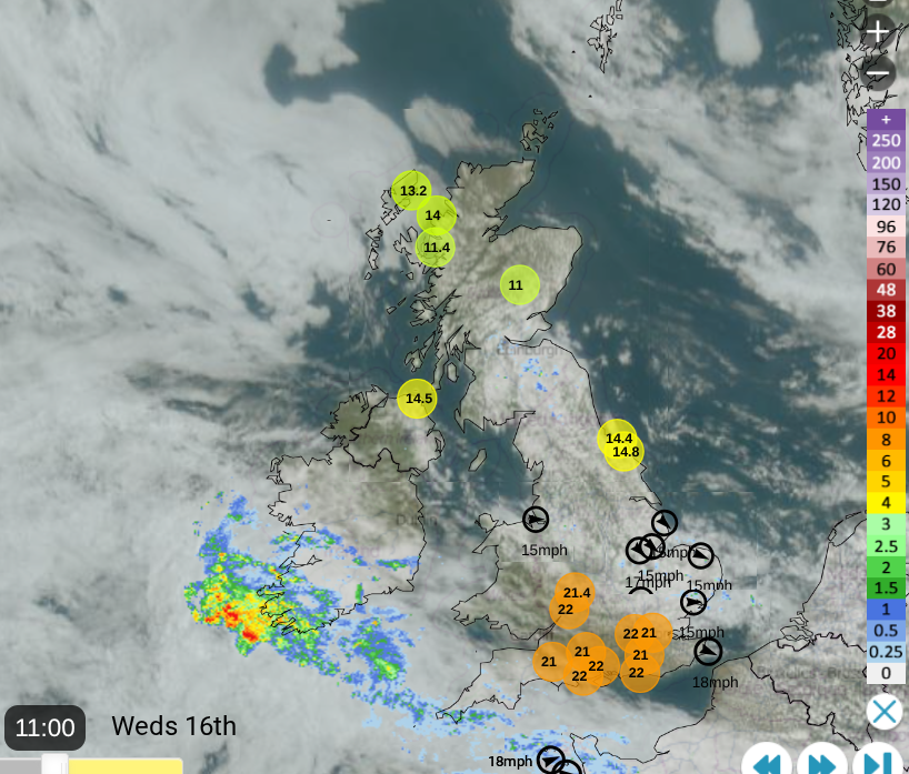
Netweather Radar with satellite, highest and lowest temperatures from 11am and top windspeeds
The middle of the week is more settled and sunny as the brisk breeze eases down. There will be showers coming and going, mixed with bright or sunny spells and more showers at the weekend. Yesterday was St Swithin's day, supposedly forecasting how the weather will be for the next month, even up to forty days ahead.
St. Swithin’s day if thou dost rain
For forty days, it will remain
St. Swithin’s day if thou be fair
For forty days, ’twill rain nae mair.
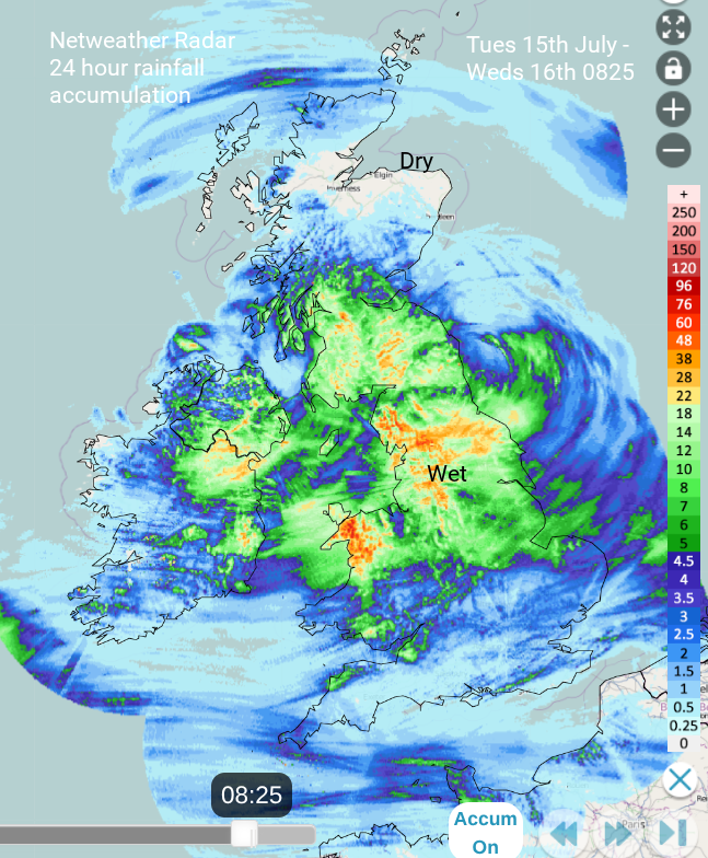
24-hour cumulative rainfall from Netweather Radar, including most of July 15th
St Swithin’s Day outlook
The top temperature on Tuesday, 15th was 24.5C with many parts peaking in the high teens, just into the low twenties. There was a close feeling to the air, even if there was rain and a blustery wind. Northern Scotland fared well with sunshine to the north of the passing low pressure. The weather on the 15th is supposed to foretell the weather for the next 40 days, whether the rain will stick around or be no more. You can also check the monthly forecast here at Netweather.
Overall, it looks warmer than average for the next week. Although the weekend and into next week will feature bouts of unsettled weather with showery outbreaks. Also, frontal bands from the Atlantic often reach western or northern parts of the UK. High pressure tries to nose in during the middle of next week but it does all look a bit unsettled rather than a bit high pressure over the UK.
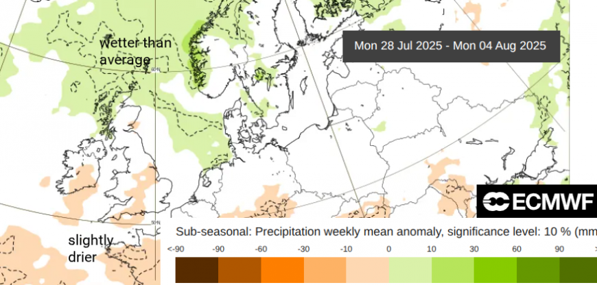
The ECM outlook charts show wetter weather in the far north, but slightly drier than average/average conditions for England and Wales as many start their school holidays here.
What about this week?
As the St Swithin’s low pressure clears away over Germany, there will be a cool northerly flow over eastern England on Wednesday. This will ease but will be noticeable for the north Norfolk coast today, and around The Wash by this evening as it veers to the northeast. There have been some patches of thicker cloud and outbreaks of rain for SE Scotland and East Anglia, caught in that flow from the north. The air will feel warmer and rather muggy and for most it will be a bright or sunny day. Temperatures will be widely in the 20sC with southern England reaching 26 or 27C in the sunshine. More sunshine for northern Scotland, Wales and central southern England. Northern Ireland will have a sunny day with 22C for Belfast. A frontal band will lurk over Cornwall, bringing outbreaks of rain and more cloud to the far southwest of England. This will edge over Pembrokeshire later this evening.
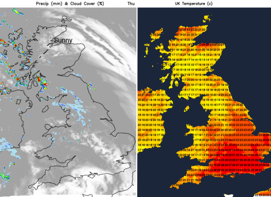
Thursday
A new low pressure will sidle to the west of the UK with its warm sector bringing warm and more humid air by Thursday. There will be early clear and sunny skies for Scotland and eastern England but increasing frontal cloud elsewhere. There will be outbreaks of rain for Northern Ireland (could be thundery) and western Britain, with bits reaching into the West Midlands, the Peaks and the Dales. By the evening, there could be isolated heavy downpours.
There used to be a regular forecast at Weather Centres when they existed around the UK, for gas suppliers. It involved temperature forecasts at intervals throughout the day and an expected variation. The dreaded “Gas Board Error” and the variation tomorrow could be large with a temperature of say 22 or 23C where the cloud cover remains but leaping to 28C in any sunshine. The cloud cover will creep northwards over Scotland as heavy showers reach the west coast but for southern England, the cloud cover will break and tear, allowing the sunshine and the higher temperatures.
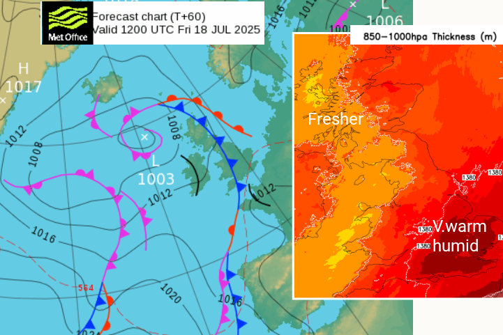
By Friday, there will be fresher air behind the cold front, with heavy showers over Northern Ireland and a scattering for Scotland. Some of these could be thundery. The very warm and humid air will still be over England with temperatures in the sunshine possibly 27 to 30C for SE Britain. It will feel warm for eastern Britain in the light S/SW flow. There is the risk of isolated heavy, even thundery showers inland for southern England along convergence lines with the heat of the day.
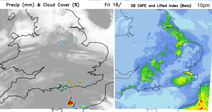
A little something for Friday evening. Hints of thunderstorms moving out of northern France across the Channel towards SE England. Those who watch this kind of weather regularly know this can be as frustrating as waiting for decent snow. However, something to keep an eye on this week, if you like a lightning show.
Loading recent activity...