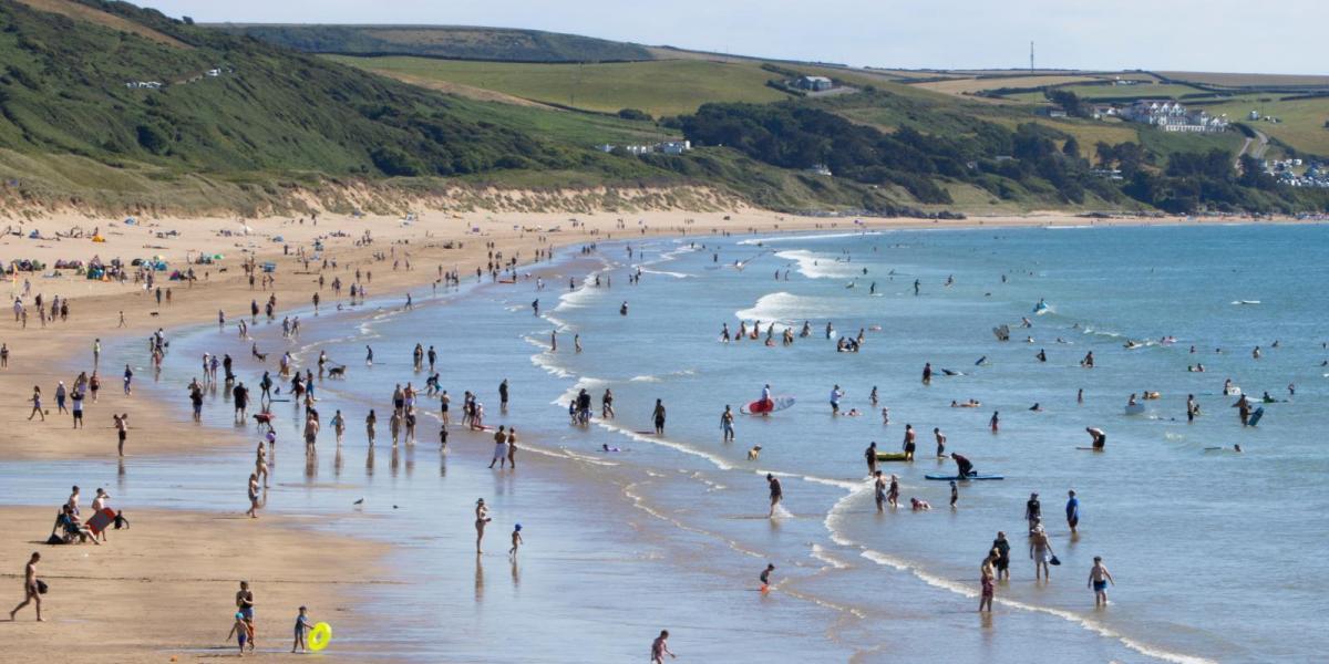
Yesterday saw the highest temperatures across the north and west, with Cardiff and Ross-on-Wye (Herefordshire) both reaching 33.1C, while Aviemore in the northern Highlands reached 32.2C and Malligan in Northern Ireland reached 30C.
Early cloud across central and eastern areas should burn back to eastern coasts, then widespread sunny spells developing and becoming very warm or hot. Like yesterday, the highest temperatures today will be across the west of mainland UK, with an easterly breeze keeping temperatures lower towards the east, we could see 30-31C across parts of SW England and south Wales, particularly the lower Severn Valley across to the Vale of Glamorgan. Mid to high twenties elsewhere, cooler along eastern coasts, with onshore breeze and low cloud.
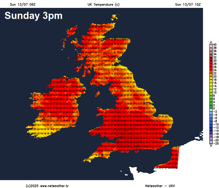
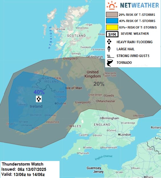
Across the island of Ireland we will start to see a change today from the Atlantic, which heralds a more widespread change across all parts early next week - which will see cold fronts introduce cooler, fresher and more unsettled conditions off the Atlantic. The change will see an increase in cloud and arrival of heavy showers and thunderstorms later today, with thundery showers also popping up across parts of northern England and southern Scotland tonight. Otherwise, most places will be dry and warm tonight, temperatures falling no lower than the high teens in places.
Risk of thunderstorms across the island of Ireland later today, with isolated storms posisble for northern mainland UK tonight too
Monday will see thundery showers clearing north and east across N. Ireland, northern England and Scotland through the day, cooler and fresher conditions following. Some well scattered showers passing through further south, but many staying dry with sunny spells. Still very warm across eastern England - with temperatures reaching 26-28C, a cooler low twenties elsewhere.
Tuesday is looking the coolest and wettest day of the week, for England and Wales, as an area of low pressure tracks east, bringing cloudier skies and some much-needed rain. Rain amounts will vary, perhaps heaviest across Wales, central and northern parts of England. Some thunderstorms possible too. Scotland looking drier and sunnier but some scattered showers possible. Temperatures reaching the high teens at best for many, though low twenties likely towards the southeast.
Some uncertainty on Wednesday, some models, such as GFS and UKMO, bring a frontal system in across the south, bringing some rain to southern areas of England and Wales later in the day and overnight into Thursday. Other models just have showers in the west only. Much depends on how quickly a ridge of high pressure rebuilds from the south from mid-week. The quicker the ridge builds north, the less likely rain will push in across southern areas from the Atlantic - as models mentioned suggest, rather rain or showers are confined to the far west.
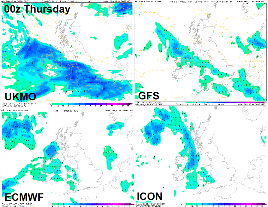
A generally improving picture for the rest of the week. Perhaps some early rain across England and Wales on Thursday, before drier, sunny and warmer conditions move in, as a ridge of high pressure continues to build back in from the south, though some showers possible in the west. Friday looking generally dry and sunny for many across central, northern and eastern areas, warm or very warm in the south, with temperatures reaching the mid-twenties. There is the possibility of further showers in the west.
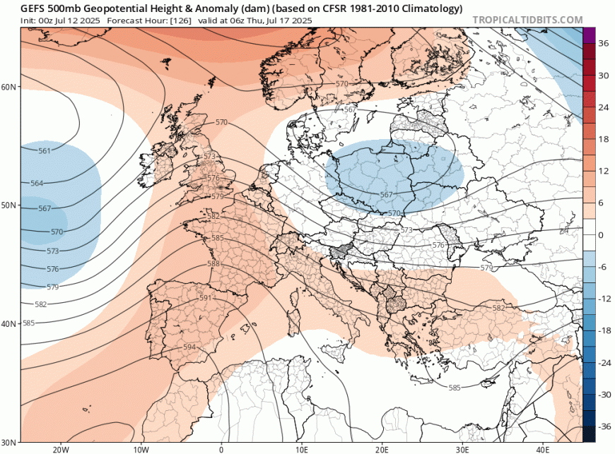
Next weekend, for now, is looking more unsettled for England and Wales, as low pressure moves in from the southwest, bringing heavy showers, thunderstorms or longer spells of rain. Scotland may end up drier and sunnier, but still with a risk of a few showers.
Loading recent activity...