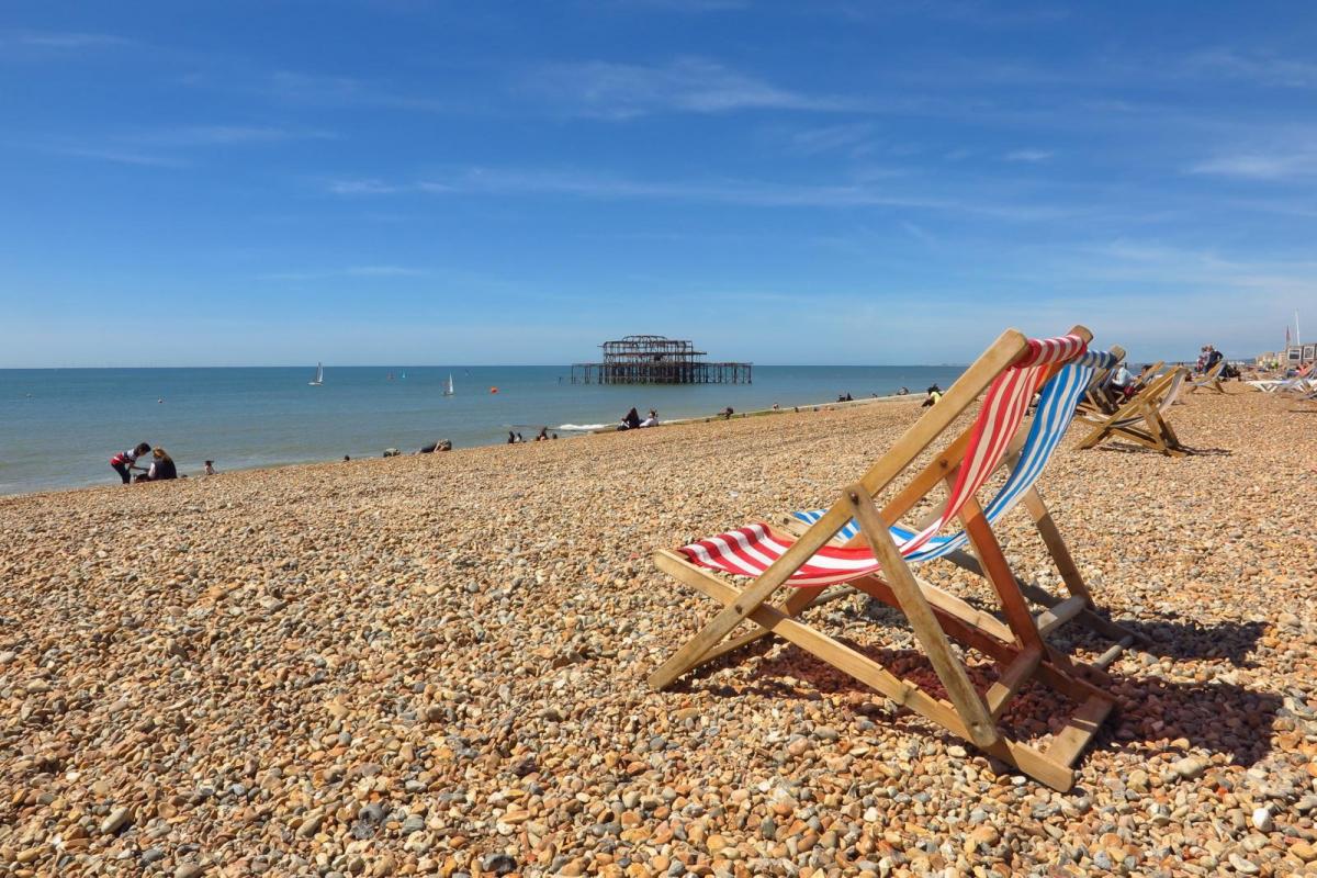
This week will be hotting up. The start of June has been unsettled, with welcome rain and felt cooler than average away from sheltered sunny spots. However, temperatures are rising, starting in southeastern Britain on Tuesday with the low twenties. This will be followed by a surge of much warmer and more humid air midweek, leading to 30C by Friday.
Friday could be the hottest day of the week and potentially of the year so far. Back on the 1st May, Kew Gardens in London saw 29.3C whereas at the weekend UK temperatures peaked at 19C and Braemar in the Cairngorms fell to zero during Saturday night.
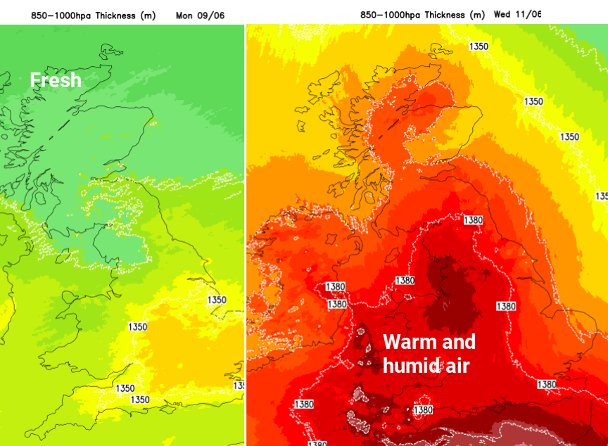
We have a significant change of airflow coming up. No longer the cool, fresh air off the north Atlantic but warm and muggy air from Spain and north Africa. AEMET (Spanish meteorological service) are warning of heat (temperatures of 34 to 39C) for Spain with thunderstorms starting today.
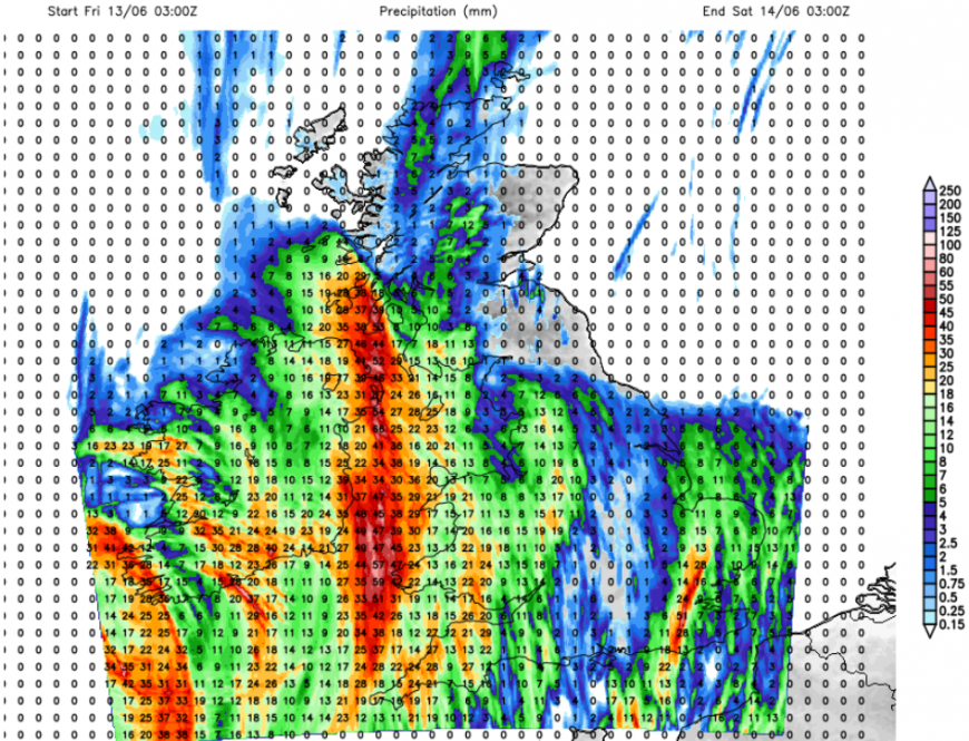
UKV model rainfall totals for Friday. Although there is low confidence about where will see the heaviest downpours and focus for the thunderstorms, this shows the threat of torrential downpours and potential disruption later this week.
Don’t expect clear blue skies and sunshine after Wednesday. Eastern Britain should see the best of any fine weather, sunny spells and lingering heat. This warm episode is complicated by the risk of heavy rain and thunderstorms.
For spring 2025 we had sunny, dry and warm weather thanks to high pressure. This week high pressure will try to push towards the UK. As it does, it disrupts the jetstream which has been barrelling across the Atlantic over the past week bringing us a succession of low pressures and showery days. As the high builds in from the Azores, the jet loops away northwards. By midweek, there will be great meanders in the jet supporting problematic low pressures.
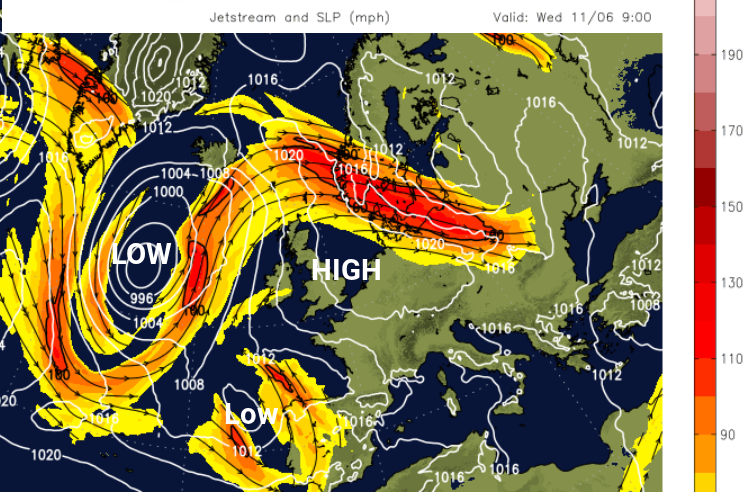
The high pressure continues moving northeastwards and ends up over Scandinavia and the Baltic Sea which is where most of the fine and settled weather will be. The UK will be between the large Atlantic low pressure and the high to the east and benefit from the southerly flow. What will complicate this picture is a developing low pressure coming out of the Bay of Biscay on Wednesday which will drift northwards towards the UK.
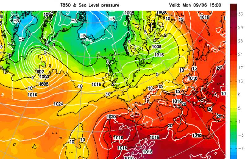
The cool, fresh air from the north Atlantic (green) and the building heat over Iberia (red)
This southerly flow brings the increasing heat and humidity. The large low pressure is sitting out in the Atlantic with its bands of frontal rain and this thundery plume will be heading our way. The high pressure to the east will slow down the progress of these lows, keeping them near to the UK. There is uncertainty about where will be affected by the heavy downpours. Expect Netweather convective forecasts this week which will outline the main areas of risk, and Met Office warnings.
This very warm and humid air surges through the UK on Wednesday and will last until at least Friday. At the weekend, there is more uncertainty around when it will finally clear away eastwards from eastern England.
Concentrating on the increasing humidity and rising temperatures, rather than the details of the thundery plume, 30 Celsius does look likely this week for SE England.
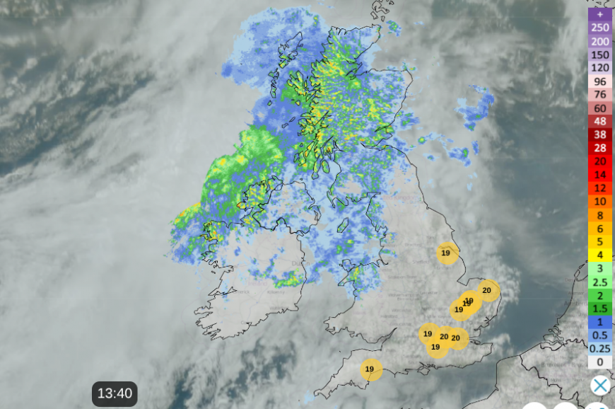
In the coming week keep an eye on the Netweather Radar, for temperature values and developing storms- image Monday 13:40
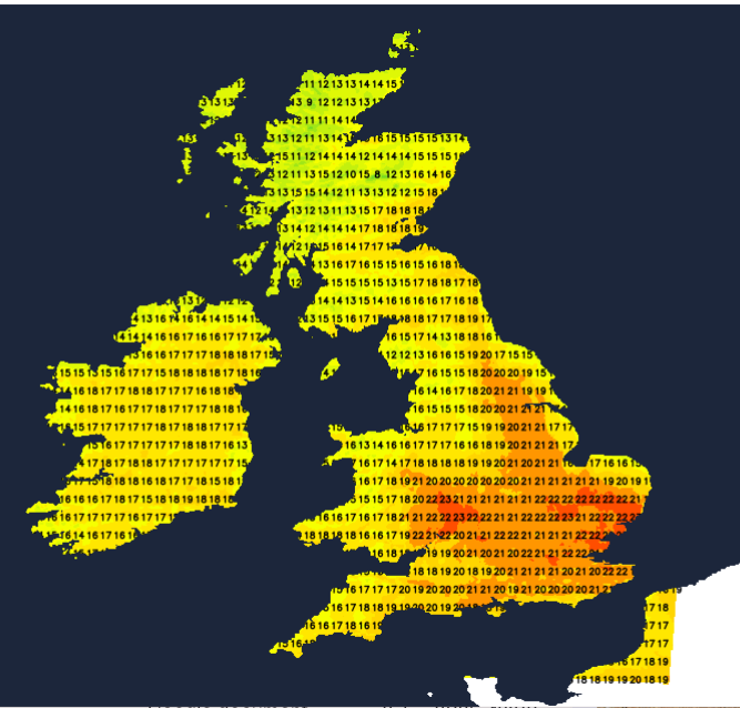
On Monday, Scotland and Northern Ireland will see many more showers arriving from the west and then more persistent rain from mid-afternoon as a little low pressure runs in with rain reaching Cumbria too. Temperatures will be subdued at only 14C. There will be showery rain reaching SE Scotland, NE England and north Wales by the evening but much of southern Britain will have a fair day with bright or sunny spells. There will be the odd shower but it looks dry for most with temperatures around 16 to 21C.
For a time this evening, there will be heavy rain for NW England and north Wales with a fresh SW wind off the Irish Sea, as the frontal bands pull southeastward.
For Tuesday morning it will be southern Britain with more cloud and patchy rain in a light to moderate westerly wind. Further north will be bright, even sunny but still feel rather fresh in a northwesterly wind. The day improves with more sunshine as the winds ease.
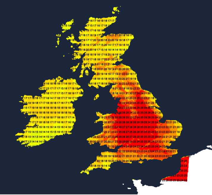
By Wednesday you will really feel the heat and humidity. There will be hours of sunshine and this warm air. With that combination, temperatures will widely move from the high teens into the twenties Celsius. The Central Belt of Scotland 20 to 22C. Northern Ireland 19 to 21C. Wales 18 to 24C. And for England, temperatures will widely be in the high teens, low to mid-twenties C, inland ranging from 23 to 26C. There will be an easterly wind along the Thames estuary and the south coast of England, so not as warm for the coasts of Kent. Also a moderate SE wind for East Anglia and the east coast of England, again just reducing the temperatures here. There will be increasing high cloud for Cornwall later in the day as the first of the showers arrive by Wednesday evening.
Temperature values will increase on Thursday and Friday as the heat builds. It could last for eastern Britain even until Saturday but the thundery rain will complicate the wider picture from Thursday onwards.
Loading recent activity...