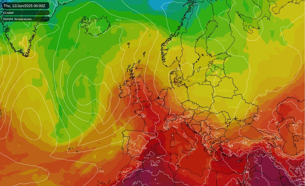
After a rather cool and changeable start to June, change is on the way. A very hot air mass will develop over Spain and Portugal over the next few days, and then towards the back end of next week, this hot air mass will push northwards into the British Isles, especially affecting the south and east of Britain. The heat will not last for long in these parts, being delivered by a “Spanish plume” type of southerly followed by a change to cooler west to south-westerlies, but it could end up quite intense for this early in the season.
It is not yet certain how much of this hot air mass will reach the British Isles, but temperatures in the high 20s Celsius are already looking highly probable, and it is possible that there could be a day or two when temperatures get into the low 30s Celsius, particularly in the south-east.
Also of note is the potential for thunderstorms. Thundery activity was relatively rare over much of the country during the very dry and sunny spring of 2025, but next Thursday and Friday have potential to bring widespread thundery activity, as low pressure pushes in from the North Atlantic and collides with the hot air mass coming up from Spain. Also into next weekend, as a cooler, showery west to south-westerly type takes hold, slow moving low pressure over northern Britain has potential to generate further thunderstorms. At present, it is not possible to pin down where and when the thunderstorms will hit, but there is potential for substantial thundery activity.
European heatwaves were not a major talking point during May 2025, except right at the end of the month when it became very hot in Spain and Portugal. This was because high pressure was often centred over north-western Britain, bringing cool northerly winds to most of Europe, and western Scotland was often among the warmest places in Europe. But into early June, pressure patterns have changed, with hot weather building over Spain and Portugal, and this hot weather will intensify and spread through France as well before entering the British Isles.
It is already hot in southern Spain today, and some places could reach 40C. The heat is forecast to peak tomorrow through Spain and Portugal, where some places in southern Spain could approach or even reach 45C. Temperatures are forecast to reach 40C over a large area of Spain and Portugal on Monday, but the heat will tend to subside later in the week as more of an Atlantic influence takes hold over the region.
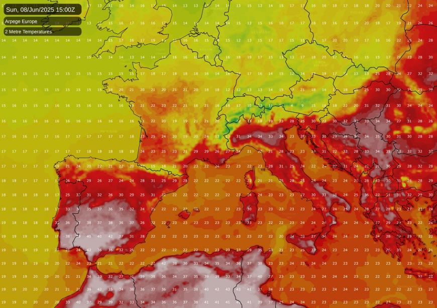
For France, temperatures are currently close to the long-term normal, but a notable heatwave is forecast to develop through next week. Between Wednesday and Friday, temperatures have potential to reach the high 30s Celsius over a wide area, starting off in south-western France and then pushing further north and east. There is a chance of 40C being reached locally. This has potential to be a very notable French heatwave for the first half of June, as traditionally the hottest weather tends to be concentrated in July and the first half of August. It is probable that the heat in France will subside towards next weekend, and that the hot plume will head into central Europe next weekend and gradually become mixed out by cooler air masses.
After the hot southerly, it is looking set to turn cooler and more unsettled for a few days, initially with sunshine, showers and thunderstorms, and then a changeable westerly type with fronts moving in from the North Atlantic. However, there has been a strong signal on the medium and long-range forecast models for high pressure to build from the south-west towards mid-June, and it is still showing on the model outputs now, just over a week away, when forecasts tend to be more reliable than at upwards of two weeks out.
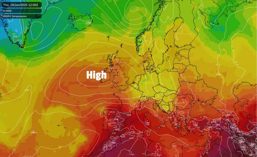
It is not guaranteed that the high pressure will move in: the 00Z operational run on the American GFS model for example keeps high pressure just to the south of Britain and keeps changeable westerlies going for most of the rest of the run. But there is strong support on the model’s ensemble members for high pressure to push in from the south-west by around 16 June, with the low pressure systems coming in off the North Atlantic taking a more northerly track as they approach north-western Europe. With this comes a likelihood of another spell of dry sunny weather for most of Britain. Thus, the answer to the popular question of “when will summer return?”, following the breakdown of the dry sunny spring, may well be "very soon”. Although this high pressure weather probably won’t be as hot as the upcoming southerly during late next week, it looks likely that temperatures will mostly be above average from mid-June, with potential for some hot spells.
Loading recent activity...