There is rain in the forecast, welcome rain after a very dry May and a dry spring. However, it is a shame that the weather has decided to turn just as the late May Bank Holiday weekend arrives. There will still be good sunny spells, it's not a washout but it isn't the reliable dry weather that we have seen in recent weeks as a blustery westerly takes hold. Saturday will feel the warmest in the sunshine, even muggy at times and Bank Holiday Monday, the coolest.
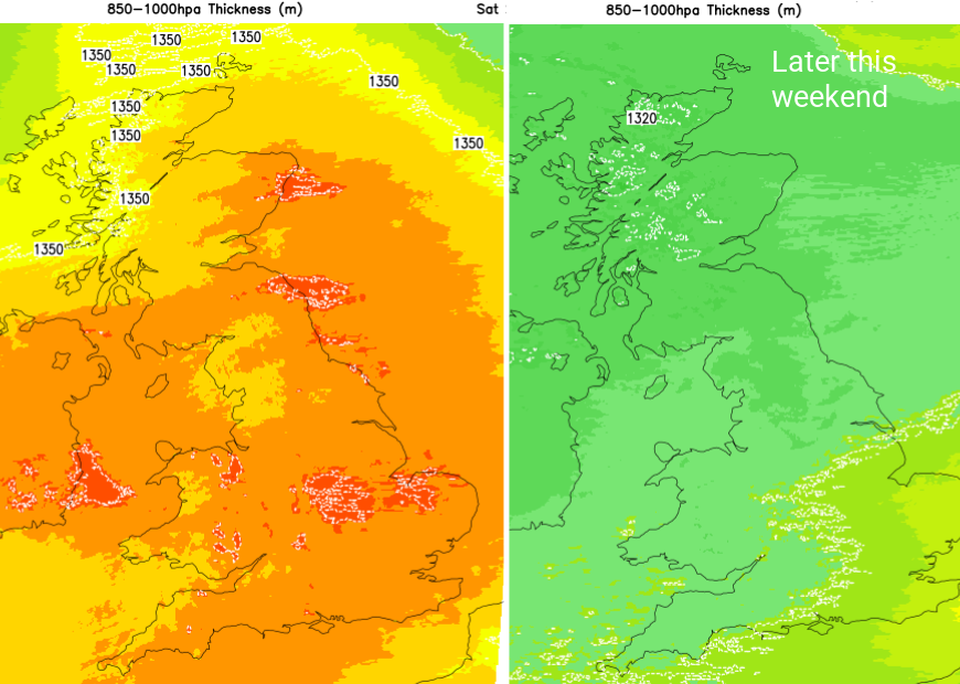
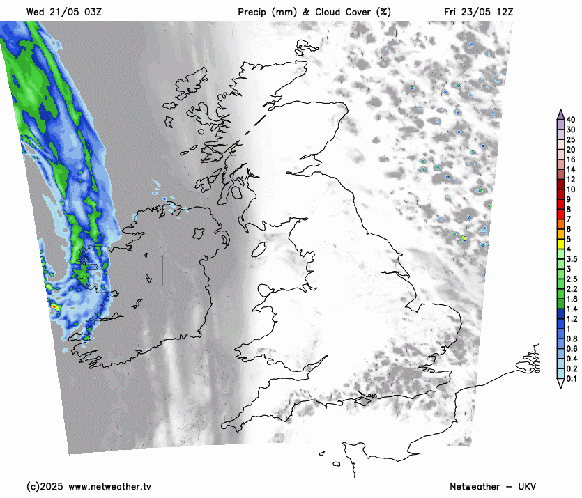
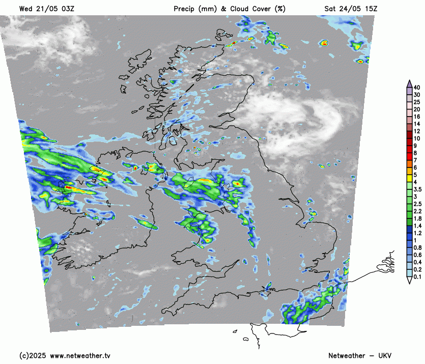
Friday will be a fine, sunny day. It will feel warm in the strong sunshine with temperatures in the high teens even low 20sC for inland southern Britain. Eastern Britain will feel cooler as an onshore breeze picks up in the afternoon but it will be Northern Ireland seeing a change in the weather to end the working week. After a sunny start, high cloud will increase as a warm front approaches. The first band of Atlantic frontal rain that the UK has seen in a good while, certain that has swept across most of the UK. This rain will edge eastwards over Northern Ireland through Friday evening signalling a change in our weather for the Bank Holiday weekend.
With the frontal cloud reaching across the UK, Friday night shouldn’t be as cold as Thursday night although eastern Britain will see temperatures falling away into single figures before midnight.
Saturday
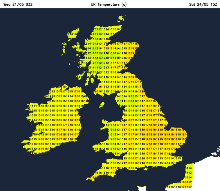
This first band of rain moves through overnight but won’t have cleared East Anglia, the Home Counties and London by Saturday morning, nor the Northern Isles. As the warm front bows out over the North Sea, much of the UK will be in a rather traditional warm sector. Westerly winds, more cloud and a rather warm and humid feel to the air. There will be outbreaks of rain, with western shores of Britain looking more likely but the grey cloud cover will break up. Eastern counties of England could see sunny spells appearing and the temperatures leaping up. 20 to 24C is possible. For Scotland, it will depend on where the frontal band waves back, linking to the cold front that will follow. Northeastern Scotland could see sunny spells too and feel warm but it might be that there is more frontal cloud and patchy rain. It’s quite hard to pin the detail down for Saturday with a brisk westerly wind and possible breaks in the cloud allowing it to feel warm again. However other parts will be grey and damp and so feel cooler.
Later in the day, there should be an area of rain approaching Ireland with fresh southwesterly winds. The ECM model takes this across northwestern parts of the UK, into western Scotland by the afternoon. The UKV has rain moving up into Northern Ireland late afternoon with a wet spell here and for SW/W Scotland into Saturday night. This would be very welcome heavy rain, although it is eastern Scotland that is on Moderate water scarcity. The UKV highlights strengthening winds through the Irish Sea and for the west coast of Ireland as the low centre moves to the NW of the UK.
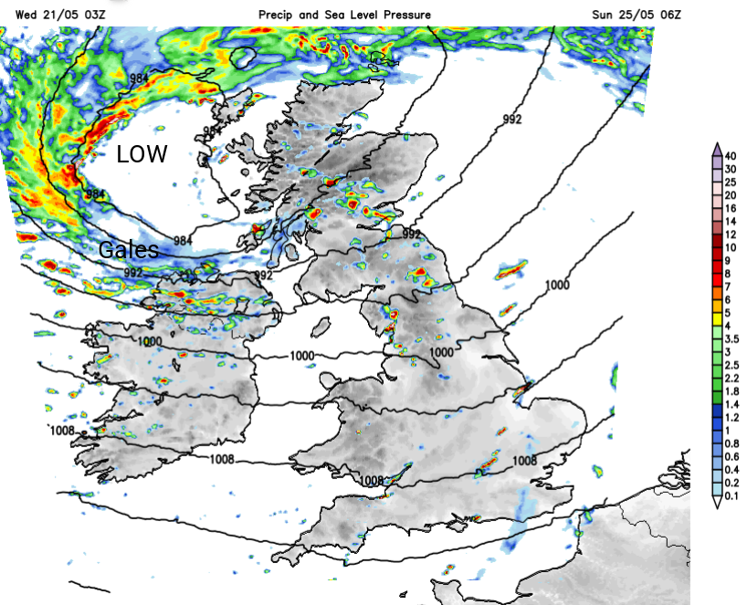
The GFS model does not develop the winds or coastal gales like this, showing the frontal band making steady progress northwards from Ireland and Wales, into northern England with not much for southern Britain. As the cold front clears the wrap round occlusion circles around Scotland on Sunday. So uncertainty around this middle bout of wet weather but some areas will only see the rain during the nighttime period.
Sunday could see lingering frontal rain over parts of Scotland with a scattering of showers for Northern Ireland and northern England. There will be bright spells and blustery winds, with some heavy downpours. Further south looks drier and many areas will see a fine day, again feeling warm in the sunshine. Southeast England could see 20 or 21C, with other areas just feeling a bit fresher than on Saturday morning. Regardless of the air temperature and if the breeze may make it feel cooler, the sun’s rays are still strong at this time of year.
Bank Holiday Monday looks like a traditional sunshine and showers with a brisk westerly flow. This will be the cooler day of the weekend with most of the showers for exposed western counties, and fewer for eastern Britain. Not a washout but an unreliable day especially for western Wales, Merseyside, the Lakes, the West Country, Northern Ireland and the west coast of Scotland.
Loading recent activity...