Temperatures have been hovering around the mid to high teens since Saturday 12th, the last time the UK saw temperatures above 20C, when Northolt in northwest London reached 24C.
Temperatures will remain in the teens for the rest of the week for most, however, that looks set to change in southeast from Sunday and elsewhere across England and Wales from Monday.
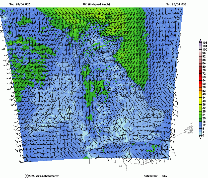
We lose the east or northeasterly flow by Sunday and a southwesterly flow develops. It looks like it will be cloudy, wet at times and windy from north Wales and northern England northwards. Meanwhile, high pressure builds in across the far south. This could allow temperatures to reach 20C across SE England on Sunday, with any sunshine, pleasantly warm for the London Marathon, but not too warm. Temperatures reaching the mid-high teens elsewhere.
Change in wind direction by Sunday from easterly to southwesterly will see temperatures rise
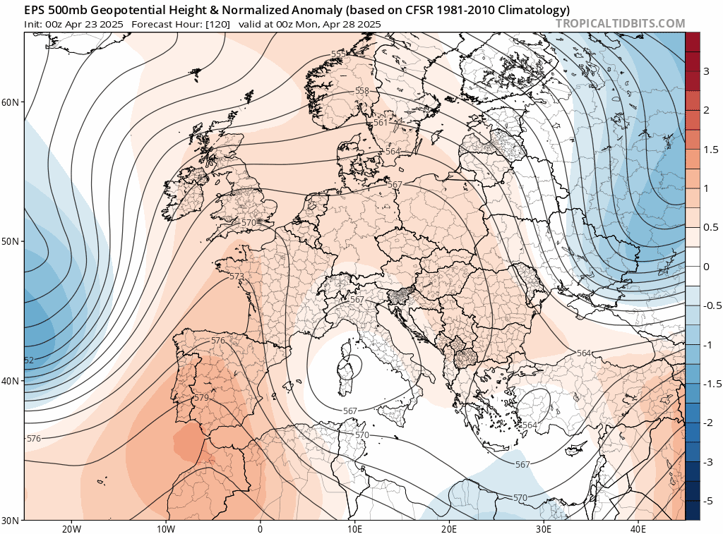
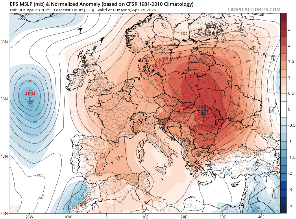
However, by Monday, an upper level ridge of high pressure looks to extend north across eastern England while surface pressure generally rises across the UK. This, combined with an upper level trough amplifying south and becoming slow-moving to the west, will allow the flow to back more south or southeasterly, drawing up warmer air from Iberia - where temperatures look to reach 30C on Sunday and Monday in southern Spain and Portugal.
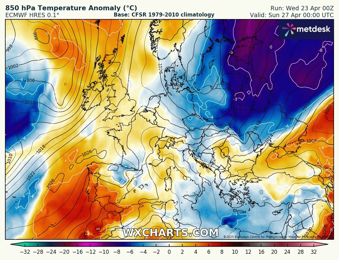
Temperatures on Monday and Tuesday could reach 20-23C in London, Cardiff and Manchester, with sunshine. Perhaps could see 24-25C in a few spots, with models tending to underestimate the temperatures by 1-2C, especially at range. Temperatures north of the border in Scotland not quite as warm, reaching the high teens at best in Edinburgh or Glasgow.
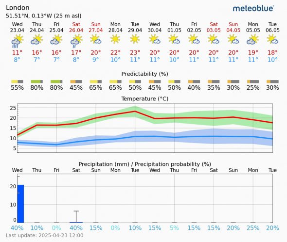
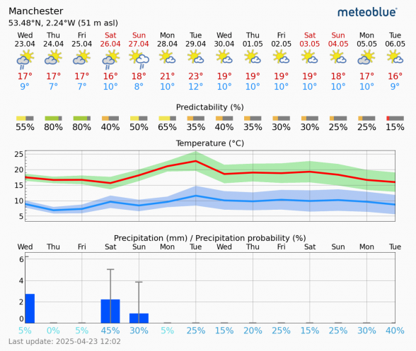
The upper trough amplifying and stalling to the west may eventually ‘disrupt’ to form a ‘cut-off’ upper low over the Bay of Biscay by mid-week, the upper low eventually sinking southeast across Iberia. This will allow high pressure close to the east to extend west across northern Britain through the second half of the week, with winds backing from a south or southeasterly to a cooler easterly or northeasterly. This will mean temperatures coming down during the second half of the week, particularly towards eastern coasts - where it could feel chilly with the breeze off the North Sea. Could still be warm enough towards the south and west for temperatures to reach 20C though.
It is looking mostly dry and sunny though through next week, with anticylonic conditions generally in control. However, there is a risk, albeit uncertain this far out, for some showers, perhaps thundery, to move in across the island of Ireland, SW England and Wales mid-week, before drier weather returns. Though also a risk of showers returning across the far south to end the week too.
So not a bad end to the month and start to May next week, with some warm sunshine on offer for many, especially across England and Wales, with higher temperatures during the first half of the week.
Loading recent activity...