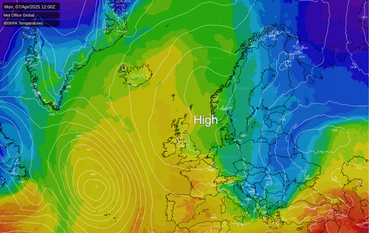
We’re all set for more fine weather for much of the upcoming week across the UK. A still dominant area of high pressure is responsible, blocking the usual Atlantic weather systems and allowing plenty of sunshine to develop for most. While daytime temperatures will often feel pleasant and generally warmer than average for early April, especially inland and away from coasts, the clear skies associated with the high pressure mean nights will turn chilly, bringing a widespread risk of rural frost.
The week kicks off on a fine note. After chilly, perhaps frosty starts with maybe some patchy fog, Monday promises widely dry and bright conditions with plenty of sunshine developing. Winds will be mostly light, although perhaps a little breezy along the south coast on Sunday. It will feel pleasantly warm in the sunshine. Clear skies overnight mean the frost risk continues into the new week.
This settled pattern continues mid-week from Tuesday through to Thursday. High pressure remains firmly in charge, maintaining the fine weather with plenty of warm sunshine by day across most parts. However, an easterly breeze will keep North Sea coasts feeling noticeably cooler than inland areas. Nights will stay rather chilly under clear skies, with frost still a risk, especially away from towns and cities.
Towards the end of the week, Friday and Saturday, while it looks set to remain largely dry and sunny initially with temperatures above normal for many, there is some uncertainty creeping in. While the settled weather may hold, there's also a growing possibility of a gradual change towards more unsettled conditions. This could potentially introduce showers, perhaps heavy and thundery, pushing up from the south or arriving via Atlantic fronts, possibly accompanied by stronger winds, especially in the west. Confidence in the forecast detail decreases for this period.
In summary, the week ahead starts under the influence of high pressure, bringing a good deal of dry, sunny, and often warm weather by day. The main caveats are the chilly nights with widespread frost risk, especially earlier in the week, and the cooler feel along North Sea coasts due to the easterly breeze. While confidence is high for the settled start, keep an eye on forecasts later in the week, as there's a distinct chance things could turn more changeable, particularly across the south and west, signalling an end to the prolonged fine spell.
Loading recent activity...