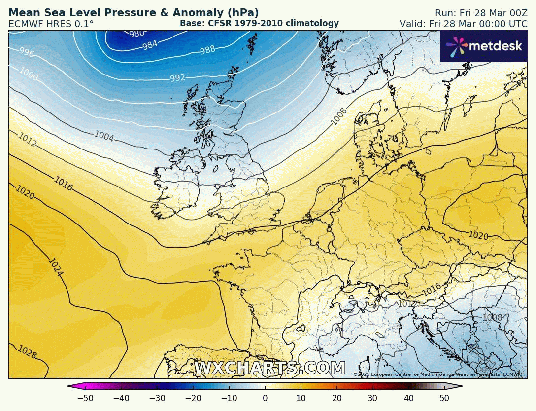
A deep low passing the north of Scotland brings a brief change in weather across much of the UK today, after much of England and Wales have had a mostly dry and relatively warm week with long spells of sunshine in places. Yesterday the temperature reached close to 20C across northern England.
A cold front, with cloud and patchy rain, clearing eastern England first thing today associated with the low to the north will usher in a cool Polar maritime northwesterly flow across all parts today. So cooler for all today, despite sunny spells returning, and there will be some blustery and locally heavy showers in the north and west too, with hail, gusty winds and thunder in places. With showers easing and skies clearing tonight, it will turn cold, with a frost in places, particularly in the north.
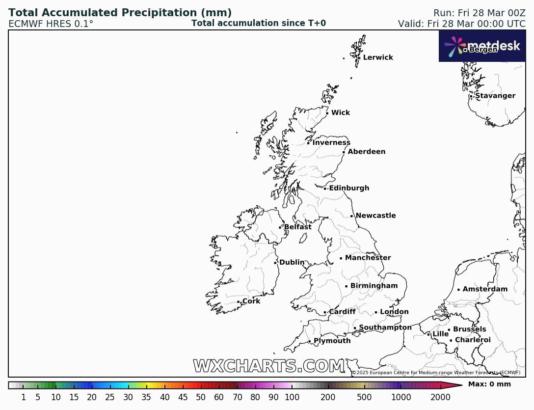
Little rain away from western Scotland over the next 7 days and possibly beyond ...
Another fairly deep area of low pressure will pass the north of Scotland later on Saturday, bringing increasingly windy conditions from the west through the afternoon and evening after a dry and bright morning, with cloud and outbreaks of rain moving east, though little if any reaching southern England and East Anglia.
However, from Mothering Sunday onwards, high pressure looks set to build back in after a brief spell of mobile and unsettled weather from the west. Sunday is looking most dry and bright or sunny with a northwesterly breeze, showers across Scotland easing by the afternoon.
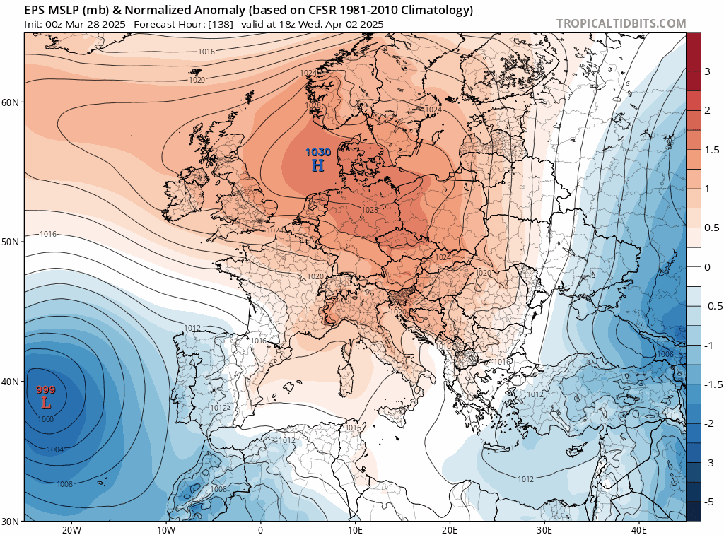
High pressure drifts northeast across southern UK early week before heading back west across the north later in the week
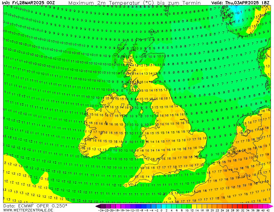
A high pressure cell looks to drift northeast across southern UK on Monday, before drifting northeast over the North Sea towards Denmark on Tuesday where it will loiter until mid-week, before the high pressure cell drift back west across northern UK during the second half of the week. So, essentially, high pressure will be close by enough through most of next week to bring almost, if not, the entire UK a dry Monday-Friday, though it’s a tall ask that everywhere stays dry! It will turn warmer next week too, with the flow from the southeast, temperatures likely reaching the high teens in places, perhaps 20C on Thursday in the south.
So a dry start to April looks likely, following a very dry March, with trace amounts of rainfall in places in the far south. It’s uncertain whether March will be a record breaker for lack of rainfall, with heavy downpours last weekend along with some rain today and again over the weekend. But, with most of the UK dry next week and perhaps beyond too, it could be a very dry first half of spring for a number of years.
Where high pressure drifts beyond the end of next week is uncertain, but the ECMWF ensemble mean and clusters over recent runs seem to suggest the upper level ridge will drift northwest towards Iceland, with high pressure close to the west and northwest. This will force the Atlantic storm / low pressure track further south back in across Iberia and perhaps extending further east across southern Europe - with high pressure over UK and Iceland - the pressure signature of a negative NAO (North Atlantic Oscillation). A -NAO can bring colder air from the northeast or east even in early April, as the arctic has yet to warm up, but there is uncertainty whether this will occur or not, depending on how high pressure positions.
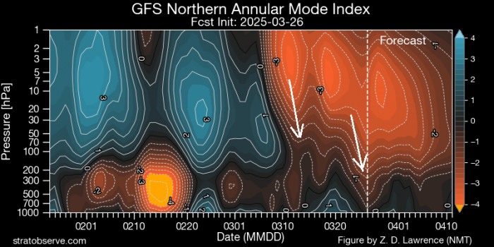
But there has been hint for a while and in the Spring Forecast that some point in early April may be at risk of colder weather at some point due to the impacts of the Final Stratospheric Warming back on 9th March. The reversal of winds to easterly high up in the stratosphere back in early March has been slowly propagating down towards the troposphere, where our weather happens. ‘Dripping down’ of the reversed winds into the troposphere may promote episodes of high-latitude blocking in early April.
With high pressure likely to stay close by at least through the first 7 days of April, but perhaps beyond to mid-month too, it’s shaping up to be a dry spring so far!
Loading recent activity...