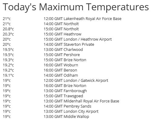
Yesterday was the first day this year that 20C was reached, in fact it reached 21C in the London area. Changes afoot into the weekend, as low pressure near Iberia extends towards the UK, bringing showers across many parts, some Sahara dust in the air on Friday before the rain arrives.
The UK has seen temperatures reach or exceed 20C for the first time this year, on the Spring Equinox. The highest temperature of 21.3C yesterday was jointly recorded at Chertsey and Northolt in the suburbs of London. 20.3C was also reached at Gogerddan in west Wales.
It came close to 20C back on the 9th March - when 19.7C was recorded in Crosby in Merseyside. But since then, it’s been on the chilly side, with winds from the north or east, but the last few days the wind has turned southeasterly, ushering in much warmer air from the Mediterranean.
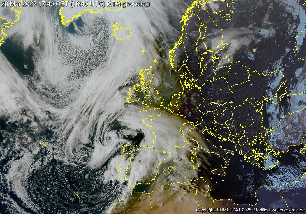
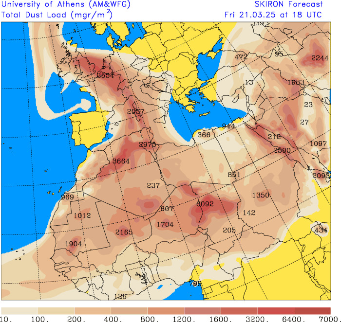
The same south to southeasterly flow tomorrow will also pull up Sahara dust into UK skies through the day. This may make for an interesting sunrise (sunset too) and the dust could also be deposited on car windows and other surfaces across the west and, later in the day, the south, where showers are forecast to push up from the south.
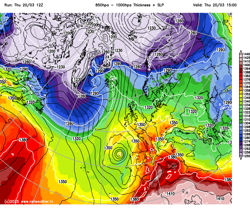
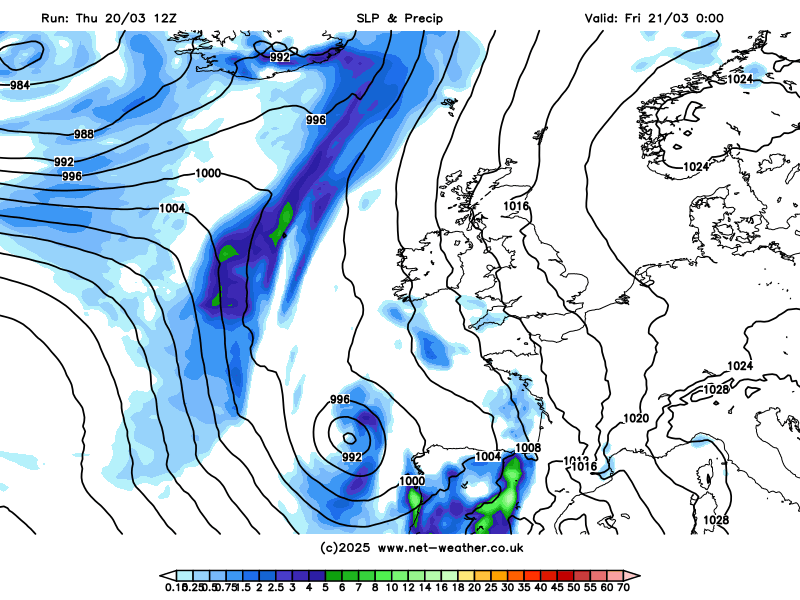
Storm Martinho affecting Iberia at the moment with further heavy rain, thunderstorms or showers over the next few days, after unsettled conditions with flooding in places for a while now, will extend its influence over the UK and Ireland from tomorrow. The storm, a low pressure system with two centres just west of Iberia, will extend northwards across the western side of the British Isles during Friday and Saturday, throwing fronts and troughs north - which will bring areas of showery rain northwards, perhaps heavy and thundery in places.
The low pressure system extending northwards across the west will also pull up a plume of Sahara dust north across France and in across the British Isles on Friday. This dust could be washed out by the showery rain spreading north across the west during the day and later moving in across southern areas. The showers developing in a plume of higher wet-bulb potential temperatures spreading north aloft across the west initially, with lift of the plume along a thermal boundary moving in from the southwest, the showers then extending north further east across England during the evening and overnight, as a cold front pushes in from the southwest.
Bands of showers, perhaps heavy and thundery in places, spreading or developing northwards across many areas on Saturday, though there will likely be some sunshine too. Sunday seeing further showers develop across southern England and south Wales, as low pressure slowly pulls away southwards, showers fading further north - as high pressure builds in across Scotland - bringing increasingly drier and sunnier conditions here into the afternoon.
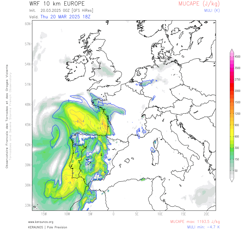
The MUCAPE animation below shows areas of instability moving north across the UK and Ireland during Friday and Saturday - indicating the potential for some thunder in places where convection is deep enough, but thunder is likely to be isolated.
It’s likely that many places will catch a shower between Friday and Sunday, but for some places rain may not amount to much for what has been a very dry month so far. England has seen only 19% of the March average rainfall two-thirds of the way through the month, while Wales has only seen 15% of the March average. So any rainfall will be welcome by farmers and gardeners alike, with the top layer of the ground drying out quickly in the sunshine over recent days.
Drier conditions look set to return again into the beginning of next week, as a ridge of high pressure builds in and low pressure moves away over the near continent. A weakening front moving in from the west will bring some rain on Tuesday across northern and western areas, but little rain by the time it reaches the southeast. It may turn more widely unsettled after mid-week from the west, with windy conditions and rain at times, but uncertainty over this for now.
Loading recent activity...