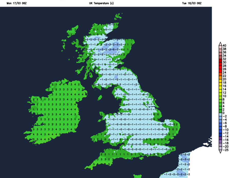
The air has been cold even if there has been some glorious sunshine this weekend. The top temperatures were only 13.2C and 12.3C across the UK but there is a warming theme this week. By Thursday some parts will be in the high teens, even reaching a few degrees higher.
We will lose the risk of frost, how the air feels will match the spring sunshine and it won’t be chilly in the shade by day nor as cold after dark. It is only March so don’t get too carried away but still, a welcome taste of spring.
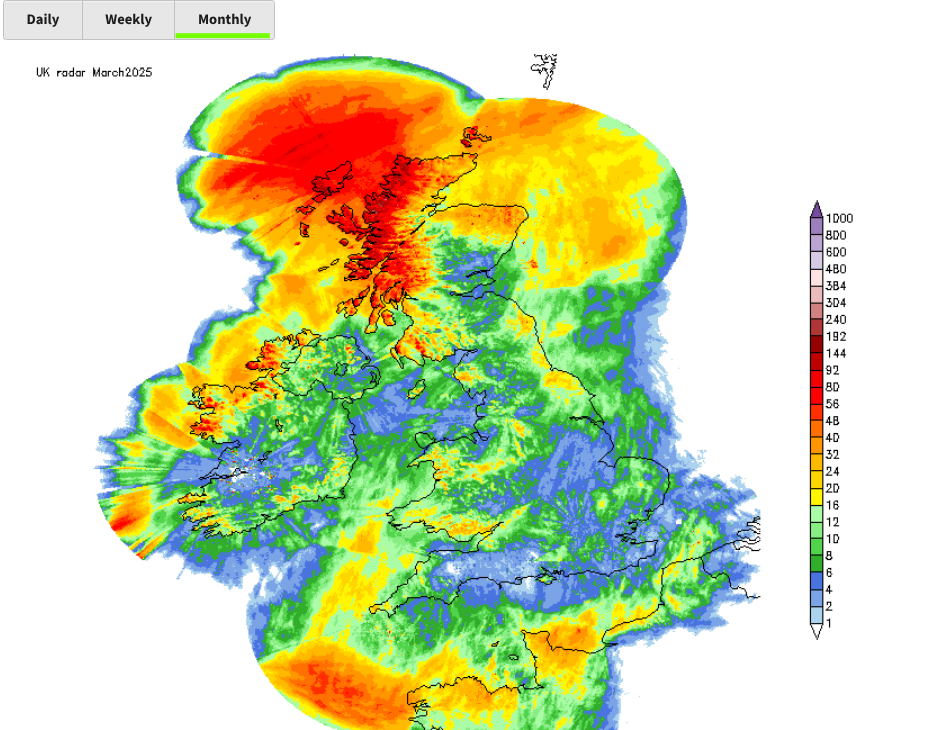 Netweather Radar monthly totals so far 1st til 17th 0800
Here in the UK, some parts of southern Britain have hardly seen any rain this month. There was patchy rain on Monday morning from weak frontal bands heading westwards around the southern side of the dominating high pressure. We have a few more dry days coming up. 
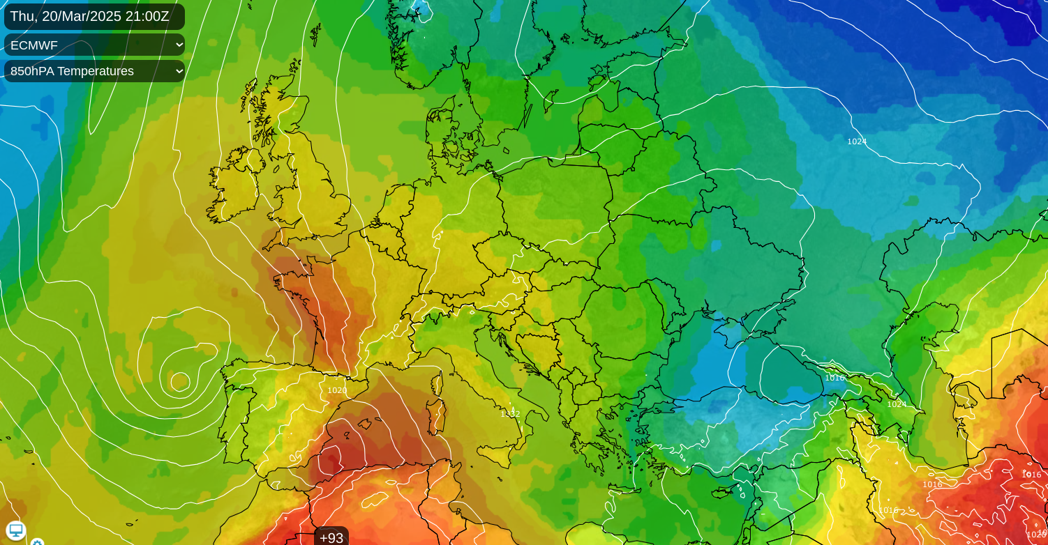
This high pressure had kept the UK in the cold, bright and settled weather but it will slide away to eastern Europe. Colder air plunges down through Scandinavia and the Baltic States, as Portugal and Spain see more stormy weather with hefty downpours including warnings for heavy rain in ‘Laurence’. With low pressures near Portugal and the high further east, a warmer southerly flow begins.
There is an increasing amount of cloud trapped under the high pressure from Sunday into Monday. As the chilly easterly flow veers to the southeast, there will be more clear skies and sunshine. Before dawn on Tuesday, much of inland Britain will be close to freezing. There will be lingering cloud for Northern Ireland so temperatures here will be around 3 or 4C.
Tuesday will still feel cool but will be fine and sunny. It will be calm for northern Scotland but there will be a light to moderate east to southeast wind for much of England and Wales. This will be fresh for parts of Wales and southwest England and around the Irish Sea. Northern Ireland could have a slower start with more cloud early on but should soon brighten up. Belfast will have a cool breeze and feel more like 6C than the air temperature of 9C.
After a fine, sunny day, the wind will ease down and it will be a clear chilly night with a widespread frost.
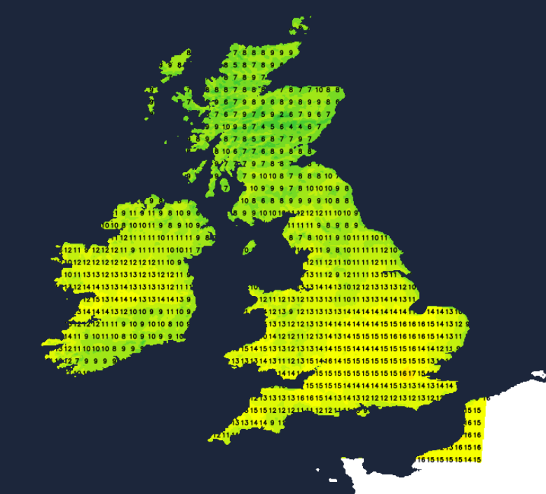
There could be a few showers near to the Western Isles first thing and a pocket of cloud and patchy rain might clip Cornwall as it drifts northwards to the southeast of Ireland. Otherwise a splendid day with sunshine and fine weather. The temperatures will begin to respond over England with 12 to 17C but still cool further north.
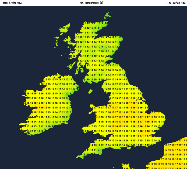
North Sea cloud could reach Shetland but many parts will have a clear night making it nippy for the northern half of the UK. Eastern England into Yorkshire might see fog forming but another super day will follow and it will feel warmer. The sea surface temperatures at this time of year are still low, so anywhere with a slight breeze off the sea will feel colder. It will be another dry sunny day with temperatures of 19 or 20C possible.
The Haar or seafret could trouble the coasts of NE England and eastern Scotland by Friday. There is uncertainty about the end of the week and the start of the new week. There are signs that the gin clear skies and sunshine might not last and that more cloud with clusters of showery rain look more likely. However, large areas could miss the rain, so we will have to watch how the next change develops.
Loading recent activity...