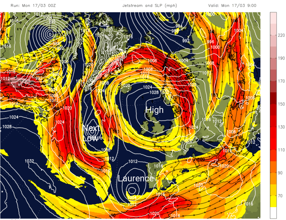
We have had a lot of dry weather here in the UK and the next four days look mostly dry. The patchy rain over southern England on Monday morning was a reminder of what had been missing. High pressure over the UK has brought a lot of fair, settled weather. However, it has felt cold, away from the March sunshine, with Arctic air locked in place. That will change this week as we pick up more of a southerly flow and daytime temperatures lift. By Thursday, temperatures across the UK could be anywhere from 12 to 18C perhaps even a few degrees higher. This warmer air will be steered our way by low pressures that are heading for Portugal and Spain.
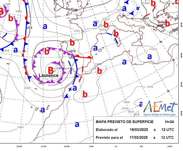 Laurence, a storm named by IPMA (Portugal)
Iberia has been experiencing plenty of unsettled and wet weather recently. As low pressures are continually steered further south in the Atlantic, there have been three named storms this month; Jana, Konrad and today’s Laurence. January also saw three storms named by IPMA or AEMET (Spain). Whilst decent rainfall will be welcome to replenish reservoir levels before the summer, the ongoing cloud and rain is becoming a bit of a stuck record. There has been heavy and persistent rain, flooding along the east coast for the Costa Brava and earlier this month in the Canary Islands especially on Gran Canaria. AEMET issued orange and red rain warnings with the provinces of Castellón and Valencia, and the northern coast of Alicante saw a (lowest level) state of emergency. There have been reports of terrific hail storms, tornadoes and heavy snowfall in the mountains. Our UK weather has been very quiet in comparison.
With the jetstream diving southwards, (Storm) Laurence brought stormy conditions around the coast of Madeira. There are numerous rain warnings for Portugal, mainland Spain, particularly in the south. Frontal rain has already fallen over Portugal and the southern half of Spain. The centre of Laurence will move from the Algarve tonight toward Madrid but the system fades on Tuesday.
However, another Atlantic low forms in the middle of the week and this will edge towards western Portugal. This will bring more rain to Spain as the cold front pushes northeastwards. If this system is also named it would be Martinho and comes from the Southwestern Naming group. Ireland, the UK and the Netherlands are in the Western Naming group and we are only up to E for Eowyn.
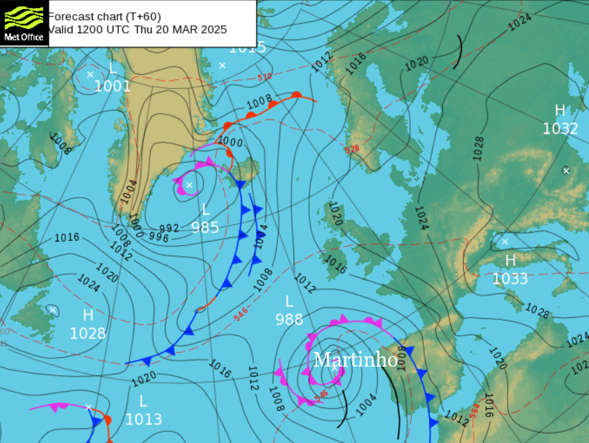
Update 18th - Martinho has been named by IPMA, the fourth storm in 12 days.
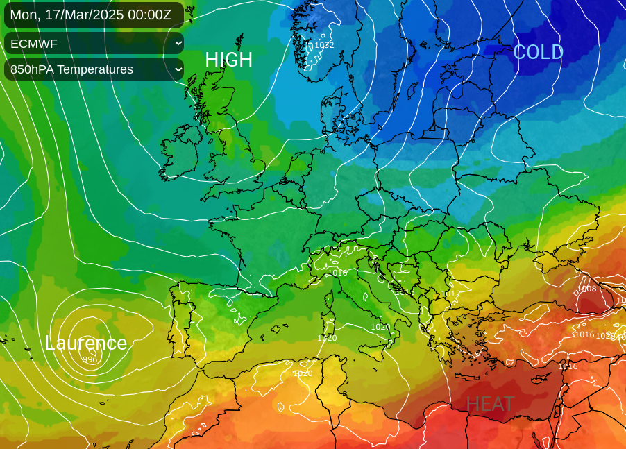
The cold Arctic air, that was over the UK, is beginning to focus on Scandinavia, western Russia and the Baltic States drawn southwards around the northern high pressure. There has been heavy snow in Tromso within the Arctic Circle. Southeastern Europe has been very warm with sandy air drawn northwards over Greece where there have been extraordinary night-time temperatures this weekend. Also, the heat has reached Ukraine, Turkey, Cyprus and SW Russia.
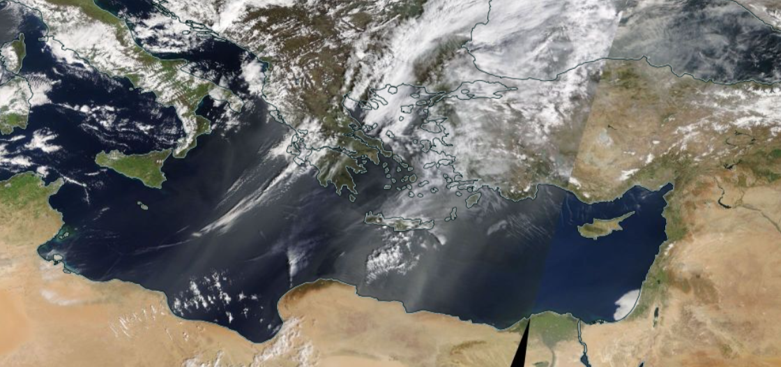
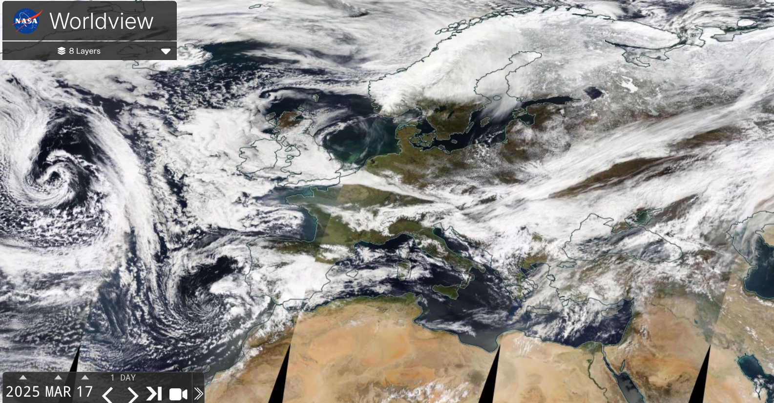
SE Mediterranean NASA worldview 16th March, dust laden warm air from Africa heating Turkey and Greece
34.9C in Fodele just west of Heraklion on the north coast of Crete which could be a new March record for Greece. Turkey has seen many March records broken with over 34C recorded along the Black Sea coast with much of the region seeing exceptionally warm nights. The cold air over Scandinavia will reach right down through eastern Europe to Greece by the middle of this week with chilly nights, but heat looks to return for the start of next week from Africa.
Loading recent activity...