"Slightly drier, duller and warmer winter UK compared to the long-term average" Met Office
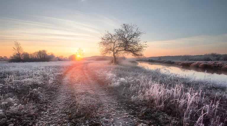
You might remember the gloomy, grey times yet, winter 24/25 has been very mixed with two named storms and episodes of rain and blustery winds changing to lingering cold and calm ones. There have been occasional snow and ice appearances, but away from northern Scotland, snow lovers have been mostly disappointed. January was the main month of wintry bits but it was only northern Scotland that experienced a true lengthy spell of snow accompanied by bitter cold.
Met Office Scientist Emily Carlisle said: “This winter has seen a typical mix of UK winter weather conditions, with a mix of wet and windy, but also cold and calm conditions. This has resulted in a season where no significant climate records have been broken."
With our warming climate, it seems that one snow day or even overnight snow that is present when you open the curtains is enough to lift excitement levels. In a Netweather online forum poll reviewing January 2025, many were grateful for any snow appearance, however brief.
“Should be noted as well that this [a mid to high score] is by recent standards, many of which have been snowless. Clearly comparing to historic Januaries, it'd have to rank a lot lower.”
Even in the easterly flow, hopes were dashed as decent snow did not appear.
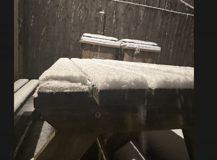 January 5th snowfall photo from Justin1705 Luton
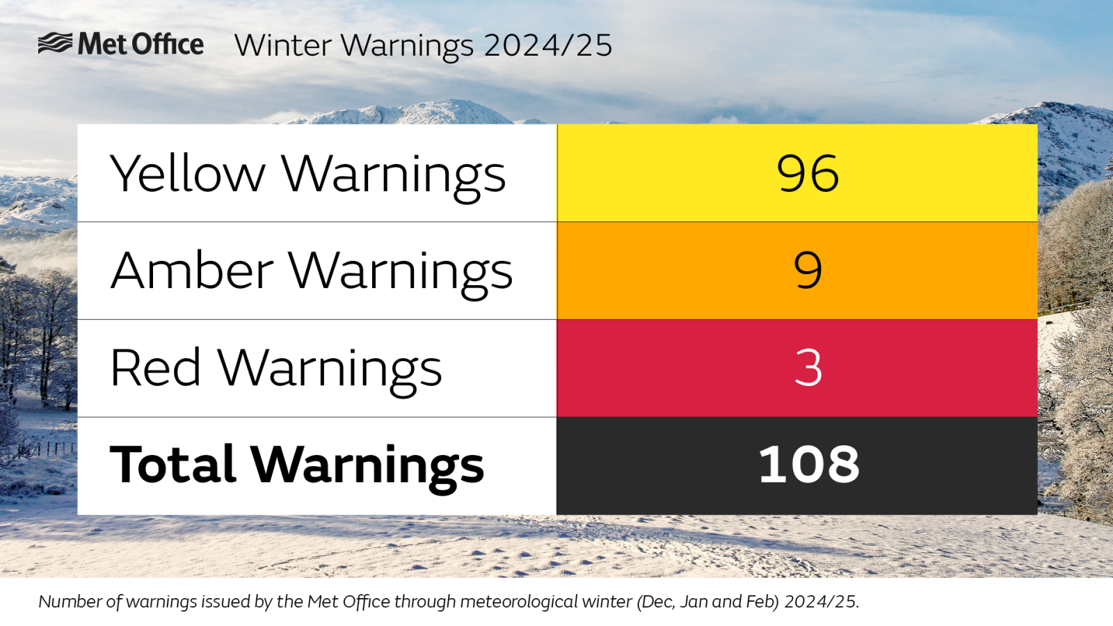
The main events were Storms Darragh and Storm Eowyn, both of which resulted in red warnings from the UK Met Office, and the use of the government’s emergency text alerts. A total of 108 severe weather warnings were issued during meteorological winter 2024/25. Eowyn became “the UK’s most significant windstorm in over a decade. “ Met Office
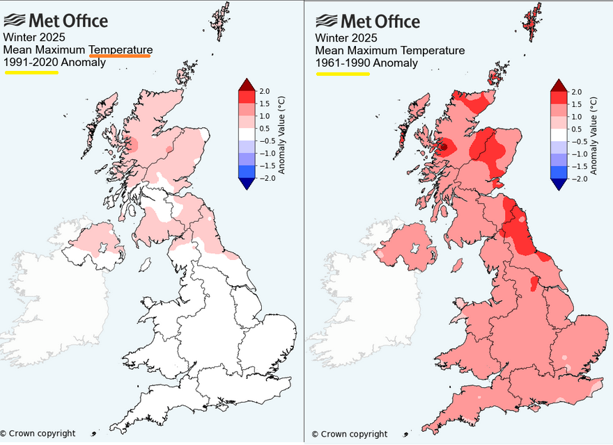
Winter statistics
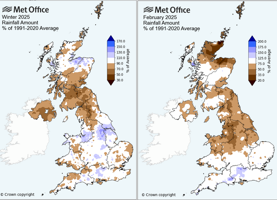
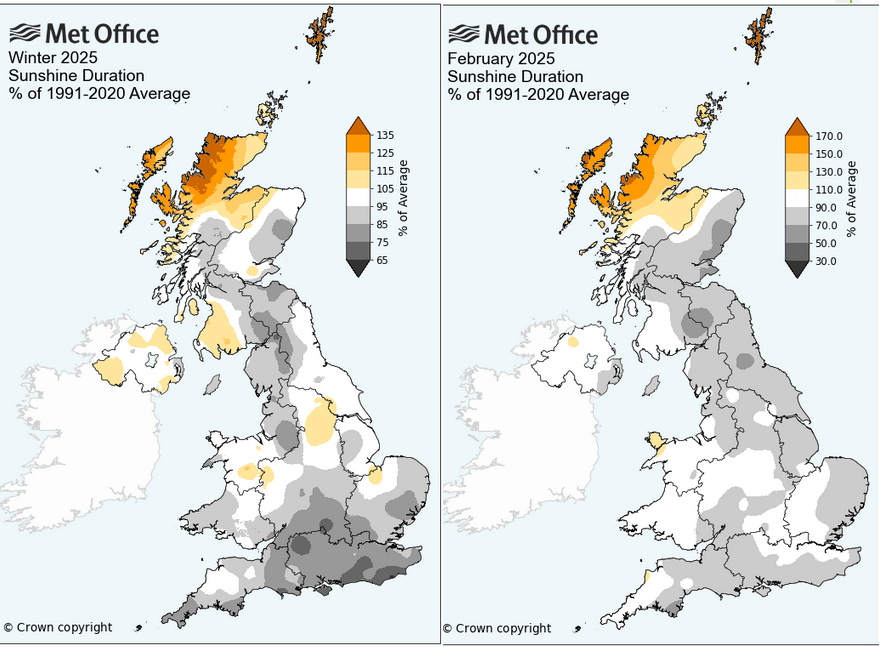
December was warm, dull and wet in the far north but dry for southern England. January 2025 was colder than average, sunny but wetter than average for parts of England, whereas Northern Ireland and Scotland were drier. February temperatures were not far off the average but milder nights pulled up the average. The far northwest of Scotland was gloriously sunny, but elsewhere it was a dull month, which became newsworthy as the grey skies just continued. Overall it was a dry February too.
For the season of winter, provisional Met Office statistics show that this winter saw below average rainfall, below average sunshine, with above average temperatures for the UK as a whole.
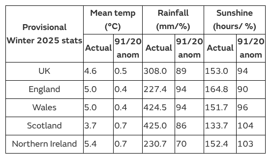
Winter (and autumn) rainfall is important to replenish water supplies for the summer ahead. Northern Ireland saw a drier than average winter with only 70% of their average and winter saw 11% less rainfall than its long-term meteorological average.
Winter temperatures- January really stands out as the cold spell of the winter with snow, widespread frosts and fog. Overall Wales and England were closer to average but in the end Scotland and Northern Ireland were warmer than average.
The gloomy, dull February will be remembered as will the grey December with the foggy spell around Christmas. In comparison, Northern Scotland enjoyed 121% of its average sunshine across the winter.
Named Storms
Storm Darragh brought very strong winds to western parts of England and Wales in early December. A red warning for wind was issued but there were also flooding concerns as Darragh was only two weeks after Storm Bert.
Storm Eowyn hit Northern Ireland and the Central Belt of Scotland with winds gusting widely at well over 80mph. People spent the day inside as schools and businesses closed and the storm raged. Thousands of people suffered power outages on the island of Ireland with some homes having to wait weeks for reconnection.
A second deep low centre affected more southern areas of the UK on the 26th and 27th January. This system was named Herminia by AEMET, the Spanish Met. Service but brought more rain, causing flooding issues to southern Britain. There were wind and rain warnings with thundery showers.
The importance of quality warning systems
The Met Office commissioned post-event surveys which suggested that the warnings and storm names are highly effective.
For Storm Darragh (early December 2024 around Wales and the Bristol Channel), 98% of those within Red National Severe Weather Warning areas were aware of the warning, and 91% of those took direct action to minimise impacts.
Storm Eowyn (late January 2025 Northern Ireland into central Scotland), another Red Warning, had a 99% awareness rate for those within this area, with 95% of those taking action to protect themselves or their property.
Hopefully the message is now clear that in a red warning you shut up shop, you stay at home or indoors and close for the day if you can. Schools will close in a red warning, it’s not a process to weigh up options. Obviously, key workers and emergency services staff have to continue, but for most within a red zone, they need to stay safe from the high-impact severe weather situation.
“A weather station on Tiree, Inner Hebrides, recorded the UK’s lowest pressure reading since storm naming was introduced in autumn 2015.”
The month of February 2025.
A steady Scandi-high dominated our UK weather for the middle part of the month with cold, grey, dry but cloudy weather. Overall, it was a dry month with provisionally just 76% of the long-term meteorological average rainfall. Northern Scotland was particularly dry with Orkney only recording 34% of its average rainfall. Southern England saw 95% of its February average. The month started off cold but became milder from mid-month. The Western Isles and Shetland recorded their 10th highest maximum temperature (records since 1884.) February became sunnier by the end of the month, which many people were thankful for after such gloomy skies.
Loading recent activity...